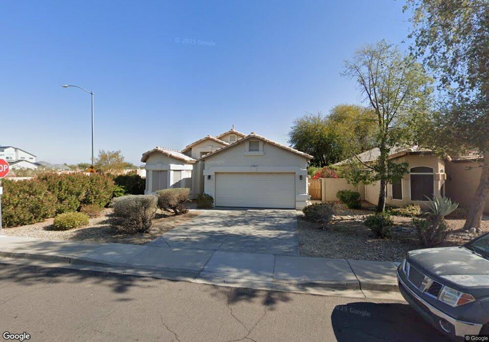
20989 N 102nd Ln Peoria, AZ 85382
Estimated Value: $324,372 - $396,000
3
Beds
2
Baths
1,523
Sq Ft
$241/Sq Ft
Est. Value
About This Home
This home is located at 20989 N 102nd Ln, Peoria, AZ 85382 and is currently estimated at $367,343, approximately $241 per square foot. 20989 N 102nd Ln is a home located in Maricopa County with nearby schools including Parkridge Elementary School, Sunrise Mountain High School, and Candeo Peoria.
Ownership History
Date
Name
Owned For
Owner Type
Purchase Details
Closed on
Feb 22, 2021
Sold by
Wood Michael P and Wood Shirley A
Bought by
Wood Michael P and Wood Shirley A
Current Estimated Value
Purchase Details
Closed on
Aug 18, 2011
Sold by
Sherwin John H and Sherwin Mitchell S
Bought by
Wood Michael R and Wood Shirley A
Home Financials for this Owner
Home Financials are based on the most recent Mortgage that was taken out on this home.
Original Mortgage
$112,084
Interest Rate
4.5%
Mortgage Type
FHA
Purchase Details
Closed on
Apr 13, 2011
Sold by
Koenig Irene
Bought by
Sherwin John H and Sherwin Mitchell S
Purchase Details
Closed on
Oct 20, 1998
Sold by
Lennar Homes Of Arizona Inc
Bought by
Koenig Selwyn Paul and Koenig Irene
Purchase Details
Closed on
Oct 15, 1998
Sold by
Lennar Communities Development Inc
Bought by
Lennar Homes Of Arizona Inc
Create a Home Valuation Report for This Property
The Home Valuation Report is an in-depth analysis detailing your home's value as well as a comparison with similar homes in the area
Home Values in the Area
Average Home Value in this Area
Purchase History
| Date | Buyer | Sale Price | Title Company |
|---|---|---|---|
| Wood Michael P | -- | None Listed On Document | |
| Wood Michael R | $115,000 | Lawyers Title Of Arizona Inc | |
| Sherwin John H | -- | None Available | |
| Koenig Irene | -- | None Available | |
| Koenig Selwyn Paul | $110,000 | North American Title Agency | |
| Lennar Homes Of Arizona Inc | -- | North American Title Agency |
Source: Public Records
Mortgage History
| Date | Status | Borrower | Loan Amount |
|---|---|---|---|
| Previous Owner | Wood Michael R | $112,084 |
Source: Public Records
Tax History Compared to Growth
Tax History
| Year | Tax Paid | Tax Assessment Tax Assessment Total Assessment is a certain percentage of the fair market value that is determined by local assessors to be the total taxable value of land and additions on the property. | Land | Improvement |
|---|---|---|---|---|
| 2025 | $1,463 | $18,147 | -- | -- |
| 2024 | $1,435 | $17,283 | -- | -- |
| 2023 | $1,435 | $26,860 | $5,370 | $21,490 |
| 2022 | $1,404 | $21,150 | $4,230 | $16,920 |
| 2021 | $1,496 | $19,800 | $3,960 | $15,840 |
| 2020 | $1,501 | $17,460 | $3,490 | $13,970 |
| 2019 | $1,445 | $16,850 | $3,370 | $13,480 |
| 2018 | $1,389 | $15,960 | $3,190 | $12,770 |
| 2017 | $1,391 | $14,000 | $2,800 | $11,200 |
| 2016 | $1,356 | $13,830 | $2,760 | $11,070 |
| 2015 | $1,284 | $13,060 | $2,610 | $10,450 |
Source: Public Records
Map
Nearby Homes
- 10344 W Burnett Rd
- 10169 W Potter Dr
- 10368 W Ross Ave
- 10347 W Mohawk Ln
- 20615 N 105th Ave
- 10528 W Potter Dr
- 10379 W Tonopah Dr
- 20640 N 100th Ln
- 20670 N 105th Dr
- 21479 N 104th Dr
- 10446 W Lone Cactus Dr
- 10549 W Albert Ln
- 10001 W Potter Dr
- 20274 N 104th Ave
- 10630 W Mohawk Ln
- 20769 N 106th Ln
- 10672 W Ross Ave
- 10134 W Pine Springs Dr
- 21635 N 102nd Ave
- 20017 N 101st Ave
- 20979 N 102nd Ln
- 20969 N 102nd Ln
- 10264 W Ross Ave
- 20859 N 102nd Ln
- 20849 N 102nd Ln
- 10268 W Ross Ave
- 20839 N 102nd Ln
- 10320 W Ross Ave
- 10263 W Ross Ave
- 10307 W Harmony Ln
- 10267 W Ross Ave
- 10324 W Ross Ave
- 10319 W Ross Ave
- 10328 W Ross Ave
- 10264 W Potter Dr
- 10323 W Ross Ave
- 10268 W Potter Dr
- 10335 W Harmony Ln
- 10332 W Ross Ave
- 10320 W Potter Dr