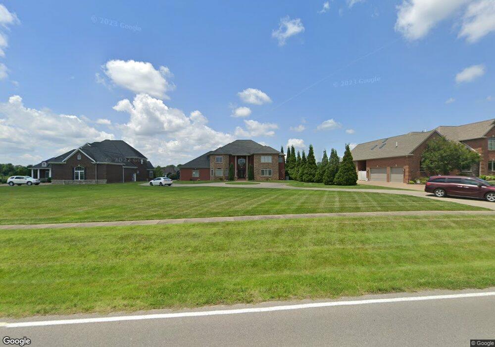
2099 Anderson Rd Newburgh, IN 47630
Estimated Value: $1,057,000 - $1,223,000
4
Beds
6
Baths
4,534
Sq Ft
$257/Sq Ft
Est. Value
About This Home
This home is located at 2099 Anderson Rd, Newburgh, IN 47630 and is currently estimated at $1,166,973, approximately $257 per square foot. 2099 Anderson Rd is a home with nearby schools including John H. Castle Elementary School, Castle North Middle School, and Castle High School.
Ownership History
Date
Name
Owned For
Owner Type
Purchase Details
Closed on
Nov 4, 2021
Sold by
Parkar Tabassum and Husain Arshad
Bought by
Moolani Mahesh Kumar and Moolani Urmila Mahesh
Current Estimated Value
Home Financials for this Owner
Home Financials are based on the most recent Mortgage that was taken out on this home.
Original Mortgage
$800,000
Outstanding Balance
$733,265
Interest Rate
3.01%
Mortgage Type
New Conventional
Estimated Equity
$433,708
Purchase Details
Closed on
Nov 8, 2010
Sold by
Parkar Tabassum
Bought by
Parkar Tabassum and Husain Arshad
Purchase Details
Closed on
Jun 7, 2010
Sold by
Waling Joseph F and Waling Sandra A
Bought by
Parkar Tabassum
Purchase Details
Closed on
Nov 28, 2007
Sold by
Bailey Donald M and Bailey Kristi L
Bought by
Waling Joseph F and Waling Sandra A
Create a Home Valuation Report for This Property
The Home Valuation Report is an in-depth analysis detailing your home's value as well as a comparison with similar homes in the area
Home Values in the Area
Average Home Value in this Area
Purchase History
| Date | Buyer | Sale Price | Title Company |
|---|---|---|---|
| Moolani Mahesh Kumar | $1,050,000 | None Available | |
| Parkar Tabassum | -- | None Available | |
| Parkar Tabassum | -- | None Available | |
| Waling Joseph F | -- | None Available |
Source: Public Records
Mortgage History
| Date | Status | Borrower | Loan Amount |
|---|---|---|---|
| Open | Moolani Mahesh Kumar | $800,000 |
Source: Public Records
Tax History Compared to Growth
Tax History
| Year | Tax Paid | Tax Assessment Tax Assessment Total Assessment is a certain percentage of the fair market value that is determined by local assessors to be the total taxable value of land and additions on the property. | Land | Improvement |
|---|---|---|---|---|
| 2024 | $8,985 | $990,500 | $90,500 | $900,000 |
| 2023 | $9,002 | $988,200 | $114,700 | $873,500 |
| 2022 | $8,872 | $932,100 | $114,700 | $817,400 |
| 2021 | $7,406 | $750,800 | $82,600 | $668,200 |
| 2020 | $6,943 | $695,200 | $74,600 | $620,600 |
| 2019 | $7,354 | $725,500 | $74,600 | $650,900 |
| 2018 | $6,754 | $690,500 | $74,600 | $615,900 |
| 2017 | $7,114 | $724,300 | $74,600 | $649,700 |
| 2016 | $7,072 | $724,300 | $74,600 | $649,700 |
| 2014 | $6,831 | $726,900 | $73,100 | $653,800 |
| 2013 | $6,834 | $740,900 | $73,100 | $667,800 |
Source: Public Records
Map
Nearby Homes
- 2230 Long Cove Cir
- 2235 Long Cove Cir
- 2886 Glen Lake Dr
- 2055 Claybrook Ct
- 6511 Venice Dr
- 2677 Briarcliff Dr
- 1469 Woodfield Dr
- 5828 Waterstone Dr
- 2800 Briarcliff Dr
- 5498 Abbe Wood Dr
- 5484 Abbe Wood Dr
- 3030 Capstone Ct
- 1711 Old Plank Rd
- 5735 Brookstone Dr
- 5540 Brompton Dr
- 3090 Limestone Ct
- 5815 Brookstone Dr
- 3150 Sandstone Ct
- 5700 Baywater Dr
- 5355 Bloomsbury Ct
- 2077 Anderson Rd
- 2055 Anderson Rd
- 2111 Anderson Rd
- 2065 Long Cove Cir
- 2075 Long Cove Cir
- 2055 Long Cove Cir
- 2033 Anderson Rd
- 2085 Long Cove Cir
- 6022 Waterbury Ct
- 2045 Long Cove Cir
- 2064 Long Cove Cir
- 2056 Long Cove Cir
- 2070 Long Cove Cir
- 2011 Anderson Rd
- 2076 Long Cove Cir
- 2041 Long Cove Cir
- 6066 Waterbury Ct
- 2095 Long Cove Cir
- 2032 Long Cove Cir
- 2084 Long Cove Cir