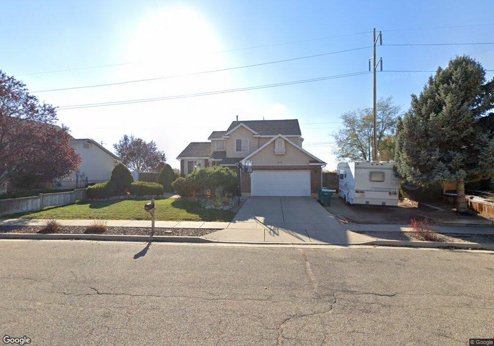
2099 Katies Way Clearfield, UT 84015
Estimated Value: $456,000 - $476,000
3
Beds
3
Baths
2,124
Sq Ft
$221/Sq Ft
Est. Value
About This Home
This home is located at 2099 Katies Way, Clearfield, UT 84015 and is currently estimated at $468,433, approximately $220 per square foot. 2099 Katies Way is a home located in Davis County with nearby schools including Antelope Elementary School, North Davis Junior High School, and Clearfield High School.
Ownership History
Date
Name
Owned For
Owner Type
Purchase Details
Closed on
Jan 22, 2020
Sold by
Bullock Todd W
Bought by
Shupe Spencer K
Current Estimated Value
Home Financials for this Owner
Home Financials are based on the most recent Mortgage that was taken out on this home.
Original Mortgage
$198,500
Outstanding Balance
$136,204
Interest Rate
3.74%
Mortgage Type
New Conventional
Estimated Equity
$332,229
Purchase Details
Closed on
Jan 21, 2020
Sold by
Shupe Spencer K
Bought by
Shupe Spencer K and Shupe Shawnee
Home Financials for this Owner
Home Financials are based on the most recent Mortgage that was taken out on this home.
Original Mortgage
$198,500
Outstanding Balance
$136,204
Interest Rate
3.74%
Mortgage Type
New Conventional
Estimated Equity
$332,229
Purchase Details
Closed on
May 7, 2009
Sold by
Us Bank National Association
Bought by
Bullock Todd W
Home Financials for this Owner
Home Financials are based on the most recent Mortgage that was taken out on this home.
Original Mortgage
$165,938
Interest Rate
4.8%
Mortgage Type
FHA
Purchase Details
Closed on
Dec 9, 2008
Sold by
Davis Shawn M and Davis Renee
Bought by
Us Bank National Association
Purchase Details
Closed on
Sep 26, 2005
Sold by
Davis Timothy M and Davis Danice
Bought by
Davis Shawn M and Davis Renee
Home Financials for this Owner
Home Financials are based on the most recent Mortgage that was taken out on this home.
Original Mortgage
$35,600
Interest Rate
5.33%
Mortgage Type
Stand Alone Second
Purchase Details
Closed on
Jun 6, 1996
Sold by
Gmw Development Inc
Bought by
Davis Timothy M and Davis Danice
Home Financials for this Owner
Home Financials are based on the most recent Mortgage that was taken out on this home.
Original Mortgage
$133,129
Interest Rate
8.01%
Mortgage Type
FHA
Create a Home Valuation Report for This Property
The Home Valuation Report is an in-depth analysis detailing your home's value as well as a comparison with similar homes in the area
Home Values in the Area
Average Home Value in this Area
Purchase History
| Date | Buyer | Sale Price | Title Company |
|---|---|---|---|
| Shupe Spencer K | -- | Old Republic Natl Tit | |
| Shupe Spencer K | -- | American Secure Tit | |
| Bullock Todd W | -- | First American Title | |
| Us Bank National Association | $162,341 | Etitle Insurance Agency | |
| Davis Shawn M | -- | American Secure Title Ins Ag | |
| Davis Timothy M | -- | Bonneville Title Company Inc | |
| Cmw Development Inc | -- | Bonneville Title Company Inc |
Source: Public Records
Mortgage History
| Date | Status | Borrower | Loan Amount |
|---|---|---|---|
| Open | Shupe Spencer K | $198,500 | |
| Previous Owner | Bullock Todd W | $165,938 | |
| Previous Owner | Davis Shawn M | $35,600 | |
| Previous Owner | Davis Shawn M | $142,400 | |
| Previous Owner | Davis Timothy M | $133,129 |
Source: Public Records
Tax History
| Year | Tax Paid | Tax Assessment Tax Assessment Total Assessment is a certain percentage of the fair market value that is determined by local assessors to be the total taxable value of land and additions on the property. | Land | Improvement |
|---|---|---|---|---|
| 2025 | $2,670 | $239,250 | $72,146 | $167,104 |
| 2024 | $2,596 | $234,300 | $68,891 | $165,409 |
| 2023 | $2,384 | $395,000 | $109,102 | $285,898 |
| 2022 | $2,578 | $231,000 | $61,394 | $169,606 |
| 2021 | $2,356 | $319,000 | $71,208 | $247,792 |
| 2020 | $2,053 | $276,000 | $61,044 | $214,956 |
| 2019 | $1,944 | $258,000 | $59,706 | $198,294 |
| 2018 | $1,802 | $233,000 | $52,883 | $180,117 |
| 2016 | $1,573 | $106,315 | $21,561 | $84,754 |
| 2015 | $1,480 | $95,425 | $21,561 | $73,864 |
| 2014 | $1,508 | $98,481 | $25,365 | $73,116 |
| 2013 | -- | $91,521 | $33,036 | $58,485 |
Source: Public Records
Map
Nearby Homes
- 2181 Katies Way
- 1961 S 100 W
- 1818 S 200 W
- 1913 S 525 W
- 711 W 2010 S
- 2480 S Main St
- 154 E 2325 S
- 794 W 2300 S
- 877 W 1920 S Unit C
- 308 E 1925 S
- 891 W 1840 S Unit A
- 1250 N 2925 W
- 929 W 1920 S Unit A
- 1445 N 2925 W
- 2601 S 200 E
- 2127 S 350 E
- 961 1910 S
- 823 W 1600 S Unit 28
- Everglade Plan at Wilcox Farms
- Echo Plan at Wilcox Farms
Your Personal Tour Guide
Ask me questions while you tour the home.