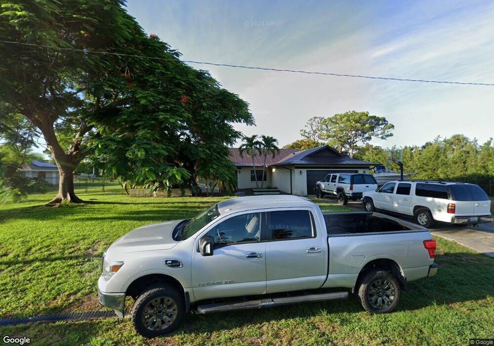
2099 SE Isabell Rd Port Saint Lucie, FL 34952
Lyngate NeighborhoodEstimated Value: $409,000 - $540,000
3
Beds
2
Baths
2,102
Sq Ft
$224/Sq Ft
Est. Value
About This Home
This home is located at 2099 SE Isabell Rd, Port Saint Lucie, FL 34952 and is currently estimated at $470,554, approximately $223 per square foot. 2099 SE Isabell Rd is a home located in St. Lucie County with nearby schools including Morningside Elementary School, Mariposa Elementary School, and Floresta Elementary School.
Ownership History
Date
Name
Owned For
Owner Type
Purchase Details
Closed on
Dec 12, 1997
Sold by
Pulkownik Mary Beth
Bought by
Ingrum Brian I and Ingrum Robin G
Current Estimated Value
Home Financials for this Owner
Home Financials are based on the most recent Mortgage that was taken out on this home.
Original Mortgage
$87,480
Interest Rate
7.16%
Purchase Details
Closed on
Jul 23, 1997
Sold by
Pulkownik Charles F
Bought by
Pulkownik Mary Beth
Create a Home Valuation Report for This Property
The Home Valuation Report is an in-depth analysis detailing your home's value as well as a comparison with similar homes in the area
Home Values in the Area
Average Home Value in this Area
Purchase History
| Date | Buyer | Sale Price | Title Company |
|---|---|---|---|
| Ingrum Brian I | $97,200 | -- | |
| Pulkownik Mary Beth | -- | -- |
Source: Public Records
Mortgage History
| Date | Status | Borrower | Loan Amount |
|---|---|---|---|
| Previous Owner | Ingrum Brian I | $87,480 |
Source: Public Records
Tax History Compared to Growth
Tax History
| Year | Tax Paid | Tax Assessment Tax Assessment Total Assessment is a certain percentage of the fair market value that is determined by local assessors to be the total taxable value of land and additions on the property. | Land | Improvement |
|---|---|---|---|---|
| 2024 | $2,792 | $128,142 | -- | -- |
| 2023 | $2,792 | $124,410 | $0 | $0 |
| 2022 | $2,667 | $120,787 | $0 | $0 |
| 2021 | $2,569 | $117,269 | $0 | $0 |
| 2020 | $2,572 | $115,650 | $0 | $0 |
| 2019 | $2,542 | $113,050 | $0 | $0 |
| 2018 | $2,423 | $110,943 | $0 | $0 |
| 2017 | $2,393 | $164,200 | $52,500 | $111,700 |
| 2016 | $2,358 | $164,400 | $56,400 | $108,000 |
| 2015 | $2,374 | $126,800 | $35,500 | $91,300 |
| 2014 | $2,277 | $104,850 | $0 | $0 |
Source: Public Records
Map
Nearby Homes
- 2097 SE Morningside Blvd
- 2125 SE Morningside Blvd
- 2151 SE Abcor Rd
- 1998 SE Morningside Blvd
- 2182 SE Bersell Rd
- 1958 SE Avanti Cir
- 2196 SE Flanders Rd
- 2185 SE Harding St
- 1997 SE Burgundy Ln
- 212 SE Village Dr Unit 212
- 239 SE Village Dr
- 217 SE Village Dr Unit 217
- 144 SE Village Dr Unit 144
- 210 SE Village Dr Unit 210
- 2080 SE Elmhurst Rd
- 197 SE Village Dr Unit 197
- 109 SE Village Dr Unit 109
- 175 SE Village Dr Unit 175
- 132 SE Village Dr Unit 132
- 1537 SE Blockton Ave
- 2085 SE Morningside Blvd
- 2085 SE Isabell Rd
- 2086 SE Morningside Blvd
- 2072 SE Morningside Blvd
- 2074 SE Isabell Rd
- 2071 SE Isabell Rd
- 2098 SE Morningside Blvd
- 2057 SE Morningside Blvd
- 2043 SE Morningside Blvd
- 2058 SE Morningside Blvd
- 2101 SE Abcor Rd
- 2057 SE Isabell Rd
- 2101 SE Morningside Blvd
- 2073 SE Hanford Rd
- 2085 SE Hanford Rd
- 2061 SE Hanford Rd
- 2050 SE Isabell Rd
- 2111 SE Abcor Rd
- 2044 SE Morningside Blvd
- 2102 SE Morningside Blvd