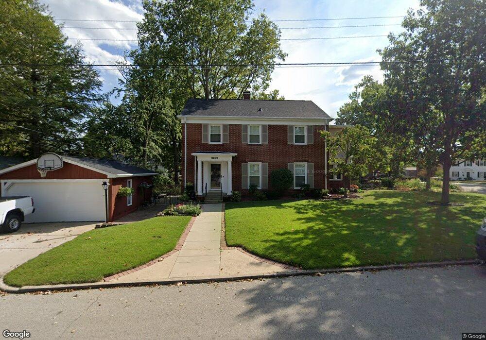
2099 W Macon St Decatur, IL 62522
West End NeighborhoodEstimated Value: $123,000 - $185,000
--
Bed
1
Bath
1,106
Sq Ft
$148/Sq Ft
Est. Value
About This Home
This home is located at 2099 W Macon St, Decatur, IL 62522 and is currently estimated at $163,948, approximately $148 per square foot. 2099 W Macon St is a home located in Macon County with nearby schools including Dennis Lab School, St. Patrick School, and Teen Challenge-Home For Girls.
Ownership History
Date
Name
Owned For
Owner Type
Purchase Details
Closed on
Oct 31, 2006
Sold by
Hickory Point Bank & Trust Fsb
Bought by
Kennedy Mark A
Current Estimated Value
Home Financials for this Owner
Home Financials are based on the most recent Mortgage that was taken out on this home.
Original Mortgage
$54,400
Interest Rate
6.38%
Mortgage Type
Future Advance Clause Open End Mortgage
Create a Home Valuation Report for This Property
The Home Valuation Report is an in-depth analysis detailing your home's value as well as a comparison with similar homes in the area
Home Values in the Area
Average Home Value in this Area
Purchase History
| Date | Buyer | Sale Price | Title Company |
|---|---|---|---|
| Kennedy Mark A | $55,000 | None Available |
Source: Public Records
Mortgage History
| Date | Status | Borrower | Loan Amount |
|---|---|---|---|
| Closed | Kennedy Mark A | $54,400 |
Source: Public Records
Tax History Compared to Growth
Tax History
| Year | Tax Paid | Tax Assessment Tax Assessment Total Assessment is a certain percentage of the fair market value that is determined by local assessors to be the total taxable value of land and additions on the property. | Land | Improvement |
|---|---|---|---|---|
| 2024 | $3,568 | $47,859 | $3,482 | $44,377 |
| 2023 | $3,500 | $46,165 | $3,359 | $42,806 |
| 2022 | $3,302 | $43,289 | $3,678 | $39,611 |
| 2021 | $3,028 | $40,428 | $3,435 | $36,993 |
| 2020 | $3,461 | $38,550 | $3,275 | $35,275 |
| 2019 | $3,461 | $38,550 | $3,275 | $35,275 |
| 2018 | $3,305 | $37,455 | $3,522 | $33,933 |
| 2017 | $3,400 | $38,455 | $3,616 | $34,839 |
| 2016 | $3,471 | $38,847 | $3,653 | $35,194 |
| 2015 | $3,287 | $38,160 | $3,588 | $34,572 |
| 2014 | $3,047 | $37,782 | $3,552 | $34,230 |
| 2013 | $3,170 | $39,201 | $3,685 | $35,516 |
Source: Public Records
Map
Nearby Homes
- 215 S Glencoe Ave
- 180 S Glencoe Ave
- 248 S Linden Ave
- 214 S Linden Ave
- 164 S Linden Ave
- 310 S Glencoe Ave
- 285 S Glencoe Ave
- 5 Ridge Ct
- 353 S Linden Ave
- 128 N Victoria Ave
- 2140 W Main St
- 198 S Westdale Ave
- 165 N Oakcrest Ave
- 345 S Westdale Ave
- 231 S Redwood Ln
- 415 N Summit Ave
- 435 N Summit Ave
- 1527 W Macon St
- 365 S Taylor Ave
- 266 Cobb Ave
- 258 S Glencoe Ave
- 259 S Linden Ave
- 268 S Glencoe Ave
- 249 S Linden Ave
- 269 S Linden Ave
- 228 S Glencoe Ave
- 2074 W Macon St
- 2066 W Macon St
- 278 S Glencoe Ave
- 229 S Glencoe Ave
- 279 S Linden Ave
- 255 S Glencoe Ave
- 257 S Glencoe Ave
- 229 S Linden Ave
- 225 S Glencoe Ave
- 288 S Glencoe Ave
- 212 S Glencoe Ave
- 289 S Linden Ave
- 215 S Linden Ave
- 265 S Glencoe Ave