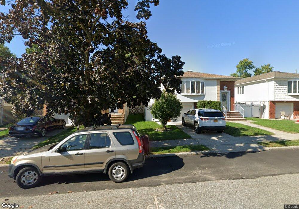
20A Deserre Ave Staten Island, NY 10312
Huguenot NeighborhoodEstimated Value: $537,893 - $628,000
--
Bed
4
Baths
1,200
Sq Ft
$496/Sq Ft
Est. Value
About This Home
This home is located at 20A Deserre Ave, Staten Island, NY 10312 and is currently estimated at $595,723, approximately $496 per square foot. 20A Deserre Ave is a home located in Richmond County with nearby schools including P.S. 36 - J.C. Drumgoole, I.S. 075 Frank D. Paulo, and Tottenville High School.
Ownership History
Date
Name
Owned For
Owner Type
Purchase Details
Closed on
Jan 5, 2000
Sold by
Bopaiah Vinod P and Bopaiah Amrit V
Bought by
Ponappa Vipul
Current Estimated Value
Home Financials for this Owner
Home Financials are based on the most recent Mortgage that was taken out on this home.
Original Mortgage
$104,000
Interest Rate
8.31%
Mortgage Type
Purchase Money Mortgage
Create a Home Valuation Report for This Property
The Home Valuation Report is an in-depth analysis detailing your home's value as well as a comparison with similar homes in the area
Home Values in the Area
Average Home Value in this Area
Purchase History
| Date | Buyer | Sale Price | Title Company |
|---|---|---|---|
| Ponappa Vipul | $130,000 | Custom Title Services Inc |
Source: Public Records
Mortgage History
| Date | Status | Borrower | Loan Amount |
|---|---|---|---|
| Previous Owner | Ponappa Vipul | $104,000 |
Source: Public Records
Tax History Compared to Growth
Tax History
| Year | Tax Paid | Tax Assessment Tax Assessment Total Assessment is a certain percentage of the fair market value that is determined by local assessors to be the total taxable value of land and additions on the property. | Land | Improvement |
|---|---|---|---|---|
| 2025 | $4,256 | $31,560 | $3,642 | $27,918 |
| 2024 | $4,268 | $27,960 | $3,878 | $24,082 |
| 2023 | $3,999 | $21,312 | $3,266 | $18,046 |
| 2022 | $4,032 | $26,340 | $4,800 | $21,540 |
| 2021 | $4,148 | $24,780 | $4,800 | $19,980 |
| 2020 | $3,928 | $21,360 | $4,800 | $16,560 |
| 2019 | $3,645 | $23,160 | $4,800 | $18,360 |
| 2018 | $3,323 | $17,760 | $4,800 | $12,960 |
| 2017 | $3,722 | $19,728 | $4,655 | $15,073 |
| 2016 | $3,421 | $18,662 | $4,524 | $14,138 |
| 2015 | $3,039 | $18,471 | $3,892 | $14,579 |
| 2014 | $3,039 | $17,426 | $3,730 | $13,696 |
Source: Public Records
Map
Nearby Homes
- 629 Marcy Ave
- 727 Stafford Ave
- 735 Sheldon Ave
- 703 Marcy Ave
- 816 Sinclair Ave
- 41 Walker Place
- 504 Huguenot Ave
- 731 Rathbun Ave
- 679 Rensselaer Ave
- 559 Alverson Ave
- 867 Sinclair Ave
- 850 Rensselaer Ave
- 658 Rathbun Ave
- 880 Sinclair Ave
- 944 Woodrow Rd
- 618 Rathbun Ave
- 859 Rathbun Ave
- 104 Wieland Ave
- 123 Cardiff St
- 106 Wieland Ave
- 22 Deserre Ave
- 18 Deserre Ave
- 30 Deserre Ave
- 14 Deserre Ave
- 34 Deserre Ave
- 25 Deserre Ave
- 21 Deserre Ave
- 29 Deserre Ave
- 17 Deserre Ave
- 38 Deserre Ave
- 1110 Woodrow Rd
- 621 Marcy Ave Unit 629
- 10 Deserre Ave
- 625 Marcy Ave Unit 629
- 617 Marcy Ave
- 1086 Woodrow Rd
- 26 Deseree Ave
- 37 Deserre Ave
- 42 Deserre Ave
- 611 Marcy Ave