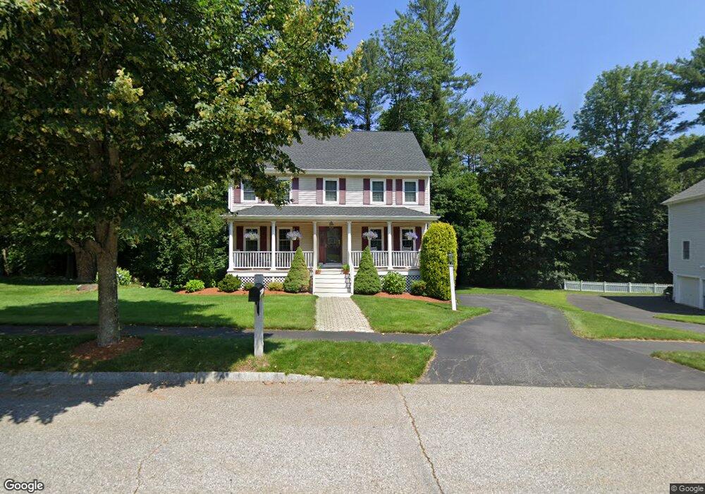
21 Amy Lynne Ln Haverhill, MA 01832
West Parish NeighborhoodEstimated Value: $683,924 - $752,000
3
Beds
3
Baths
1,816
Sq Ft
$395/Sq Ft
Est. Value
About This Home
This home is located at 21 Amy Lynne Ln, Haverhill, MA 01832 and is currently estimated at $717,481, approximately $395 per square foot. 21 Amy Lynne Ln is a home located in Essex County with nearby schools including Tilton Elementary School, Silver Hill Elementary School, and Hill View Montessori Charter Public School.
Ownership History
Date
Name
Owned For
Owner Type
Purchase Details
Closed on
Dec 27, 2012
Sold by
Mcarthur William A and Mcarthur Mary E
Bought by
Mcarthur Ft
Current Estimated Value
Purchase Details
Closed on
Sep 15, 2003
Sold by
Lynch Dina Cottone and Lynch Michael S
Bought by
Mcarthur Mary E and Mcarthur William A
Home Financials for this Owner
Home Financials are based on the most recent Mortgage that was taken out on this home.
Original Mortgage
$300,000
Interest Rate
6.22%
Mortgage Type
Purchase Money Mortgage
Purchase Details
Closed on
Mar 26, 1999
Sold by
Forest Meadows Corp
Bought by
Lynch Michael S
Create a Home Valuation Report for This Property
The Home Valuation Report is an in-depth analysis detailing your home's value as well as a comparison with similar homes in the area
Home Values in the Area
Average Home Value in this Area
Purchase History
| Date | Buyer | Sale Price | Title Company |
|---|---|---|---|
| Mcarthur Ft | -- | -- | |
| Mcarthur Mary E | $378,000 | -- | |
| Lynch Michael S | $199,000 | -- |
Source: Public Records
Mortgage History
| Date | Status | Borrower | Loan Amount |
|---|---|---|---|
| Previous Owner | Mcarthur Mary E | $300,000 |
Source: Public Records
Tax History Compared to Growth
Tax History
| Year | Tax Paid | Tax Assessment Tax Assessment Total Assessment is a certain percentage of the fair market value that is determined by local assessors to be the total taxable value of land and additions on the property. | Land | Improvement |
|---|---|---|---|---|
| 2025 | $6,178 | $576,800 | $206,400 | $370,400 |
| 2024 | $5,817 | $546,700 | $196,100 | $350,600 |
| 2023 | $5,575 | $500,000 | $178,900 | $321,100 |
| 2022 | $5,236 | $411,600 | $158,200 | $253,400 |
| 2021 | $5,172 | $384,800 | $151,400 | $233,400 |
| 2020 | $5,129 | $377,100 | $149,600 | $227,500 |
| 2019 | $4,997 | $358,200 | $130,700 | $227,500 |
| 2018 | $4,908 | $344,200 | $130,700 | $213,500 |
| 2017 | $4,779 | $318,800 | $117,000 | $201,800 |
| 2016 | $4,834 | $314,700 | $117,000 | $197,700 |
| 2015 | -- | $325,200 | $129,900 | $195,300 |
Source: Public Records
Map
Nearby Homes
- 43 Mercury Terrace
- 216 Morgan Dr Unit 216
- 12 Perkins Ct Unit 12
- 13 Sylvan Hill Crossing
- 23 Sylvan Hill Crossing
- 81 Clement Ct
- 1 W Parish Ct
- 186 Mohawk Trail
- 655 W Lowell Ave Unit 6
- 16 W Parish Ct
- 635 W Lowell Ave Unit 7
- 43 W Parish Ct Unit 30-A
- 132 W Meadow Rd Unit 18
- 2 Danforth Ct
- 51 Kelly St
- 29 Prescott St
- 48 Coolidge Ave
- 33 Lake St
- 450 Lake St
- 70 Birch Ave