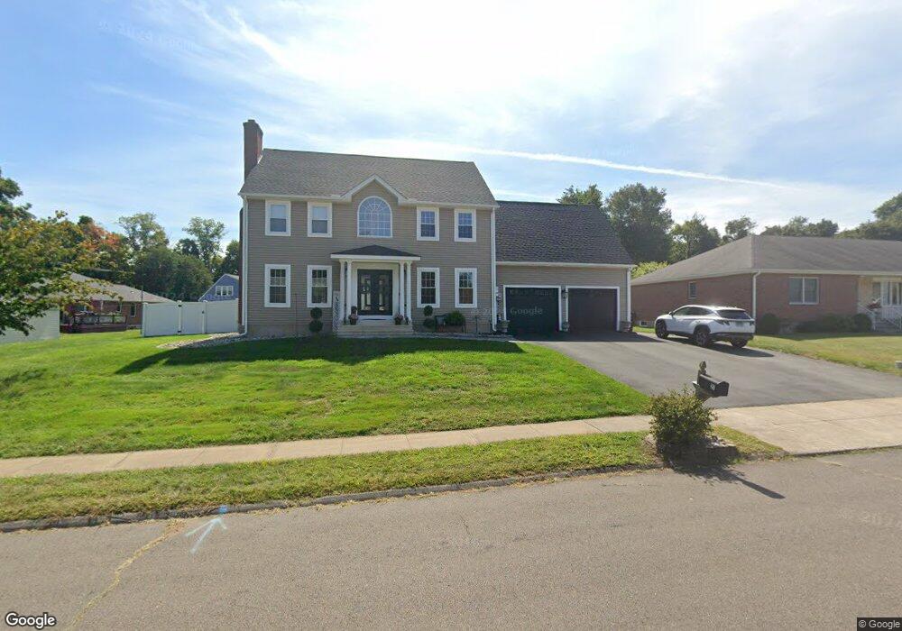
21 Aresco Dr Middletown, CT 06457
Westfield NeighborhoodEstimated Value: $440,000 - $568,000
3
Beds
3
Baths
2,282
Sq Ft
$209/Sq Ft
Est. Value
About This Home
This home is located at 21 Aresco Dr, Middletown, CT 06457 and is currently estimated at $478,067, approximately $209 per square foot. 21 Aresco Dr is a home located in Middlesex County with nearby schools including Wilbert Snow Elementary School, St John Paul II School, and Mercy High School.
Ownership History
Date
Name
Owned For
Owner Type
Purchase Details
Closed on
Sep 29, 2021
Sold by
Gilbert Cheryl A
Bought by
Labbadia Holly M and Aresco Daniel A
Current Estimated Value
Home Financials for this Owner
Home Financials are based on the most recent Mortgage that was taken out on this home.
Original Mortgage
$285,000
Outstanding Balance
$259,329
Interest Rate
2.8%
Mortgage Type
Purchase Money Mortgage
Estimated Equity
$218,738
Purchase Details
Closed on
Sep 7, 1999
Sold by
Aresco Louis
Bought by
Ezzard Stafford W and Ezzard Patricia S
Create a Home Valuation Report for This Property
The Home Valuation Report is an in-depth analysis detailing your home's value as well as a comparison with similar homes in the area
Home Values in the Area
Average Home Value in this Area
Purchase History
| Date | Buyer | Sale Price | Title Company |
|---|---|---|---|
| Labbadia Holly M | $300,000 | None Available | |
| Ezzard Stafford W | $55,000 | -- |
Source: Public Records
Mortgage History
| Date | Status | Borrower | Loan Amount |
|---|---|---|---|
| Open | Labbadia Holly M | $285,000 | |
| Previous Owner | Ezzard Stafford W | $244,252 | |
| Previous Owner | Ezzard Stafford W | $97,440 | |
| Previous Owner | Ezzard Stafford W | $224,000 | |
| Previous Owner | Ezzard Stafford W | $219,000 |
Source: Public Records
Tax History Compared to Growth
Tax History
| Year | Tax Paid | Tax Assessment Tax Assessment Total Assessment is a certain percentage of the fair market value that is determined by local assessors to be the total taxable value of land and additions on the property. | Land | Improvement |
|---|---|---|---|---|
| 2025 | $11,536 | $296,550 | $76,320 | $220,230 |
| 2024 | $10,913 | $296,550 | $76,320 | $220,230 |
| 2023 | $10,216 | $291,060 | $76,320 | $214,740 |
| 2022 | $9,686 | $220,130 | $50,880 | $169,250 |
| 2021 | $9,686 | $220,130 | $50,880 | $169,250 |
| 2020 | $9,730 | $220,130 | $50,880 | $169,250 |
| 2019 | $9,774 | $220,130 | $50,880 | $169,250 |
| 2018 | $9,620 | $220,130 | $50,880 | $169,250 |
| 2017 | $9,957 | $234,840 | $62,370 | $172,470 |
| 2016 | $9,675 | $234,840 | $62,370 | $172,470 |
| 2015 | $9,300 | $234,840 | $62,370 | $172,470 |
| 2014 | $9,394 | $234,840 | $62,370 | $172,470 |
Source: Public Records
Map
Nearby Homes
- 81 Aresco Dr
- 574 Butternut St
- 17 Mckenna Dr
- 40 Batt St
- 160 Boston Rd
- 237 Boston Rd
- 27 Barbara Rd
- 60 Old Mill Rd
- 498 Pine St
- 10 Lorelei Cir
- 55 Lorelei Cir
- 18 Phedon Pkwy
- 128 Highland Ave
- 1 Nathan Hale Rd
- 2 Nathan Hale Rd
- 4 Nathan Hale Rd
- 3 Nathan Hale Rd
- 31 Broadview Pkwy
- 84 Camp St
- 1271 Washington St Unit 7