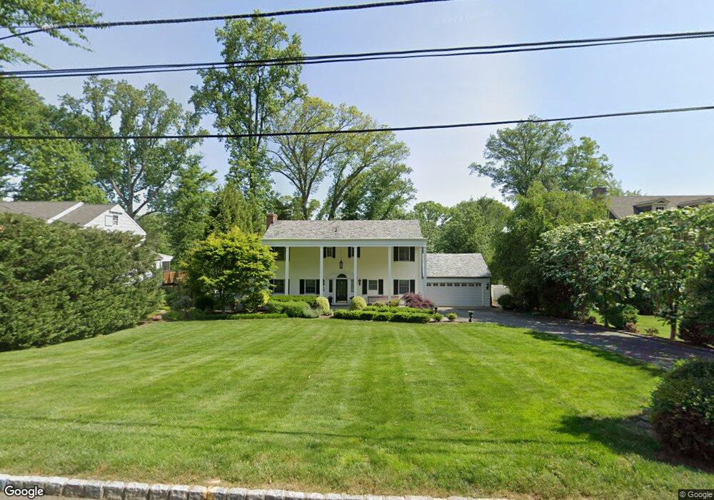
21 Armstrong Rd Morristown, NJ 07960
Estimated Value: $1,322,000 - $1,641,000
4
Beds
4
Baths
2,840
Sq Ft
$512/Sq Ft
Est. Value
About This Home
This home is located at 21 Armstrong Rd, Morristown, NJ 07960 and is currently estimated at $1,454,340, approximately $512 per square foot. 21 Armstrong Rd is a home located in Morris County with nearby schools including Hillcrest School, Thomas Jefferson School, and Alexander Hamilton School.
Ownership History
Date
Name
Owned For
Owner Type
Purchase Details
Closed on
Jul 30, 2008
Sold by
Altman Dean V and Altman Kristine
Bought by
Ball Mary Ellen
Current Estimated Value
Purchase Details
Closed on
Jan 21, 1999
Sold by
Croke Mark L and Croke Margaret A
Bought by
Altman Dean A and Altman Kristine
Home Financials for this Owner
Home Financials are based on the most recent Mortgage that was taken out on this home.
Original Mortgage
$410,000
Interest Rate
6.78%
Purchase Details
Closed on
May 31, 1996
Sold by
Strathearn Nancy E and William Strathearn J
Bought by
Croke Mark I and Croke Margaret A
Home Financials for this Owner
Home Financials are based on the most recent Mortgage that was taken out on this home.
Original Mortgage
$125,000
Interest Rate
7.45%
Create a Home Valuation Report for This Property
The Home Valuation Report is an in-depth analysis detailing your home's value as well as a comparison with similar homes in the area
Home Values in the Area
Average Home Value in this Area
Purchase History
| Date | Buyer | Sale Price | Title Company |
|---|---|---|---|
| Ball Mary Ellen | $1,075,000 | Chicago Title Insurance Co | |
| Altman Dean A | $565,000 | -- | |
| Croke Mark I | $425,000 | -- |
Source: Public Records
Mortgage History
| Date | Status | Borrower | Loan Amount |
|---|---|---|---|
| Previous Owner | Altman Dean A | $410,000 | |
| Previous Owner | Croke Mark I | $125,000 |
Source: Public Records
Tax History Compared to Growth
Tax History
| Year | Tax Paid | Tax Assessment Tax Assessment Total Assessment is a certain percentage of the fair market value that is determined by local assessors to be the total taxable value of land and additions on the property. | Land | Improvement |
|---|---|---|---|---|
| 2025 | $17,682 | $883,200 | $428,900 | $454,300 |
| 2024 | $17,708 | $883,200 | $428,900 | $454,300 |
| 2023 | $17,708 | $883,200 | $428,900 | $454,300 |
| 2022 | $16,387 | $883,200 | $428,900 | $454,300 |
| 2021 | $16,387 | $883,200 | $428,900 | $454,300 |
| 2020 | $16,445 | $883,200 | $428,900 | $454,300 |
| 2019 | $16,189 | $883,200 | $428,900 | $454,300 |
| 2018 | $16,012 | $883,200 | $428,900 | $454,300 |
| 2017 | $15,906 | $883,200 | $428,900 | $454,300 |
| 2016 | $15,659 | $883,200 | $428,900 | $454,300 |
| 2015 | $17,022 | $671,200 | $404,700 | $266,500 |
| 2014 | $16,800 | $671,200 | $404,700 | $266,500 |
Source: Public Records
Map
Nearby Homes
- 24 Spring Brook Rd
- 1 Spring Brook Rd
- 9 Wren Ct
- 4 Old Harter Rd
- 234 Mount Kemble Ave
- 10 Westminster Place
- 232 Mount Kemble Ave
- 282 Mount Kemble Ave
- 237 Mount Kemble Ave
- 2 Skyline Dr
- 194 James St
- 97 Skyline Dr
- 21 Maxwell Ct
- 1 Twin Oaks Ln
- 43 Raven Dr
- 9 Carla Ct
- 2 Blackwell Ave
- 6 Brookfield Way
- 59 James St
- 2 Squirrel Run
- 19 Armstrong Rd
- 23 Armstrong Rd
- 17 Armstrong Rd
- 25 Armstrong Rd
- 20 Armstrong Rd
- 22 Armstrong Rd
- 18 Armstrong Rd
- 24 Armstrong Rd
- 27 Armstrong Rd
- 11 Armstrong Rd
- 16 Armstrong Rd
- 26 Armstrong Rd
- 14 Armstrong Rd
- 29 Armstrong Rd
- 9 Armstrong Rd
- 28 Armstrong Rd
- 37 Spring Brook Rd
- 39 Spring Brook Rd
- 33 Spring Brook Rd
- 31 Spring Brook Rd