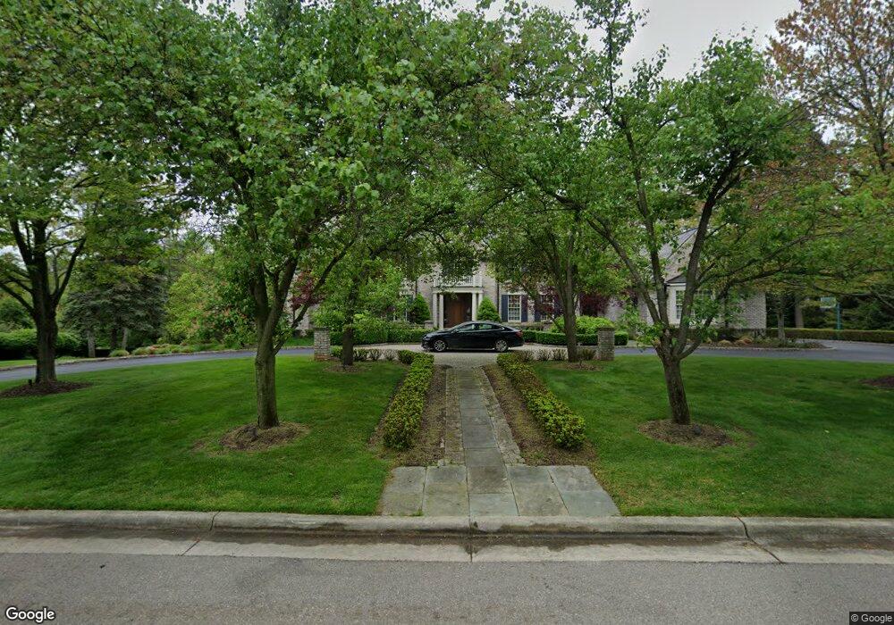
21 Beresford Ct Bloomfield Hills, MI 48304
Estimated Value: $2,957,666 - $5,297,000
5
Beds
7
Baths
5,877
Sq Ft
$720/Sq Ft
Est. Value
About This Home
This home is located at 21 Beresford Ct, Bloomfield Hills, MI 48304 and is currently estimated at $4,231,555, approximately $720 per square foot. 21 Beresford Ct is a home located in Oakland County with nearby schools including Way Elementary School, South Hills Middle School, and Bloomfield Hills High School.
Ownership History
Date
Name
Owned For
Owner Type
Purchase Details
Closed on
Jul 11, 2012
Sold by
Peck George A and Peck Andrea L
Bought by
Peck Andrea L and Peck George A
Current Estimated Value
Purchase Details
Closed on
Sep 12, 2007
Sold by
Gardhouse Ronald J and Gardhouse Christine L
Bought by
Peck George A and Peck Andrea L
Purchase Details
Closed on
Apr 24, 2001
Sold by
Manor Homes Inc
Bought by
Gardhouse Ronald J
Purchase Details
Closed on
Feb 2, 2001
Sold by
Ocean Capital Inv Ltd Pt
Bought by
Manor Homes Inc
Create a Home Valuation Report for This Property
The Home Valuation Report is an in-depth analysis detailing your home's value as well as a comparison with similar homes in the area
Home Values in the Area
Average Home Value in this Area
Purchase History
| Date | Buyer | Sale Price | Title Company |
|---|---|---|---|
| Peck Andrea L | -- | None Available | |
| Peck George A | -- | Philip R Seaver Title Co Inc | |
| Gardhouse Ronald J | $800,000 | -- | |
| Manor Homes Inc | -- | -- |
Source: Public Records
Tax History Compared to Growth
Tax History
| Year | Tax Paid | Tax Assessment Tax Assessment Total Assessment is a certain percentage of the fair market value that is determined by local assessors to be the total taxable value of land and additions on the property. | Land | Improvement |
|---|---|---|---|---|
| 2024 | $34,029 | $1,879,770 | $0 | $0 |
| 2023 | $32,737 | $1,728,390 | $0 | $0 |
| 2022 | $38,071 | $1,703,490 | $0 | $0 |
| 2021 | $36,619 | $1,696,560 | $0 | $0 |
| 2020 | $29,892 | $1,649,990 | $0 | $0 |
| 2019 | $33,938 | $1,635,250 | $0 | $0 |
| 2018 | $34,031 | $1,568,820 | $0 | $0 |
| 2017 | $33,677 | $1,452,050 | $0 | $0 |
| 2016 | $33,563 | $1,335,350 | $0 | $0 |
| 2015 | -- | $1,234,210 | $0 | $0 |
| 2014 | -- | $1,081,460 | $0 | $0 |
| 2011 | -- | $944,640 | $0 | $0 |
Source: Public Records
Map
Nearby Homes
- 270 Martell Dr
- 596 Rudgate Rd
- 692 Bennington Dr
- 60 Kingsley Manor Dr
- 341 Keswick Rd
- 33 Boulder Ln Unit 2
- 931 Vaughan Rd
- 275 Barden Rd
- 1348 Charrington Rd
- 362 Keswick Rd
- 1260 Lyonhurst St
- 1287 Charrington Rd
- 170 Kirkwood Ct
- 1120 Lyonhurst St
- 1012 Stratford Ln Unit 64
- 3673 York Ct
- 956 Westwood Dr
- 130 Denbar Rd
- 110 Denbar Rd
- 4650 Lahser Rd
- 475 Goodhue Rd
- 475 Goodhue Rd
- 451 Goodhue Rd
- 14 Beresford Ct
- 35 Beresford Ct
- 42 Beresford Ct
- 420 Martell Dr
- 433 Goodhue Rd
- 469 Goodhue Rd Unit Bldg-Unit
- 469 Goodhue Rd
- 460 Martell Dr
- 490 Martell Dr
- 420 Goodhue Rd
- 400 Martell Dr
- 330 Martell Ct
- 459 Martell Dr
- 340 Martell Ct
- 411 Martell Dr
- 491 Martell Dr
- 320 Martell Ct