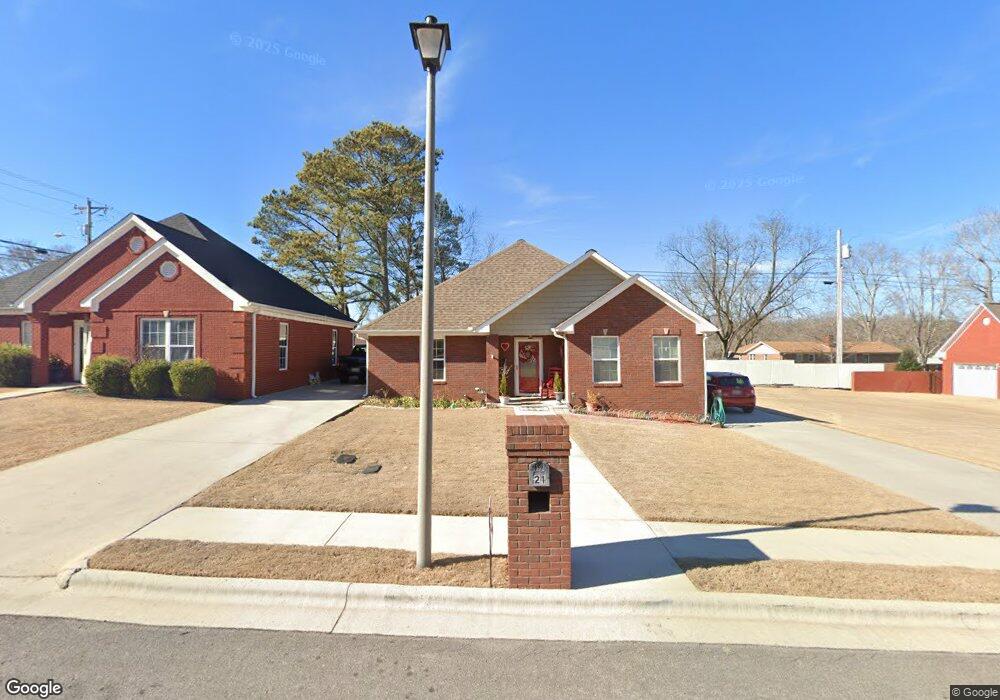
21 Boardwalk Scottsboro, AL 35769
Estimated Value: $252,000 - $344,000
--
Bed
1
Bath
1,458
Sq Ft
$205/Sq Ft
Est. Value
About This Home
This home is located at 21 Boardwalk, Scottsboro, AL 35769 and is currently estimated at $299,343, approximately $205 per square foot. 21 Boardwalk is a home located in Jackson County with nearby schools including Scottsboro High School.
Ownership History
Date
Name
Owned For
Owner Type
Purchase Details
Closed on
Oct 31, 2022
Sold by
Wright Thelma Lee
Bought by
Starling William Bruce and Starling Patrick Teresa
Current Estimated Value
Purchase Details
Closed on
Mar 7, 2017
Sold by
Tucker Alison Small Matthews
Bought by
Wright Thelma Lee
Purchase Details
Closed on
Apr 26, 2012
Sold by
Moore Moore Dana Dana and Moore Cope Skylar
Bought by
Matthews Alison Small
Home Financials for this Owner
Home Financials are based on the most recent Mortgage that was taken out on this home.
Original Mortgage
$120,000
Interest Rate
4.01%
Create a Home Valuation Report for This Property
The Home Valuation Report is an in-depth analysis detailing your home's value as well as a comparison with similar homes in the area
Home Values in the Area
Average Home Value in this Area
Purchase History
| Date | Buyer | Sale Price | Title Company |
|---|---|---|---|
| Starling William Bruce | $210,000 | -- | |
| Wright Thelma Lee | $169,000 | None Available | |
| Matthews Alison Small | -- | -- |
Source: Public Records
Mortgage History
| Date | Status | Borrower | Loan Amount |
|---|---|---|---|
| Previous Owner | Matthews Alison Small | $120,000 |
Source: Public Records
Tax History Compared to Growth
Tax History
| Year | Tax Paid | Tax Assessment Tax Assessment Total Assessment is a certain percentage of the fair market value that is determined by local assessors to be the total taxable value of land and additions on the property. | Land | Improvement |
|---|---|---|---|---|
| 2024 | $999 | $20,200 | $0 | $0 |
| 2023 | $931 | $20,200 | $0 | $0 |
| 2022 | $756 | $15,580 | $0 | $0 |
| 2021 | $756 | $15,580 | $0 | $0 |
| 2020 | $651 | $13,420 | $0 | $0 |
| 2019 | $6 | $13,420 | $0 | $0 |
| 2018 | $0 | $13,760 | $0 | $0 |
| 2017 | $618 | $137,500 | $0 | $0 |
| 2016 | $588 | $131,300 | $0 | $0 |
| 2015 | $588 | $131,300 | $0 | $0 |
| 2014 | $588 | $131,300 | $0 | $0 |
| 2013 | -- | $131,300 | $0 | $0 |
Source: Public Records
Map
Nearby Homes
- 1625 Delwood Cir
- 1802 Roseberry Dr
- 6 Acres John T Reid Pkwy
- 1916 Virginia Ave
- 000 John T Reid Pkwy
- 2108 Roseberry Dr
- 2103 Roseberry Dr
- 1808 Roseberry Dr
- 1610 E Ridge Rd
- 2111 Meadow Island Rd
- 279 Winn Rd
- 302 Picadilly Dr
- 1503 Larry Dr
- 2918 Hillcrest Dr
- 2904 S Broad St
- 1302 Garden Dr
- 1611 Hood Ave
- 0 S Broad St Unit 16484396
- 0 Wisteria Way Unit 7233402
- 0 Wisteria Way Unit 10396630