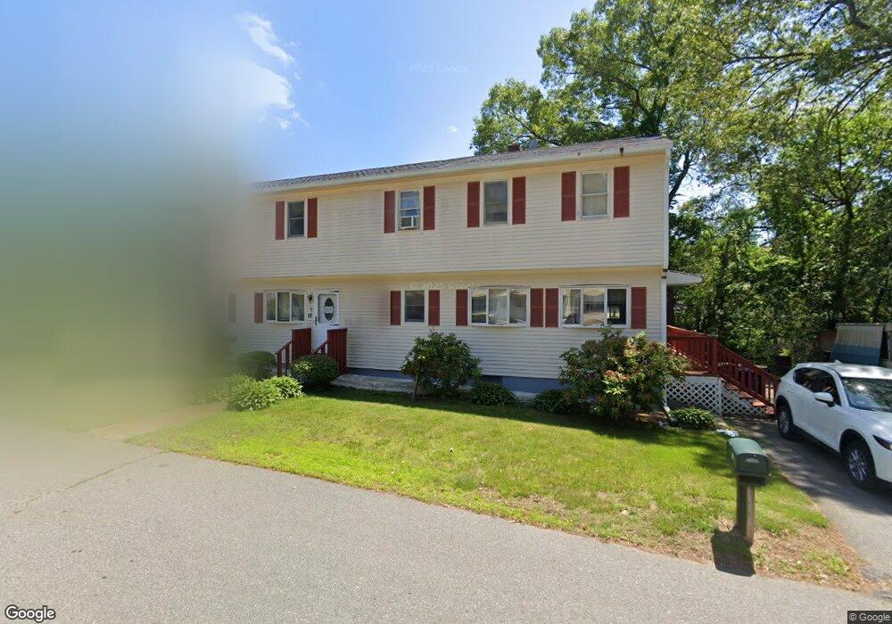
21 Bolton Ave Dracut, MA 01826
Estimated Value: $578,618 - $681,000
5
Beds
2
Baths
2,184
Sq Ft
$283/Sq Ft
Est. Value
About This Home
This home is located at 21 Bolton Ave, Dracut, MA 01826 and is currently estimated at $617,655, approximately $282 per square foot. 21 Bolton Ave is a home located in Middlesex County with nearby schools including George H. Englesby Elementary School, Richardson Middle School, and Dracut Senior High School.
Ownership History
Date
Name
Owned For
Owner Type
Purchase Details
Closed on
May 19, 2014
Sold by
Nay Sarin and Chea Sophy
Bought by
Chea Ft
Current Estimated Value
Purchase Details
Closed on
Oct 15, 2003
Sold by
Ean Ath
Bought by
Nay Sarin and Chea Sophy
Home Financials for this Owner
Home Financials are based on the most recent Mortgage that was taken out on this home.
Original Mortgage
$80,000
Interest Rate
6.43%
Mortgage Type
Purchase Money Mortgage
Purchase Details
Closed on
Sep 7, 1999
Sold by
Norton William J and Norton Deborah J
Bought by
Ean Ath
Home Financials for this Owner
Home Financials are based on the most recent Mortgage that was taken out on this home.
Original Mortgage
$144,000
Interest Rate
7.5%
Mortgage Type
Purchase Money Mortgage
Purchase Details
Closed on
Apr 30, 1998
Sold by
Vigeant Russell G
Bought by
Norton William J and Norton Deborah J
Home Financials for this Owner
Home Financials are based on the most recent Mortgage that was taken out on this home.
Original Mortgage
$152,900
Interest Rate
7.04%
Mortgage Type
Purchase Money Mortgage
Create a Home Valuation Report for This Property
The Home Valuation Report is an in-depth analysis detailing your home's value as well as a comparison with similar homes in the area
Home Values in the Area
Average Home Value in this Area
Purchase History
| Date | Buyer | Sale Price | Title Company |
|---|---|---|---|
| Chea Ft | -- | -- | |
| Nay Sarin | $280,000 | -- | |
| Ean Ath | $180,000 | -- | |
| Norton William J | $169,900 | -- |
Source: Public Records
Mortgage History
| Date | Status | Borrower | Loan Amount |
|---|---|---|---|
| Previous Owner | Nay Sarin | $80,000 | |
| Previous Owner | Norton William J | $180,000 | |
| Previous Owner | Norton William J | $144,000 | |
| Previous Owner | Norton William J | $152,900 |
Source: Public Records
Tax History Compared to Growth
Tax History
| Year | Tax Paid | Tax Assessment Tax Assessment Total Assessment is a certain percentage of the fair market value that is determined by local assessors to be the total taxable value of land and additions on the property. | Land | Improvement |
|---|---|---|---|---|
| 2025 | $4,745 | $468,900 | $180,100 | $288,800 |
| 2024 | $4,576 | $437,900 | $171,500 | $266,400 |
| 2023 | $4,429 | $382,500 | $149,100 | $233,400 |
| 2022 | $4,315 | $351,100 | $135,500 | $215,600 |
| 2021 | $4,162 | $319,900 | $123,200 | $196,700 |
| 2020 | $9,424 | $301,800 | $119,600 | $182,200 |
| 2019 | $3,850 | $280,000 | $113,900 | $166,100 |
| 2018 | $4,028 | $284,900 | $113,900 | $171,000 |
| 2017 | $3,995 | $284,900 | $113,900 | $171,000 |
| 2016 | $3,884 | $261,700 | $109,500 | $152,200 |
| 2015 | $3,744 | $250,800 | $109,500 | $141,300 |
| 2014 | $3,498 | $241,400 | $109,500 | $131,900 |
Source: Public Records
Map
Nearby Homes
- 157 Old Rd
- 174 Old Rd
- 11 Mountain View Dr
- 190 Old Rd
- 100 Cass Ave Unit A13
- 14 Louis Farm Rd Unit 14
- 999 Hildreth St
- 15 Louis Farm Rd Unit 15
- 20 Dean Ave
- 148 Flower Ln Unit 14
- 94 Hampson St
- 83 Turgeon Ave
- 161 Flower Ln Unit 5
- 81 Spring Park Ave
- 101 Donohue Rd Unit 19
- 101 Donohue Rd Unit 3
- 1572 Bridge St
- 26 Frank St
- 18 Stone St
- 45 Hoover St