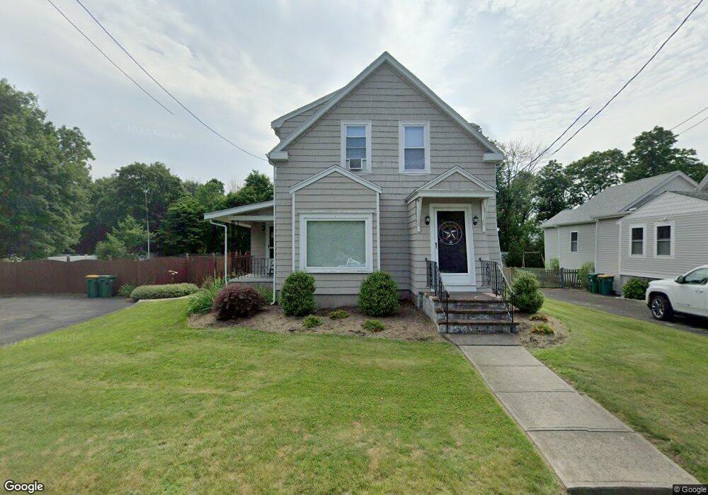
21 Branch St Mansfield, MA 02048
Estimated Value: $609,825 - $672,000
3
Beds
2
Baths
1,538
Sq Ft
$421/Sq Ft
Est. Value
About This Home
This home is located at 21 Branch St, Mansfield, MA 02048 and is currently estimated at $647,956, approximately $421 per square foot. 21 Branch St is a home located in Bristol County with nearby schools including Everett W. Robinson Elementary School, Jordan/Jackson Elementary School, and Harold L. Qualters Middle School.
Ownership History
Date
Name
Owned For
Owner Type
Purchase Details
Closed on
Jan 8, 2021
Sold by
Schofield Kelly A and Schofield Vincent G
Bought by
Schofield Kelly A
Current Estimated Value
Home Financials for this Owner
Home Financials are based on the most recent Mortgage that was taken out on this home.
Original Mortgage
$316,000
Outstanding Balance
$282,031
Interest Rate
2.71%
Mortgage Type
Stand Alone Refi Refinance Of Original Loan
Estimated Equity
$365,925
Purchase Details
Closed on
Jun 25, 1998
Sold by
Kruglewicz Stephen
Bought by
Schofield Vincent G and Schofield Kelly A
Home Financials for this Owner
Home Financials are based on the most recent Mortgage that was taken out on this home.
Original Mortgage
$149,694
Interest Rate
7.09%
Mortgage Type
Purchase Money Mortgage
Purchase Details
Closed on
Apr 29, 1988
Sold by
Tarquinio Ernest D
Bought by
Kruglwicz Stephen
Create a Home Valuation Report for This Property
The Home Valuation Report is an in-depth analysis detailing your home's value as well as a comparison with similar homes in the area
Home Values in the Area
Average Home Value in this Area
Purchase History
| Date | Buyer | Sale Price | Title Company |
|---|---|---|---|
| Schofield Kelly A | -- | None Available | |
| Schofield Vincent G | $152,000 | -- | |
| Kruglwicz Stephen | $156,500 | -- |
Source: Public Records
Mortgage History
| Date | Status | Borrower | Loan Amount |
|---|---|---|---|
| Open | Schofield Kelly A | $316,000 | |
| Previous Owner | Kruglwicz Stephen | $10,000 | |
| Previous Owner | Kruglwicz Stephen | $173,500 | |
| Previous Owner | Kruglwicz Stephen | $149,694 |
Source: Public Records
Tax History Compared to Growth
Tax History
| Year | Tax Paid | Tax Assessment Tax Assessment Total Assessment is a certain percentage of the fair market value that is determined by local assessors to be the total taxable value of land and additions on the property. | Land | Improvement |
|---|---|---|---|---|
| 2025 | $6,440 | $489,000 | $233,100 | $255,900 |
| 2024 | $6,473 | $479,500 | $233,100 | $246,400 |
| 2023 | $6,270 | $445,000 | $233,100 | $211,900 |
| 2022 | $6,200 | $408,700 | $215,700 | $193,000 |
| 2021 | $0 | $375,300 | $188,900 | $186,400 |
| 2020 | $0 | $341,700 | $179,900 | $161,800 |
| 2019 | $5,068 | $333,000 | $149,800 | $183,200 |
| 2018 | $0 | $317,700 | $142,800 | $174,900 |
| 2017 | $4,377 | $310,300 | $138,600 | $171,700 |
| 2016 | $4,400 | $285,500 | $131,900 | $153,600 |
| 2015 | $4,222 | $272,400 | $131,900 | $140,500 |
Source: Public Records
Map
Nearby Homes
- 21 East St Unit 1D
- 12 Wilson Place
- 16 East St Unit 2
- 72 Court St Unit B
- 72 Court St Unit A
- 38 Court St
- 28 Court St
- 28 Court St Unit 4
- 76 Samoset Ave
- 241-243 N Main St
- 99 Pleasant St
- 150 Rumford Ave Unit 222
- 14 School St
- 22 Pleasant St Unit B
- 22 Pleasant St Unit A
- 82 Brook St
- 34 Warren Ave
- 245 Willow St
- 60 King St
- 442 Ware St