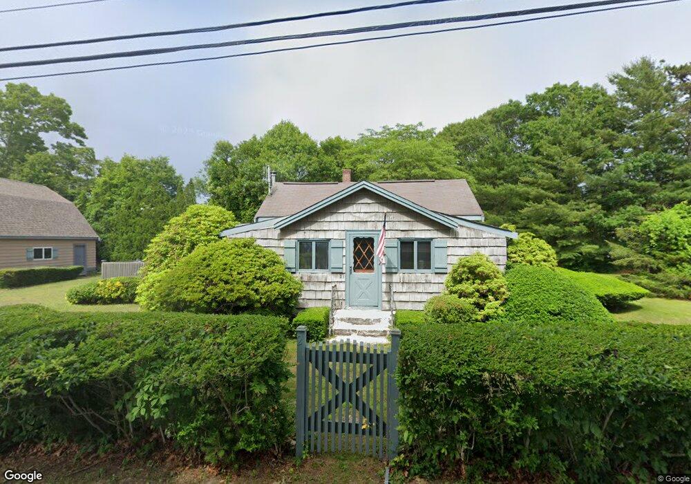
21 Cahoon Rd Unit 1 Buzzards Bay, MA 02532
Estimated Value: $470,000 - $569,000
2
Beds
2
Baths
1,372
Sq Ft
$368/Sq Ft
Est. Value
About This Home
This home is located at 21 Cahoon Rd Unit 1, Buzzards Bay, MA 02532 and is currently estimated at $505,518, approximately $368 per square foot. 21 Cahoon Rd Unit 1 is a home located in Plymouth County with nearby schools including St Margaret Regional School.
Ownership History
Date
Name
Owned For
Owner Type
Purchase Details
Closed on
Aug 22, 2022
Sold by
Forsyth Ft and Forsyth
Bought by
Forsyth David S and Forsyth Jesse B
Current Estimated Value
Purchase Details
Closed on
Feb 16, 2016
Sold by
Forsyth David F
Bought by
Forsyth Ft and Forsyth
Purchase Details
Closed on
Sep 30, 2015
Sold by
Johnson Gilbert and Johnson Sybil T
Bought by
Forsyth David F
Create a Home Valuation Report for This Property
The Home Valuation Report is an in-depth analysis detailing your home's value as well as a comparison with similar homes in the area
Purchase History
| Date | Buyer | Sale Price | Title Company |
|---|---|---|---|
| Forsyth David S | -- | None Available | |
| Forsyth David S | -- | None Available | |
| Forsyth Ft | -- | None Available | |
| Forsyth Ft | -- | None Available | |
| Forsyth David F | $245,000 | -- | |
| Forsyth David F | $245,000 | -- |
Source: Public Records
Tax History
| Year | Tax Paid | Tax Assessment Tax Assessment Total Assessment is a certain percentage of the fair market value that is determined by local assessors to be the total taxable value of land and additions on the property. | Land | Improvement |
|---|---|---|---|---|
| 2025 | $4,575 | $416,700 | $121,900 | $294,800 |
| 2024 | $4,359 | $373,200 | $95,600 | $277,600 |
| 2023 | $3,977 | $336,900 | $86,900 | $250,000 |
| 2022 | $3,977 | $292,000 | $86,900 | $205,100 |
| 2021 | $3,972 | $283,700 | $86,900 | $196,800 |
| 2020 | $3,700 | $269,900 | $86,900 | $183,000 |
| 2019 | $3,557 | $262,300 | $84,900 | $177,400 |
| 2018 | $3,410 | $242,900 | $84,900 | $158,000 |
| 2017 | $3,201 | $229,000 | $84,900 | $144,100 |
| 2016 | $2,629 | $186,600 | $83,500 | $103,100 |
| 2015 | $2,556 | $186,600 | $83,500 | $103,100 |
| 2014 | $2,521 | $189,700 | $83,500 | $106,200 |
Source: Public Records
Map
Nearby Homes
- 3 Fairway Dr Unit F
- 3132 Cranberry Hwy Unit 59
- 13 Bay Pointe Drive Extension
- 13 Bay Pointe Drive Extension Unit 13
- 92 Choctaw Dr
- 60 Martin St
- 67 Algonquin St
- 22 Long Neck Rd
- 23 Starboard Dr Unit Lot 50
- 36B Starboard Dr Unit 36E
- 36B Starboard Dr Unit 36G
- 36B Starboard Dr Unit 36C
- 36B Starboard Dr Unit 36A
- 36B Starboard Dr Unit 36D
- 36B Starboard Dr Unit 36B
- 36B Starboard Dr Unit 36F
- 36B Starboard Dr Unit 36H
- 29 Wenonah Rd
- 29 Wenonah Rd
- 0 Broad St Off Unit 72362523
Your Personal Tour Guide
Ask me questions while you tour the home.