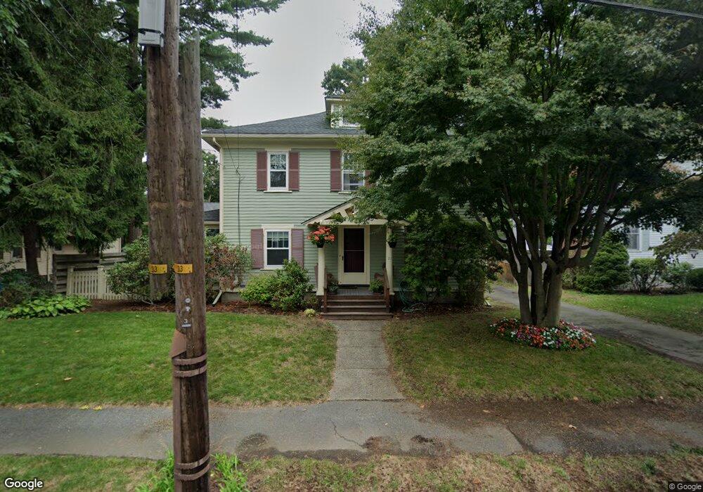
21 Camden Rd Auburndale, MA 02466
Auburndale NeighborhoodEstimated Value: $1,243,000 - $1,379,000
4
Beds
2
Baths
1,865
Sq Ft
$698/Sq Ft
Est. Value
About This Home
This home is located at 21 Camden Rd, Auburndale, MA 02466 and is currently estimated at $1,302,016, approximately $698 per square foot. 21 Camden Rd is a home located in Middlesex County with nearby schools including C.C. Burr, F.A. Day Middle School, and Newton North High School.
Ownership History
Date
Name
Owned For
Owner Type
Purchase Details
Closed on
Mar 3, 1993
Sold by
Romich Douglas A and Tietbohl Patricia A
Bought by
Weisberg Jonathan and Hemley Deborah
Current Estimated Value
Create a Home Valuation Report for This Property
The Home Valuation Report is an in-depth analysis detailing your home's value as well as a comparison with similar homes in the area
Home Values in the Area
Average Home Value in this Area
Purchase History
| Date | Buyer | Sale Price | Title Company |
|---|---|---|---|
| Weisberg Jonathan | $271,500 | -- |
Source: Public Records
Mortgage History
| Date | Status | Borrower | Loan Amount |
|---|---|---|---|
| Closed | Weisberg Jonathan | $120,000 | |
| Open | Weisberg Jonathan | $225,000 | |
| Closed | Weisberg Jonathan | $120,000 |
Source: Public Records
Tax History Compared to Growth
Tax History
| Year | Tax Paid | Tax Assessment Tax Assessment Total Assessment is a certain percentage of the fair market value that is determined by local assessors to be the total taxable value of land and additions on the property. | Land | Improvement |
|---|---|---|---|---|
| 2025 | $8,884 | $906,500 | $856,500 | $50,000 |
| 2024 | $8,590 | $880,100 | $831,600 | $48,500 |
| 2023 | $8,094 | $795,100 | $628,300 | $166,800 |
| 2022 | $7,745 | $736,200 | $581,800 | $154,400 |
| 2021 | $7,473 | $694,500 | $548,900 | $145,600 |
| 2020 | $7,251 | $694,500 | $548,900 | $145,600 |
| 2019 | $7,046 | $674,300 | $532,900 | $141,400 |
| 2018 | $6,702 | $619,400 | $480,900 | $138,500 |
| 2017 | $6,497 | $584,300 | $453,700 | $130,600 |
| 2016 | $6,215 | $546,100 | $424,000 | $122,100 |
| 2015 | $5,926 | $510,400 | $396,300 | $114,100 |
Source: Public Records
Map
Nearby Homes
- 62-64 Rowe St Unit B
- 13 Weir St
- 17 Crescent St
- 160 Pine St Unit 12
- 10 Crescent St Unit 1
- 10 Crescent St Unit 2
- 226 Auburn St Unit 226
- 224 Auburn St Unit 224
- 224 Auburn St Unit A
- 51 Bourne St
- 0 Duncan Rd Unit 72925240
- 17 Gilbert St
- 90 Auburndale Ave
- 283 Melrose St
- 1639 Washington St
- 49 Staniford St
- 2202 Commonwealth Ave Unit 2
- 2202 Commonwealth Ave Unit 1
- 101-103 Lexington St
- 17 Lasell St
- 15 Camden Rd
- 27 Camden Rd
- 12 Tudor Terrace
- 18 Tudor Terrace
- 341 Wolcott St
- 252 Auburndale Ave Unit 254
- 254 Auburndale Ave
- 18 Camden Rd
- 248 Auburndale Ave
- 14 Camden Rd
- 256 Auburndale Ave
- 335 Wolcott St
- 10 Camden Rd
- 361 Wolcott St
- 346 Wolcott St
- 340 Wolcott St
- 242 Auburndale Ave
- 5 Tudor Terrace
- 354 Wolcott St
- 327 Wolcott St