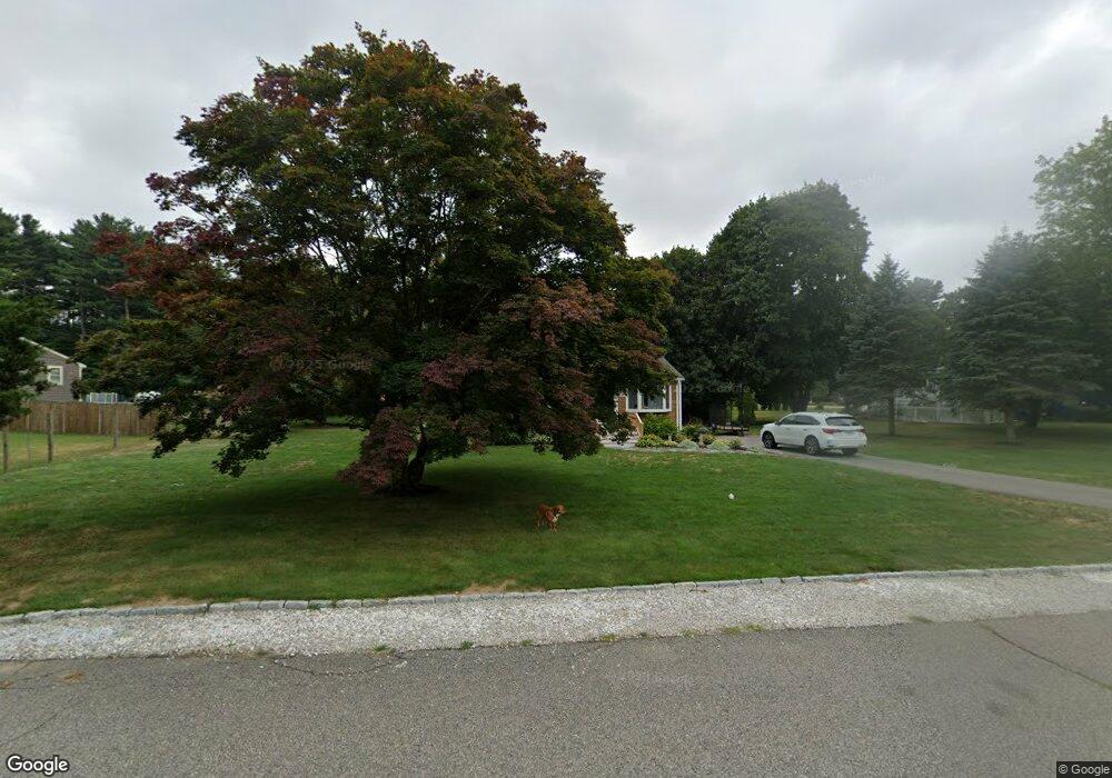
21 Cedarcrest Rd Hanover, MA 02339
Estimated Value: $528,307 - $658,000
3
Beds
1
Bath
960
Sq Ft
$621/Sq Ft
Est. Value
About This Home
This home is located at 21 Cedarcrest Rd, Hanover, MA 02339 and is currently estimated at $596,577, approximately $621 per square foot. 21 Cedarcrest Rd is a home located in Plymouth County with nearby schools including Hanover High School, Cadence Academy Preschool - Hanover, and The Master's Academy.
Ownership History
Date
Name
Owned For
Owner Type
Purchase Details
Closed on
Jul 8, 2004
Sold by
Calkins Nancylee
Bought by
Strojny Stephanie and Brackett Jennifer A
Current Estimated Value
Purchase Details
Closed on
Jan 22, 1977
Bought by
Stroiny Stephanie and Brackett Jennifer A
Create a Home Valuation Report for This Property
The Home Valuation Report is an in-depth analysis detailing your home's value as well as a comparison with similar homes in the area
Home Values in the Area
Average Home Value in this Area
Purchase History
| Date | Buyer | Sale Price | Title Company |
|---|---|---|---|
| Strojny Stephanie | -- | -- | |
| Stroiny Stephanie | -- | -- |
Source: Public Records
Mortgage History
| Date | Status | Borrower | Loan Amount |
|---|---|---|---|
| Open | Stroiny Stephanie | $90,000 | |
| Closed | Stroiny Stephanie | $30,000 | |
| Previous Owner | Stroiny Stephanie | $15,000 |
Source: Public Records
Tax History
| Year | Tax Paid | Tax Assessment Tax Assessment Total Assessment is a certain percentage of the fair market value that is determined by local assessors to be the total taxable value of land and additions on the property. | Land | Improvement |
|---|---|---|---|---|
| 2025 | $5,975 | $483,800 | $269,400 | $214,400 |
| 2024 | $6,212 | $483,800 | $269,400 | $214,400 |
| 2023 | $5,695 | $422,200 | $244,900 | $177,300 |
| 2022 | $5,841 | $383,000 | $244,900 | $138,100 |
| 2021 | $3,870 | $361,800 | $222,600 | $139,200 |
| 2020 | $5,837 | $357,900 | $222,600 | $135,300 |
| 2019 | $7,288 | $342,200 | $222,600 | $119,600 |
| 2018 | $3,614 | $337,000 | $222,600 | $114,400 |
| 2017 | $9,188 | $314,800 | $209,500 | $105,300 |
| 2016 | $4,987 | $295,800 | $190,500 | $105,300 |
| 2015 | $4,569 | $282,900 | $190,500 | $92,400 |
Source: Public Records
Map
Nearby Homes
- 506 Main St
- 62 Larchmont Ln
- 776 Main St
- 44 Stone Meadow Ln
- 47 Stone Meadow Ln
- 53 Chestnut St
- 36 Grove St
- 36 Bayberry Ln
- 250 Center St
- 51 Cervelli Farm Dr
- 37 Dr
- 23 Cervelli Farm Dr
- 38 Cervelli Farm Dr
- 9 Cervelli Farm Dr
- 561 Circuit St
- 535 Webster St
- 73 Shingle Mill Ln
- 46 Brookwood Rd
- 75 School St
- 95 Tecumseh Dr
- 33 Cedarcrest Rd
- 42 Ridge Hill Dr
- 60 Ridge Hill Dr
- 20 Cedarcrest Rd
- 8 Cedarcrest Rd
- 43 Cedarcrest Rd
- 42 Cedarcrest Rd
- 74 Ridge Hill Dr
- 41 Ridge Hill Dr
- 32 Cedarcrest Rd
- 53 Ridge Hill Dr
- 31 Ridge Hill Dr
- 55 Cedarcrest Rd
- 80 Ridge Hill Dr
- 76 Cedar St
- 65 Ridge Hill Dr
- 17 Ridge Hill Dr
- 56 Cedarcrest Rd
- 90 Cedar St
- 52 Cedarcrest Rd
Your Personal Tour Guide
Ask me questions while you tour the home.