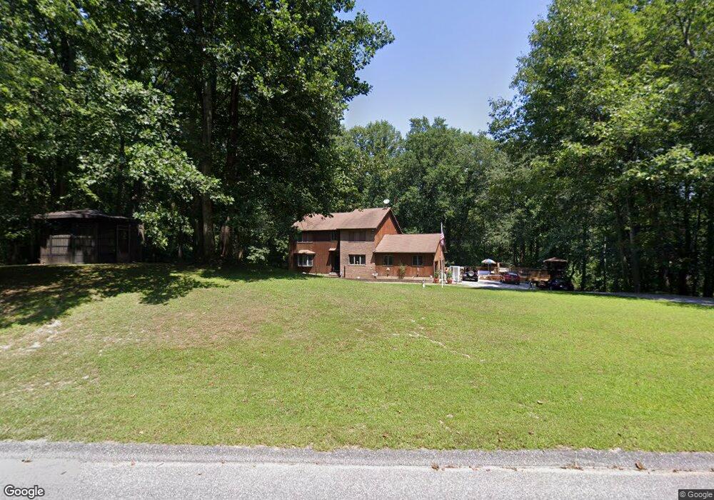
21 Clarks Ln Reisterstown, MD 21136
Estimated Value: $612,522 - $750,000
--
Bed
3
Baths
2,703
Sq Ft
$253/Sq Ft
Est. Value
About This Home
This home is located at 21 Clarks Ln, Reisterstown, MD 21136 and is currently estimated at $684,881, approximately $253 per square foot. 21 Clarks Ln is a home located in Baltimore County with nearby schools including Cedarmere Elementary School, Franklin Middle, and Franklin High.
Ownership History
Date
Name
Owned For
Owner Type
Purchase Details
Closed on
Sep 24, 2007
Sold by
Miller Lillian M
Bought by
Miller Steven M and Miller Loretta
Current Estimated Value
Home Financials for this Owner
Home Financials are based on the most recent Mortgage that was taken out on this home.
Original Mortgage
$258,000
Outstanding Balance
$159,711
Interest Rate
6.14%
Mortgage Type
Stand Alone Refi Refinance Of Original Loan
Estimated Equity
$525,170
Purchase Details
Closed on
Apr 19, 2007
Sold by
Miller Lillian M
Bought by
Miller Steven M and Miller Loretta
Home Financials for this Owner
Home Financials are based on the most recent Mortgage that was taken out on this home.
Original Mortgage
$258,000
Interest Rate
6.14%
Mortgage Type
New Conventional
Purchase Details
Closed on
May 30, 2000
Sold by
Miller Jeffrey D E
Bought by
Miller Lillian M
Create a Home Valuation Report for This Property
The Home Valuation Report is an in-depth analysis detailing your home's value as well as a comparison with similar homes in the area
Home Values in the Area
Average Home Value in this Area
Purchase History
| Date | Buyer | Sale Price | Title Company |
|---|---|---|---|
| Miller Steven M | -- | -- | |
| Miller Steven M | -- | -- | |
| Miller Lillian M | $275,000 | -- |
Source: Public Records
Mortgage History
| Date | Status | Borrower | Loan Amount |
|---|---|---|---|
| Open | Miller Steven M | $258,000 | |
| Previous Owner | Miller Steven M | $258,000 |
Source: Public Records
Tax History Compared to Growth
Tax History
| Year | Tax Paid | Tax Assessment Tax Assessment Total Assessment is a certain percentage of the fair market value that is determined by local assessors to be the total taxable value of land and additions on the property. | Land | Improvement |
|---|---|---|---|---|
| 2025 | $6,223 | $541,633 | -- | -- |
| 2024 | $6,223 | $510,800 | $117,200 | $393,600 |
| 2023 | $2,978 | $486,500 | $0 | $0 |
| 2022 | $5,611 | $462,200 | $0 | $0 |
| 2021 | $5,090 | $437,900 | $117,200 | $320,700 |
| 2020 | $5,090 | $415,000 | $0 | $0 |
| 2019 | $4,812 | $392,100 | $0 | $0 |
| 2018 | $4,535 | $369,200 | $117,200 | $252,000 |
| 2017 | $4,494 | $369,200 | $0 | $0 |
| 2016 | $4,257 | $369,200 | $0 | $0 |
| 2015 | $4,257 | $373,300 | $0 | $0 |
| 2014 | $4,257 | $373,300 | $0 | $0 |
Source: Public Records
Map
Nearby Homes
- 9 Norris Run Ct
- 1015 Nicodemus Rd
- 926 Nicodemus Rd
- 701 Cockeys Mill Rd
- 123 Glyndon Trace Dr
- 617 Berrymans Ln
- 902 Honeyflower Dr
- 623 Berrymans Ln
- 903 Honeyflower Dr
- 906 Honeyflower Dr
- 8 Beau Mondes Ct
- 625 Berrymans Ln
- 700 Pineapple Ct
- Presley Plan at Worthington Grove
- Melody Plan at Worthington Grove
- Hemingway Plan at Worthington Grove
- Donovan Plan at Worthington Grove
- Preston Plan at Worthington Grove
- 703 Pineapple Ct
- 704 Pineapple Ct