21 Clarkston Rd Clarkston, MI 48346
Estimated Value: $310,000 - $476,000
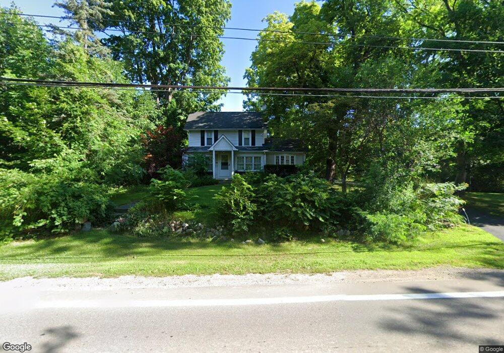
About This Home
This home is located at 21 Clarkston Rd, Clarkston, MI 48346 and is currently estimated at $373,914, approximately $11 per square foot. 21 Clarkston Rd is a home located in Oakland County with nearby schools including Everest Academy, Springfield Christian Academy, and Our Lady Of The Lakes Catholic School.
Ownership History
We collect this data history from publicly available records. To have your information removed, we recommend requesting removal directly through your county’s website.
Purchase Details
Home Financials for this Owner
Home Financials are based on the most recent Mortgage that was taken out on this home.Purchase Details
Purchase Details
Purchase Details
Home Financials for this Owner
Home Financials are based on the most recent Mortgage that was taken out on this home.Home Values in the Area
Average Home Value in this Area
Purchase History
We collect this data history from publicly available records. To have your information removed, we recommend requesting removal directly through your county’s website.
| Date | Buyer | Sale Price | Title Company |
|---|---|---|---|
| -- | Betters Law Firm Pllc | ||
| -- | None Available | ||
| $16,000 | None Available | ||
| -- | First American Title Ins Co | ||
| -- | First American Title Ins Co |
Mortgage History
We collect this data history from publicly available records. To have your information removed, we recommend requesting removal directly through your county’s website.
| Date | Status | Borrower | Loan Amount |
|---|---|---|---|
| Previous Owner | $156,000 | ||
| Previous Owner | $145,000 |
Tax History
We collect this data history from publicly available records. To have your information removed, we recommend requesting removal directly through your county’s website.
| Year | Tax Paid | Tax Assessment Tax Assessment Total Assessment is a certain percentage of the fair market value that is determined by local assessors to be the total taxable value of land and additions on the property. | Land | Improvement |
|---|---|---|---|---|
| 2025 | $1,963 | $121,850 | $0 | $0 |
| 2024 | $1,889 | $115,390 | $0 | $0 |
| 2023 | $2,003 | $108,710 | $0 | $0 |
| 2022 | $1,920 | $105,940 | $0 | $0 |
| 2021 | $2,458 | $99,860 | $0 | $0 |
| 2020 | $1,986 | $90,560 | $0 | $0 |
| 2019 | $2,430 | $83,880 | $0 | $0 |
| 2018 | $2,390 | $78,980 | $0 | $0 |
| 2017 | $2,380 | $74,180 | $0 | $0 |
| 2016 | $2,772 | $69,340 | $0 | $0 |
| 2015 | -- | $61,380 | $0 | $0 |
| 2014 | -- | $57,540 | $0 | $0 |
| 2011 | -- | $67,560 | $0 | $0 |
Map
- 109 Wompole Dr
- 155 N Main St
- 7 Buffalo St
- 138 N Holcomb Rd
- 12 E Church St
- Townview drive Townview Dr
- 6905 W Church St
- 6415 Sunnydale Rd
- 6512 White Lake Rd
- 7350 Mountridge Dr
- 6620 Greene Haven Dr
- 7152 Snow Apple Dr
- 7763 Ortonville Rd
- 7186 Snow Apple Dr
- 6141 Paramus
- 6025 Princess Ln
- 6672 Seth Ct
- 6556 Amy Dr
- 00 Cranberry Lake Rd
- 7690 Allen Rd
- 21 Clarkston Rd
- 105 Wompole Dr
- 105 Wompole Dr
- 107 Wompole Dr
- 26 Clarkston Rd
- 100 Wompole Dr
- 164 N Main St
- 30 Clarkston Rd
- 16 Clarkston Rd
- 24 Clarkston Rd
- 53 Clarkston Rd
- 46 Clarkston Rd
- 130 N Main St
- 17 Robertson Ct
- 112 Wompole Dr
- 7 Robertson Ct
- 27 Robertson Ct
- 154 N Main St
- 122 N Main St
- 114 N Main St
Ask me questions while you tour the home.