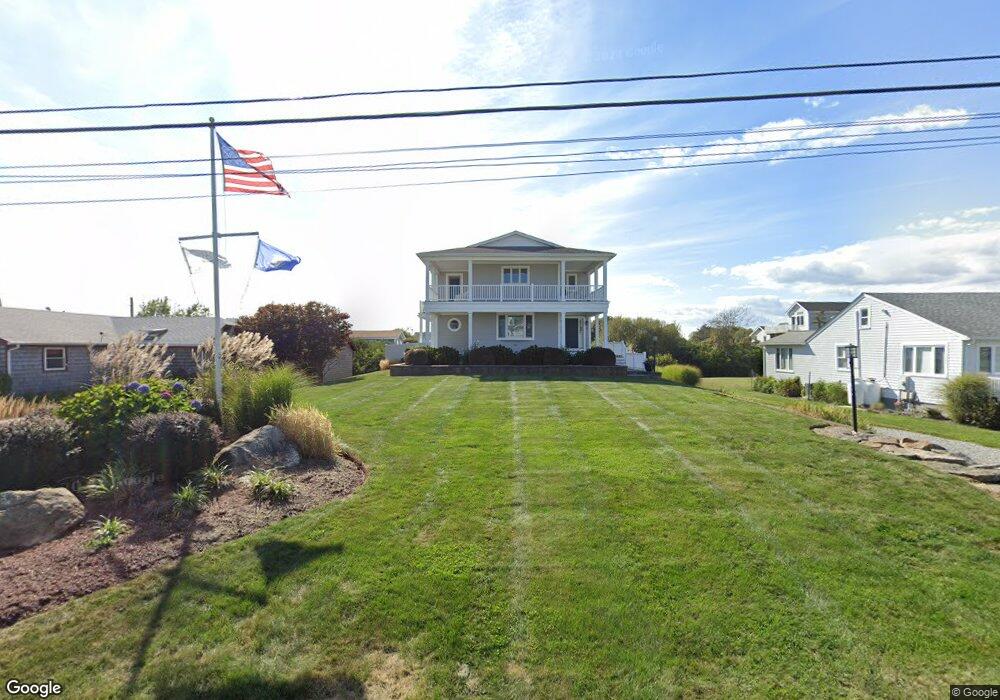
21 Coast Guard Ave Wakefield, RI 02879
Estimated Value: $1,568,000 - $2,263,000
3
Beds
1
Bath
788
Sq Ft
$2,411/Sq Ft
Est. Value
About This Home
This home is located at 21 Coast Guard Ave, Wakefield, RI 02879 and is currently estimated at $1,900,082, approximately $2,411 per square foot. 21 Coast Guard Ave is a home located in Washington County with nearby schools including South Kingstown High School.
Ownership History
Date
Name
Owned For
Owner Type
Purchase Details
Closed on
Feb 23, 2016
Sold by
Dellabianca Joyce A
Bought by
Della-Bianca Joyce A and Krezel Richard M
Current Estimated Value
Purchase Details
Closed on
Aug 5, 1999
Sold by
Est Glodell Frances G and Glodell Dwight M
Bought by
Dellabianca Lawrence L and Dellabianca Joyce
Home Financials for this Owner
Home Financials are based on the most recent Mortgage that was taken out on this home.
Original Mortgage
$169,000
Interest Rate
7.54%
Create a Home Valuation Report for This Property
The Home Valuation Report is an in-depth analysis detailing your home's value as well as a comparison with similar homes in the area
Home Values in the Area
Average Home Value in this Area
Purchase History
| Date | Buyer | Sale Price | Title Company |
|---|---|---|---|
| Della-Bianca Joyce A | -- | -- | |
| Della-Bianca Joyce A | -- | -- | |
| Dellabianca Lawrence L | $209,000 | -- |
Source: Public Records
Mortgage History
| Date | Status | Borrower | Loan Amount |
|---|---|---|---|
| Previous Owner | Dellabianca Lawrence L | $369,384 | |
| Previous Owner | Dellabianca Lawrence L | $169,000 |
Source: Public Records
Tax History
| Year | Tax Paid | Tax Assessment Tax Assessment Total Assessment is a certain percentage of the fair market value that is determined by local assessors to be the total taxable value of land and additions on the property. | Land | Improvement |
|---|---|---|---|---|
| 2025 | $18,025 | $2,016,200 | $1,371,400 | $644,800 |
| 2024 | $16,056 | $1,453,000 | $940,400 | $512,600 |
| 2023 | $16,056 | $1,453,000 | $940,400 | $512,600 |
| 2022 | $15,910 | $1,453,000 | $940,400 | $512,600 |
| 2021 | $13,391 | $926,700 | $561,000 | $365,700 |
| 2020 | $13,391 | $926,700 | $561,000 | $365,700 |
| 2019 | $13,391 | $926,700 | $561,000 | $365,700 |
| 2018 | $12,706 | $810,300 | $512,600 | $297,700 |
| 2017 | $12,406 | $810,300 | $512,600 | $297,700 |
| 2016 | $12,227 | $810,300 | $512,600 | $297,700 |
| 2015 | $11,277 | $726,600 | $465,800 | $260,800 |
| 2014 | $11,248 | $726,600 | $465,800 | $260,800 |
Source: Public Records
Map
Nearby Homes
- 37 Coast Guard Ave
- 2 Green Hill Ave
- 209 Carpenter Dr
- 107 Wild Goose Rd
- 61 Slope Ave
- 38 Beach Dr
- 5 Shadberry Trail
- 1935 Matunuck School House Rd
- 63 Aspen Rd
- 259 Green Hill Beach Rd
- 694 Charlestown Beach Rd
- 14 Charlestown Rd
- 15 Charlestown Rd
- 130 S Niantic Dr
- 12 Mautucket Rd
- 10 Josephine Dr Unit 1C
- 10 Josephine Dr Unit 2D
- 0 Old Post Rd
- 130 Pequot Dr
- 350 Narrow Ln
- 29 Coast Guard Ave
- 13 Coast Guard Ave
- 7 Coast Guard Ave
- 22 Surfside Ave
- 14 Surfside Ave
- 22 Coast Guard Ave
- 39 Coast Guard Ave
- 30 Coast Guard Ave
- 16 Coast Guard Ave
- 79 Browning St
- 34 Surfside Ave
- 0 Browning St Unit 12598
- 0 Browning St Unit 849218
- 0 Browning St Unit 934602
- 0 Browning St Unit 1129681
- 0 Browning St Unit 1164721
- 0 Browning St Unit 1275635
- 0 Browning St Unit 1286321
- 38 Coast Guard Ave
- 2 Carpenter Dr