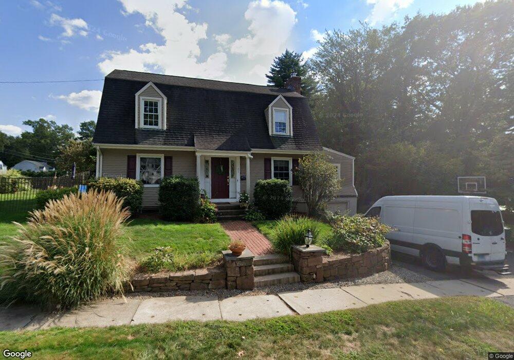
21 Cobbs Rd West Hartford, CT 06107
Estimated Value: $569,000 - $599,000
3
Beds
3
Baths
1,878
Sq Ft
$309/Sq Ft
Est. Value
About This Home
This home is located at 21 Cobbs Rd, West Hartford, CT 06107 and is currently estimated at $580,810, approximately $309 per square foot. 21 Cobbs Rd is a home located in Hartford County with nearby schools including Braeburn School, Sedgwick Middle School, and Conard High School.
Ownership History
Date
Name
Owned For
Owner Type
Purchase Details
Closed on
Dec 16, 1999
Sold by
Matthews David J and Matthews Rollande F
Bought by
Niman Jeffrey and Niman Joan
Current Estimated Value
Home Financials for this Owner
Home Financials are based on the most recent Mortgage that was taken out on this home.
Original Mortgage
$55,000
Interest Rate
7.81%
Create a Home Valuation Report for This Property
The Home Valuation Report is an in-depth analysis detailing your home's value as well as a comparison with similar homes in the area
Home Values in the Area
Average Home Value in this Area
Purchase History
| Date | Buyer | Sale Price | Title Company |
|---|---|---|---|
| Niman Jeffrey | $95,000 | -- |
Source: Public Records
Mortgage History
| Date | Status | Borrower | Loan Amount |
|---|---|---|---|
| Closed | Niman Jeffrey | $200,000 | |
| Closed | Niman Jeffrey | $55,000 |
Source: Public Records
Tax History Compared to Growth
Tax History
| Year | Tax Paid | Tax Assessment Tax Assessment Total Assessment is a certain percentage of the fair market value that is determined by local assessors to be the total taxable value of land and additions on the property. | Land | Improvement |
|---|---|---|---|---|
| 2025 | $10,438 | $233,100 | $94,570 | $138,530 |
| 2024 | $9,872 | $233,100 | $94,570 | $138,530 |
| 2023 | $9,538 | $233,100 | $94,570 | $138,530 |
| 2022 | $9,483 | $233,100 | $94,570 | $138,530 |
| 2021 | $9,006 | $212,310 | $91,910 | $120,400 |
| 2020 | $8,591 | $205,520 | $89,390 | $116,130 |
| 2019 | $8,591 | $205,520 | $89,390 | $116,130 |
| 2018 | $8,426 | $205,520 | $89,390 | $116,130 |
| 2017 | $8,435 | $205,520 | $89,390 | $116,130 |
| 2016 | $7,863 | $199,010 | $78,820 | $120,190 |
| 2015 | $7,624 | $199,010 | $78,820 | $120,190 |
| 2014 | $7,437 | $199,010 | $78,820 | $120,190 |
Source: Public Records
Map
Nearby Homes
- 95 Clifton Ave
- 473 Fern St
- 89 N Main St
- 101 N Main St
- 132 N Main St
- 37 Sylvan Ave
- 183 Loomis Dr Unit 104
- 37 W Normandy Dr
- 223 N Main St
- 6 W Maxwell Dr
- 1110 Trout Brook Dr
- 2 Arapahoe Rd Unit 308
- 2 Arapahoe Rd Unit 415
- 2 Arapahoe Rd Unit 611
- 2 Arapahoe Rd Unit 613
- 2 Arapahoe Rd Unit 311
- 2 Arapahoe Rd Unit 312
- 2 Arapahoe Rd Unit 510
- 2 Arapahoe Rd Unit 610
- 2 Arapahoe Rd Unit 609