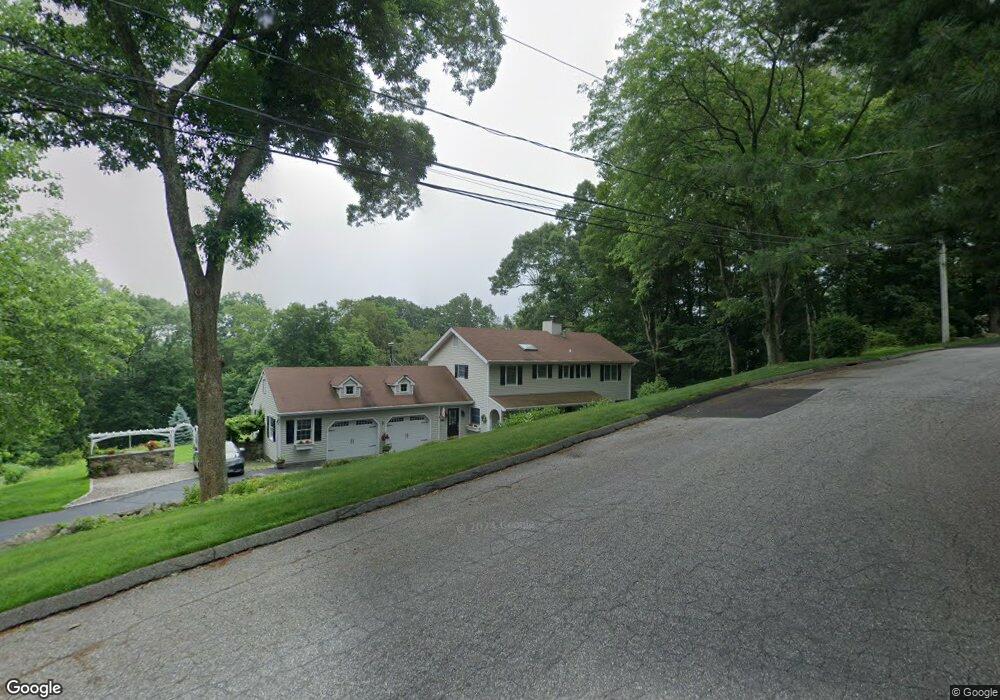
21 Craig Ct Stamford, CT 06903
North Stamford NeighborhoodEstimated Value: $1,012,493 - $1,169,000
3
Beds
3
Baths
2,500
Sq Ft
$426/Sq Ft
Est. Value
About This Home
This home is located at 21 Craig Ct, Stamford, CT 06903 and is currently estimated at $1,064,373, approximately $425 per square foot. 21 Craig Ct is a home located in Fairfield County with nearby schools including Northeast Elementary School, Turn of River School, and Westhill High School.
Ownership History
Date
Name
Owned For
Owner Type
Purchase Details
Closed on
Aug 19, 2009
Sold by
Galvin William E and Galvin Catherine C
Bought by
Truslow Robert and Armino Linda
Current Estimated Value
Home Financials for this Owner
Home Financials are based on the most recent Mortgage that was taken out on this home.
Original Mortgage
$350,000
Interest Rate
5.19%
Purchase Details
Closed on
Mar 18, 2005
Sold by
Dolger Jason and Leonard Monica
Bought by
Galvin William E and Galvin Catherine C
Purchase Details
Closed on
Mar 1, 2001
Sold by
Rossi Barbara A and Rossi Donald G
Bought by
Dolger Jason and Leonard Monica
Purchase Details
Closed on
Oct 19, 1993
Sold by
Ct Bk Of Commerce
Bought by
Rossi Donald and Rossi Barbara
Create a Home Valuation Report for This Property
The Home Valuation Report is an in-depth analysis detailing your home's value as well as a comparison with similar homes in the area
Home Values in the Area
Average Home Value in this Area
Purchase History
| Date | Buyer | Sale Price | Title Company |
|---|---|---|---|
| Truslow Robert | $747,000 | -- | |
| Galvin William E | $788,000 | -- | |
| Dolger Jason | $517,500 | -- | |
| Rossi Donald | $294,500 | -- |
Source: Public Records
Mortgage History
| Date | Status | Borrower | Loan Amount |
|---|---|---|---|
| Open | Rossi Donald | $290,000 | |
| Closed | Rossi Donald | $350,000 | |
| Previous Owner | Rossi Donald | $500,000 |
Source: Public Records
Tax History Compared to Growth
Tax History
| Year | Tax Paid | Tax Assessment Tax Assessment Total Assessment is a certain percentage of the fair market value that is determined by local assessors to be the total taxable value of land and additions on the property. | Land | Improvement |
|---|---|---|---|---|
| 2025 | $11,802 | $507,160 | $209,010 | $298,150 |
| 2024 | $11,543 | $507,160 | $209,010 | $298,150 |
| 2023 | $12,405 | $507,160 | $209,010 | $298,150 |
| 2022 | $10,675 | $405,430 | $151,450 | $253,980 |
| 2021 | $10,529 | $405,430 | $151,450 | $253,980 |
| 2020 | $10,270 | $405,430 | $151,450 | $253,980 |
| 2019 | $10,270 | $405,430 | $151,450 | $253,980 |
| 2018 | $9,913 | $405,430 | $151,450 | $253,980 |
| 2017 | $10,355 | $404,660 | $168,280 | $236,380 |
| 2016 | $10,044 | $404,660 | $168,280 | $236,380 |
| 2015 | $9,768 | $404,660 | $168,280 | $236,380 |
| 2014 | $9,433 | $404,660 | $168,280 | $236,380 |
Source: Public Records
Map
Nearby Homes
- 78 Trinity Pass
- 2993 High Ridge Rd
- 115 Mayapple Rd
- 0 Rolling Meadow Ln Unit ONEH6302491
- 65 Mcintosh Rd
- 226 Ingleside Dr
- 518 Woodbine Rd
- 26 Pequot Ln
- 501 Woodbine Rd
- 32 Joshua Hobby Ln
- 22 Joshua Hobby Ln
- 61 Shady Ln
- 119 Proprietors Crossing
- 49 Alexandra Dr
- 171 Proprietors Crossing
- 199 Upper Shad Rd
- 928 West Rd
- 104 Dans Hwy
- 104 Ramhorne Rd
- 22 Blackberry Dr E
- 3153 High Ridge Rd
- 7 Craig Ct
- 54 Riding Stable Trail
- 2 Craig Ct
- 1 Craig Ct
- 35 Craig Ct
- 3151 High Ridge Rd
- 41 Craig Ct
- 46 Riding Stable Trail
- 3145 High Ridge Rd
- 15 Craig Ct
- 0 High Ridge Rd Unit H4609930
- 37 Craig Ct
- 3196 High Ridge Rd
- 3143 High Ridge Rd
- 3143 High Ridge Rd
- 45 Riding Stable Trail
- 10 Fairway Dr
- 15 Fairway Dr
- 3127 High Ridge Rd