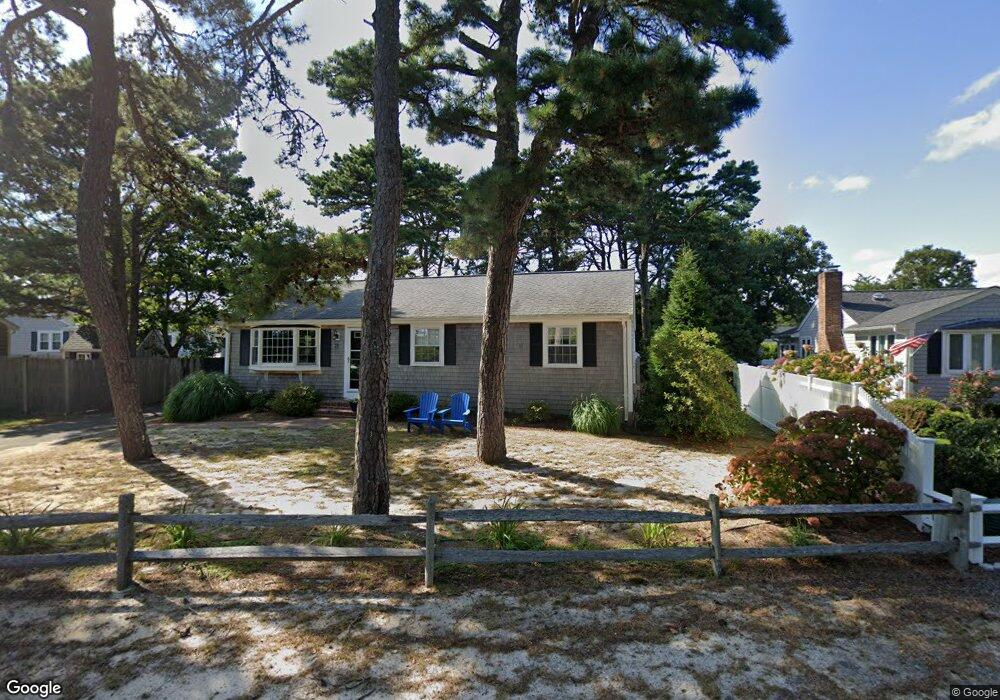
21 Cygnet Rd West Dennis, MA 2670
West Dennis NeighborhoodEstimated Value: $618,000 - $831,000
3
Beds
2
Baths
1,201
Sq Ft
$587/Sq Ft
Est. Value
About This Home
This home is located at 21 Cygnet Rd, West Dennis, MA 2670 and is currently estimated at $705,399, approximately $587 per square foot. 21 Cygnet Rd is a home located in Barnstable County with nearby schools including Dennis-Yarmouth Regional High School and St. Pius X. School.
Ownership History
Date
Name
Owned For
Owner Type
Purchase Details
Closed on
Oct 29, 2001
Sold by
Bahren Susan A and Bahren Mary Beth
Bought by
Donahue Paul J and Donahue Jennifer
Current Estimated Value
Home Financials for this Owner
Home Financials are based on the most recent Mortgage that was taken out on this home.
Original Mortgage
$225,000
Outstanding Balance
$88,848
Interest Rate
6.86%
Mortgage Type
Purchase Money Mortgage
Estimated Equity
$616,551
Purchase Details
Closed on
Feb 16, 1996
Sold by
Bourque William E and Bourque Joan L
Bought by
Bahren Susan A and Bahren Mary Beth
Home Financials for this Owner
Home Financials are based on the most recent Mortgage that was taken out on this home.
Original Mortgage
$116,000
Interest Rate
6.99%
Mortgage Type
Purchase Money Mortgage
Create a Home Valuation Report for This Property
The Home Valuation Report is an in-depth analysis detailing your home's value as well as a comparison with similar homes in the area
Home Values in the Area
Average Home Value in this Area
Purchase History
| Date | Buyer | Sale Price | Title Company |
|---|---|---|---|
| Donahue Paul J | $250,000 | -- | |
| Bahren Susan A | $145,000 | -- |
Source: Public Records
Mortgage History
| Date | Status | Borrower | Loan Amount |
|---|---|---|---|
| Open | Bahren Susan A | $225,000 | |
| Previous Owner | Bahren Susan A | $116,000 |
Source: Public Records
Tax History Compared to Growth
Tax History
| Year | Tax Paid | Tax Assessment Tax Assessment Total Assessment is a certain percentage of the fair market value that is determined by local assessors to be the total taxable value of land and additions on the property. | Land | Improvement |
|---|---|---|---|---|
| 2025 | $3,260 | $752,800 | $298,000 | $454,800 |
| 2024 | $3,112 | $708,900 | $286,600 | $422,300 |
| 2023 | $3,010 | $644,600 | $260,500 | $384,100 |
| 2022 | $2,907 | $519,100 | $234,700 | $284,400 |
| 2021 | $2,812 | $466,300 | $230,100 | $236,200 |
| 2020 | $2,089 | $444,400 | $230,100 | $214,300 |
| 2019 | $2,714 | $439,800 | $249,300 | $190,500 |
| 2018 | $1,851 | $412,200 | $237,300 | $174,900 |
| 2017 | $2,153 | $350,100 | $180,800 | $169,300 |
| 2016 | $2,039 | $312,300 | $192,100 | $120,200 |
| 2015 | $1,999 | $312,300 | $192,100 | $120,200 |
| 2014 | $1,983 | $312,300 | $192,100 | $120,200 |
Source: Public Records
Map
Nearby Homes
- 80 Michaels Ave
- 12 Spoonbill Rd
- 15 Woodside Park Rd
- 19 Standish Way
- 61 Trotters Ln
- 71 Main St
- 4 Coffey Ln
- 26 Center St
- 125 Main St Unit 3
- 95 Center St
- 31 Easy St
- 3 Pinefield Ln
- 22 Wixon Rd
- 37 Ocean Dr Unit 2
- 72 Bassett Ln
- 64 Beaten Rd
- 268 Main St
- 467 Main St
- 112 Old Wharf Rd Unit E4
- 112 Old Wharf Rd Unit E1