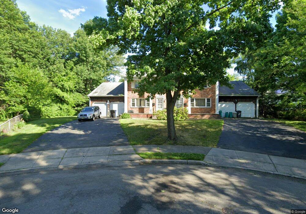
21 Daisy Way Paramus, NJ 07652
Estimated Value: $1,227,000 - $1,421,000
--
Bed
--
Bath
4,368
Sq Ft
$304/Sq Ft
Est. Value
About This Home
This home is located at 21 Daisy Way, Paramus, NJ 07652 and is currently estimated at $1,326,554, approximately $303 per square foot. 21 Daisy Way is a home located in Bergen County with nearby schools including Paramus High School, Yavneh Academy, and Visitation Academy.
Ownership History
Date
Name
Owned For
Owner Type
Purchase Details
Closed on
Sep 28, 2004
Sold by
Setless Ian
Bought by
Setless Marilyn Anshien
Current Estimated Value
Purchase Details
Closed on
Aug 7, 1998
Sold by
Scherer Carol Anne and Lehner Carol Anne
Bought by
Setless Ian E and Setless Marilyn Anshien
Home Financials for this Owner
Home Financials are based on the most recent Mortgage that was taken out on this home.
Original Mortgage
$121,000
Interest Rate
6.92%
Create a Home Valuation Report for This Property
The Home Valuation Report is an in-depth analysis detailing your home's value as well as a comparison with similar homes in the area
Home Values in the Area
Average Home Value in this Area
Purchase History
| Date | Buyer | Sale Price | Title Company |
|---|---|---|---|
| Setless Marilyn Anshien | $70,000 | -- | |
| Setless Ian E | $542,000 | -- |
Source: Public Records
Mortgage History
| Date | Status | Borrower | Loan Amount |
|---|---|---|---|
| Previous Owner | Setless Ian E | $121,000 |
Source: Public Records
Tax History Compared to Growth
Tax History
| Year | Tax Paid | Tax Assessment Tax Assessment Total Assessment is a certain percentage of the fair market value that is determined by local assessors to be the total taxable value of land and additions on the property. | Land | Improvement |
|---|---|---|---|---|
| 2025 | $12,571 | $902,000 | $444,900 | $457,100 |
| 2024 | $12,146 | $830,300 | $390,900 | $439,400 |
| 2023 | $14,044 | $791,800 | $373,400 | $418,400 |
| 2022 | $14,044 | $904,900 | $349,100 | $555,800 |
| 2021 | $13,847 | $837,200 | $325,100 | $512,100 |
| 2020 | $13,172 | $825,800 | $320,100 | $505,700 |
| 2019 | $13,606 | $733,100 | $414,200 | $318,900 |
| 2018 | $13,438 | $733,100 | $414,200 | $318,900 |
| 2017 | $13,203 | $733,100 | $414,200 | $318,900 |
| 2016 | $12,844 | $733,100 | $414,200 | $318,900 |
| 2015 | $13,015 | $750,600 | $414,200 | $336,400 |
| 2014 | $12,903 | $750,600 | $414,200 | $336,400 |
Source: Public Records
Map
Nearby Homes
- 29 Millar Ct
- 104 Trinity Ct
- 6 Schubert Ln
- 4 Schubert Ln
- 187 Brookfield Ave
- 187 Crest Dr
- 46 E Century Rd
- 56 Lilac Ln
- 122 Village Cir E
- 150 Village Cir E
- 45 Longview Ct
- 146 Lawrence Dr
- 189 Forest Ave Unit 409
- 189 Forest Ave Unit 303
- 862 Grant Ave
- 1 Sipporta Ln
- 162 Split Rock Rd
- 81 Eastbrook Dr
- 207 Hillcrest Dr
- 165 Hebberd Ave
- 17 Millar Ct Unit A
- 17 Millar Ct
- 17 Daisy Way
- 21B Millar Ct
- 21A Millar Ct
- 20 Daisy Way
- 21 Millar Ct
- 30 Laurel Ct
- 25 Millar Ct
- 25 Millar Ct Unit B-right
- 32 Laurel Ct
- 14 Daisy Way
- 113 Maitland Ave
- 11 Daisy Way
- 29 Millar Ct Unit B-right
- 115 Maitland Ave
- 8 Daisy Way
- 28 Laurel Ct
- 10 Forsythia Ln
- 10 Forsythia Ln Unit A,left