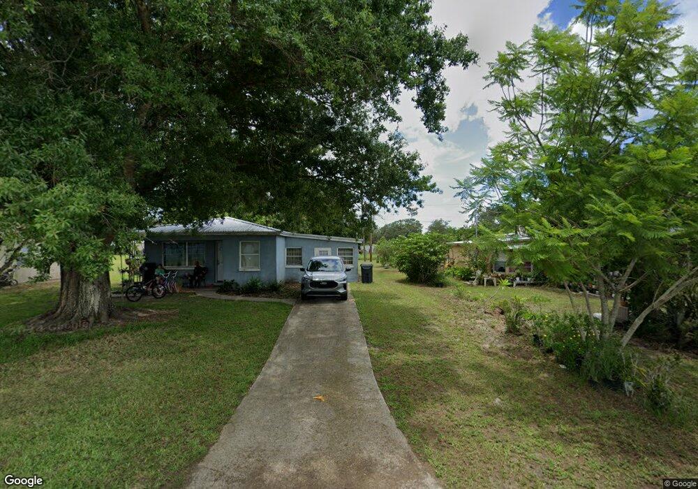
21 Delarm Ave Frostproof, FL 33843
Estimated Value: $120,000 - $185,000
2
Beds
1
Bath
933
Sq Ft
$163/Sq Ft
Est. Value
About This Home
This home is located at 21 Delarm Ave, Frostproof, FL 33843 and is currently estimated at $151,701, approximately $162 per square foot. 21 Delarm Ave is a home located in Polk County with nearby schools including Kruse Elementary School, Olander Elementary School, and Ben Hill Griffin Jr. Elementary School.
Ownership History
Date
Name
Owned For
Owner Type
Purchase Details
Closed on
Apr 27, 2011
Sold by
Rodriguez Jose Fermin
Bought by
Rodriguez Jose Rodrigo
Current Estimated Value
Purchase Details
Closed on
Apr 1, 1999
Sold by
Rodriguez Isidro
Bought by
Rodriguez Jose F
Home Financials for this Owner
Home Financials are based on the most recent Mortgage that was taken out on this home.
Original Mortgage
$26,000
Interest Rate
6.82%
Purchase Details
Closed on
Feb 1, 1996
Sold by
Reising Anton C and Reising Marie D
Bought by
Rodriguez Isidro
Create a Home Valuation Report for This Property
The Home Valuation Report is an in-depth analysis detailing your home's value as well as a comparison with similar homes in the area
Home Values in the Area
Average Home Value in this Area
Purchase History
| Date | Buyer | Sale Price | Title Company |
|---|---|---|---|
| Rodriguez Jose Rodrigo | -- | Attorney | |
| Rodriguez Jose F | $26,000 | -- | |
| Rodriguez Isidro | $23,000 | -- |
Source: Public Records
Mortgage History
| Date | Status | Borrower | Loan Amount |
|---|---|---|---|
| Previous Owner | Rodriguez Isidro | $26,000 |
Source: Public Records
Tax History Compared to Growth
Tax History
| Year | Tax Paid | Tax Assessment Tax Assessment Total Assessment is a certain percentage of the fair market value that is determined by local assessors to be the total taxable value of land and additions on the property. | Land | Improvement |
|---|---|---|---|---|
| 2025 | $1,438 | $54,531 | -- | -- |
| 2024 | $1,266 | $49,574 | -- | -- |
| 2023 | $1,266 | $45,067 | $0 | $0 |
| 2022 | $1,127 | $40,970 | $0 | $0 |
| 2021 | $1,007 | $37,245 | $0 | $0 |
| 2020 | $970 | $38,677 | $4,200 | $34,477 |
| 2018 | $838 | $29,655 | $4,000 | $25,655 |
| 2017 | $786 | $25,439 | $0 | $0 |
| 2016 | $720 | $23,126 | $0 | $0 |
| 2015 | $333 | $21,382 | $0 | $0 |
| 2014 | $619 | $19,438 | $0 | $0 |
Source: Public Records
Map
Nearby Homes
- 229 Raymond Ave
- 253 Walter Ave
- 202 Central Ave
- 262 Walter Ave
- 192 Freedom Dr
- 319 Thomas Ave
- 74 Oakridge Dr
- 54 Oakridge Dr
- 0 Joey Ln
- The Roanoke II Plan at Sun Ray
- The Savannah Plan at Sun Ray
- The Cambridge Plan at Sun Ray
- 508 Stanley Ave
- 129 Constitution Ln
- 686 Sandwedge Dr
- 690 Sandwedge Dr
- 32 Oakridge Dr
- 698 Sandwedge Dr
- 624 Alice St
- 651 Village Blvd
- 19 Delarm Ave
- 23 Delarm Ave
- 17 Delarm Ave
- 15 Delarm Ave
- 13 Delarm Ave
- 11 Delarm Ave
- 1650 Us Highway 27 S
- 9 Delarm Ave
- 7 Delarm Ave
- 5 Delarm Ave
- 50 Robarts Ln
- 3 Delarm Ave
- 1 Delarm Ave
- 5320 Us Highway 27
- 5320 U S 27
- 0 Charles St
- 0 Charles St Unit K4900784
- 0 Charles St Unit P4713544
- 204 Raymond Ave
- 86 Charles St