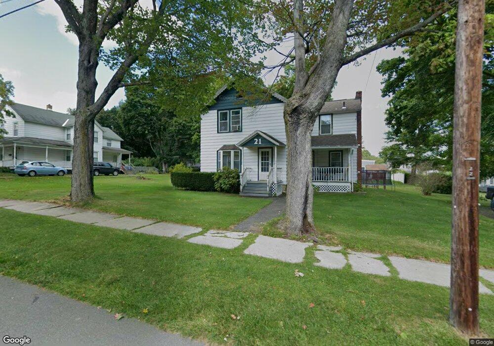
21 Deming St Dalton, MA 01226
Estimated Value: $277,111 - $324,000
3
Beds
1
Bath
1,376
Sq Ft
$222/Sq Ft
Est. Value
About This Home
This home is located at 21 Deming St, Dalton, MA 01226 and is currently estimated at $305,028, approximately $221 per square foot. 21 Deming St is a home located in Berkshire County with nearby schools including Wahconah Regional High School and St. Agnes Academy.
Ownership History
Date
Name
Owned For
Owner Type
Purchase Details
Closed on
Oct 24, 2005
Sold by
Galliher James R and Galliher Carolina S
Bought by
Celentano David and Celentano Anna
Current Estimated Value
Home Financials for this Owner
Home Financials are based on the most recent Mortgage that was taken out on this home.
Original Mortgage
$138,000
Outstanding Balance
$73,226
Interest Rate
5.72%
Mortgage Type
Purchase Money Mortgage
Estimated Equity
$231,802
Purchase Details
Closed on
Feb 5, 1996
Sold by
Wellspeak Susan M
Bought by
Sylvia Mark M
Create a Home Valuation Report for This Property
The Home Valuation Report is an in-depth analysis detailing your home's value as well as a comparison with similar homes in the area
Home Values in the Area
Average Home Value in this Area
Purchase History
| Date | Buyer | Sale Price | Title Company |
|---|---|---|---|
| Celentano David | $173,000 | -- | |
| Sylvia Mark M | $37,500 | -- | |
| Celentano David | $173,000 | -- | |
| Sylvia Mark M | $37,500 | -- |
Source: Public Records
Mortgage History
| Date | Status | Borrower | Loan Amount |
|---|---|---|---|
| Open | Celentano David | $138,000 | |
| Closed | Sylvia Mark M | $138,000 |
Source: Public Records
Tax History
| Year | Tax Paid | Tax Assessment Tax Assessment Total Assessment is a certain percentage of the fair market value that is determined by local assessors to be the total taxable value of land and additions on the property. | Land | Improvement |
|---|---|---|---|---|
| 2025 | $3,920 | $216,200 | $57,300 | $158,900 |
| 2024 | $3,687 | $202,600 | $52,300 | $150,300 |
| 2023 | $3,325 | $172,800 | $46,400 | $126,400 |
| 2022 | $3,144 | $151,600 | $46,400 | $105,200 |
| 2021 | $3,100 | $144,100 | $44,200 | $99,900 |
| 2020 | $2,810 | $138,500 | $44,200 | $94,300 |
| 2019 | $2,581 | $132,500 | $44,600 | $87,900 |
| 2018 | $2,570 | $129,100 | $44,600 | $84,500 |
| 2017 | $2,565 | $129,100 | $44,600 | $84,500 |
| 2016 | $2,534 | $129,100 | $44,600 | $84,500 |
| 2015 | $2,492 | $128,000 | $44,600 | $83,400 |
Source: Public Records
Map
Nearby Homes
- 60 Franklin St
- 20 Prospect St
- 188 North St
- 60 North St Unit 7
- 750 Main St
- 70 Lake St Unit B
- 32 Marcella Way
- 0 Crane Ave Suite 2 -- Unit 248430
- 0 Crane Ave Suite 1 -- Unit 248429
- 249 Orchard Rd
- 18 Chestnut St
- 1157 Main St
- 39 Barton Hill Rd
- 0 Crane Ave
- 65 Johnson Rd
- 190 Fox Rd
- 218 Johnson Rd
- 149 Kittredge Rd
- 127 Pinecrest Dr
- 121 Kittredge Rd
- 21 W Deming St Extension
- 185 Pleasant St
- 193 Pleasant St
- 28 Deming St Extension
- 28 Deming St
- 205 Pleasant St
- 177 Pleasant St
- 38 Deming St Extension
- 131 Hale Street Extension
- 211 Pleasant St
- 141 Hale Street Extension
- 169 Pleasant St
- 17 Florence St
- 23 Florence St
- 19 Prospect St
- 64 Deming St
- 180 Pleasant St
- 2 Kaonkapot Dr
- 30 Prospect St
- 30 Prospect St
Your Personal Tour Guide
Ask me questions while you tour the home.