Estimated Value: $638,791 - $708,000
2
Beds
3
Baths
2,182
Sq Ft
$313/Sq Ft
Est. Value
About This Home
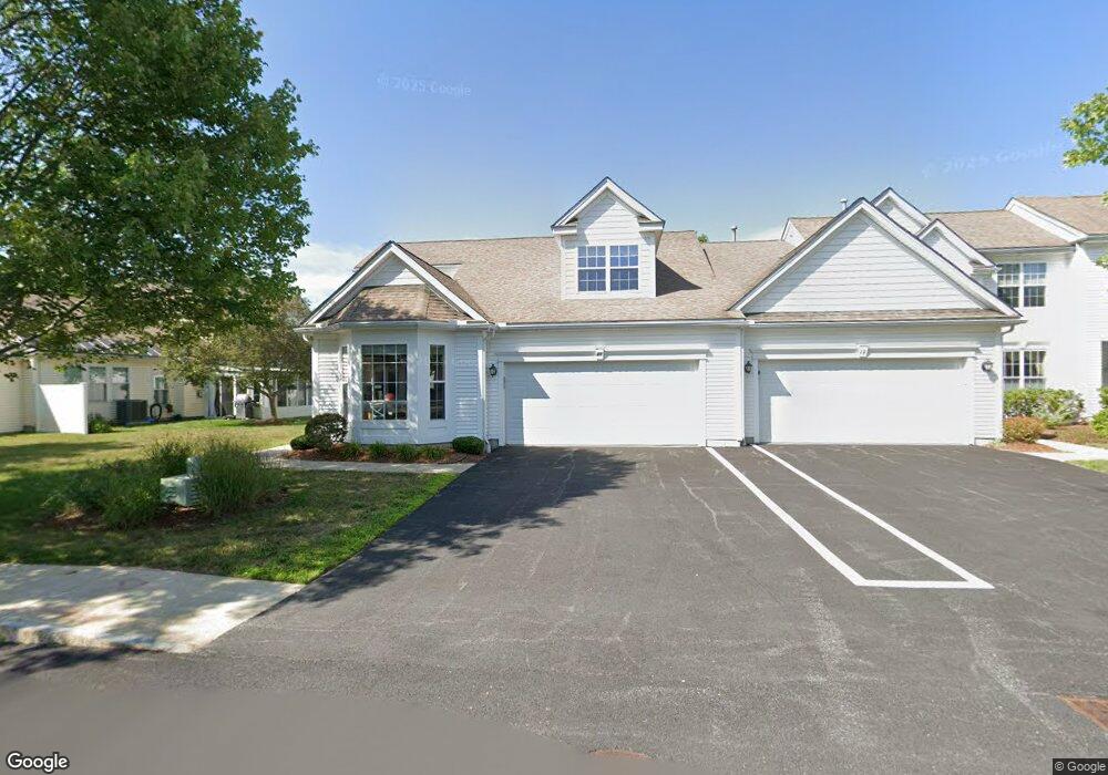
This home is located at 21 Devon Dr, Acton, MA 01720 and is currently estimated at $683,698, approximately $313 per square foot. 21 Devon Dr is a home located in Middlesex County with nearby schools including Acton-Boxborough Regional High School and Oak Meadow Montessori School.
Ownership History
Date
Name
Owned For
Owner Type
Purchase Details
Closed on
Feb 22, 2017
Sold by
Sandra C 2005 Ret
Bought by
Warren David T and Warren Kathleen L
Current Estimated Value
Purchase Details
Closed on
Mar 29, 2016
Sold by
King Sandra C
Bought by
Sandra C King Ret
Purchase Details
Closed on
Jul 15, 2002
Sold by
Pulte Home Corp Ne
Bought by
King Sandra C
Home Financials for this Owner
Home Financials are based on the most recent Mortgage that was taken out on this home.
Original Mortgage
$110,000
Interest Rate
6.79%
Mortgage Type
Purchase Money Mortgage
Create a Home Valuation Report for This Property
The Home Valuation Report is an in-depth analysis detailing your home's value as well as a comparison with similar homes in the area
Home Values in the Area
Average Home Value in this Area
Purchase History
| Date | Buyer | Sale Price | Title Company |
|---|---|---|---|
| Warren David T | $400,000 | -- | |
| Sandra C King Ret | -- | -- | |
| King Sandra C | $399,237 | -- |
Source: Public Records
Mortgage History
| Date | Status | Borrower | Loan Amount |
|---|---|---|---|
| Previous Owner | King Sandra C | $110,000 |
Source: Public Records
Tax History
| Year | Tax Paid | Tax Assessment Tax Assessment Total Assessment is a certain percentage of the fair market value that is determined by local assessors to be the total taxable value of land and additions on the property. | Land | Improvement |
|---|---|---|---|---|
| 2025 | $9,839 | $573,700 | $0 | $573,700 |
| 2024 | $8,997 | $539,700 | $0 | $539,700 |
| 2023 | $8,794 | $500,800 | $0 | $500,800 |
| 2022 | $8,894 | $457,300 | $0 | $457,300 |
| 2021 | $8,497 | $420,000 | $0 | $420,000 |
| 2020 | $7,502 | $389,900 | $0 | $389,900 |
| 2019 | $7,475 | $385,900 | $0 | $385,900 |
| 2018 | $7,107 | $366,700 | $0 | $366,700 |
| 2017 | $5,777 | $303,100 | $0 | $303,100 |
| 2016 | $5,931 | $308,400 | $0 | $308,400 |
| 2015 | $5,831 | $306,100 | $0 | $306,100 |
| 2014 | $5,703 | $293,200 | $0 | $293,200 |
Source: Public Records
Map
Nearby Homes
- 927 Main St
- 87 Canterbury Hill Rd
- 875 Acton St
- 5 Samantha Way Unit 5
- 420 Great Rd Unit B3
- 390 Great Rd Unit B16
- 11 Walnut St
- 388 Great Rd Unit A9
- 388 Great Rd Unit B14
- 386 Great Rd Unit A8
- 18 Quail Run Unit 18
- 405 Great Elm Way
- 380A Great Rd Unit 301
- 380 Great Rd Unit B301
- 262 Brown Bear Crossing Unit 262
- 237 Brown Bear Crossing Unit 237
- 238 Brown Bear Crossing Unit 238
- 10 Blue Heron Way Unit 10
- 11 Davis Rd Unit A5
- 11 Davis Rd Unit B8
- 21 Devon Dr Unit 10
- 19 Devon Dr
- 19 Devon Dr Unit 19
- 17 Devon Dr
- 17 Devon Dr Unit 8
- 11 Devon Dr
- 11 Devon Dr Unit 11,11
- 9 Devon Dr
- 1 Tinsdale Dr
- 7 Tinsdale Dr
- 7 Tinsdale Dr Unit 7
- 7 Devon Dr
- 3 Devon Dr
- 3 Tinsdale Dr
- 5 Tinsdale Dr
- 5 Tinsdale Dr Unit 5
- 12 Hartland Way
- 14 Hartland Way
- 12 Hartland Way Unit 12
- 22 Hartland Way
Your Personal Tour Guide
Ask me questions while you tour the home.