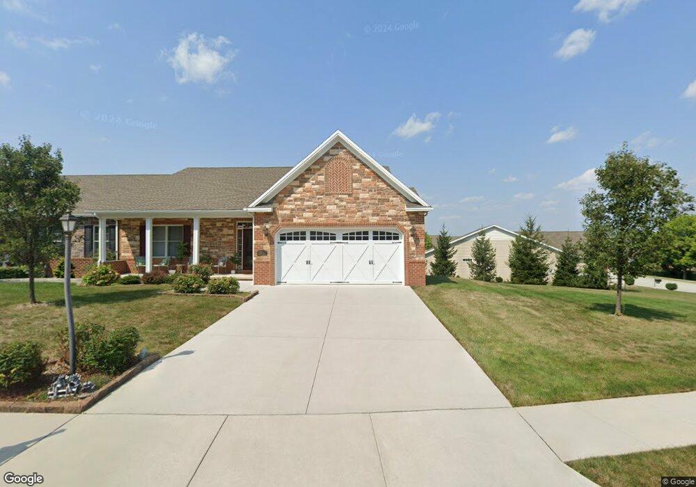
21 Digges Ct Littlestown, PA 17340
Estimated Value: $449,000 - $480,000
3
Beds
3
Baths
2,032
Sq Ft
$226/Sq Ft
Est. Value
About This Home
This home is located at 21 Digges Ct, Littlestown, PA 17340 and is currently estimated at $459,905, approximately $226 per square foot. 21 Digges Ct is a home with nearby schools including Rolling Acres El School, Maple Avenue Middle School, and Littlestown Senior High School.
Ownership History
Date
Name
Owned For
Owner Type
Purchase Details
Closed on
Apr 23, 2015
Sold by
Aurora Development Group Llc
Bought by
Jones James J and Tsantis Linda A
Current Estimated Value
Home Financials for this Owner
Home Financials are based on the most recent Mortgage that was taken out on this home.
Original Mortgage
$383,200
Outstanding Balance
$291,161
Interest Rate
3.86%
Mortgage Type
Future Advance Clause Open End Mortgage
Estimated Equity
$168,744
Create a Home Valuation Report for This Property
The Home Valuation Report is an in-depth analysis detailing your home's value as well as a comparison with similar homes in the area
Home Values in the Area
Average Home Value in this Area
Purchase History
We collect this data history from publicly available records. To have your information removed, we recommend requesting removal directly through your county’s website.
| Date | Buyer | Sale Price | Title Company |
|---|---|---|---|
| Jones James J | $488,068 | None Available |
Source: Public Records
Mortgage History
We collect this data history from publicly available records. To have your information removed, we recommend requesting removal directly through your county’s website.
| Date | Status | Borrower | Loan Amount |
|---|---|---|---|
| Open | Jones James J | $383,200 |
Source: Public Records
Tax History
| Year | Tax Paid | Tax Assessment Tax Assessment Total Assessment is a certain percentage of the fair market value that is determined by local assessors to be the total taxable value of land and additions on the property. | Land | Improvement |
|---|---|---|---|---|
| 2026 | $7,084 | $301,600 | $65,000 | $236,600 |
| 2025 | $6,933 | $301,600 | $65,000 | $236,600 |
| 2024 | $6,681 | $301,600 | $65,000 | $236,600 |
| 2023 | $6,422 | $301,600 | $65,000 | $236,600 |
| 2022 | $6,383 | $301,600 | $65,000 | $236,600 |
| 2021 | $6,194 | $301,600 | $65,000 | $236,600 |
| 2020 | $6,120 | $301,600 | $65,000 | $236,600 |
| 2019 | $5,937 | $301,600 | $65,000 | $236,600 |
| 2018 | $6,712 | $347,300 | $65,000 | $282,300 |
| 2017 | $6,539 | $347,300 | $65,000 | $282,300 |
| 2016 | -- | $59,000 | $59,000 | $0 |
Source: Public Records
Map
Nearby Homes
- 67 Stedtle Ct
- 4 Appler Ct Unit 60
- 136 Colorado Ave Unit 92
- 64 N Gala Unit 400
- 1014 Frederick Pike Unit 5
- 315 N Queen St
- 54 Patrick Ave
- 0 Locust Dr Unit PAAD2015910
- 102 N Queen St
- 8 Brandywine Ct Unit 39
- 117 Charles St
- 115 Charles St
- 162 Newark St
- 15 Yorktowne Ct Unit 97
- 23 Park Ave
- 417 S Columbus Ave Unit 85
- 484 S Columbus Ave Unit 19
- 41 Smith Cir
- 117 Wheaton Dr Unit 119
- 6016 Baltimore Pike
- 23 Digges Ct
- 9 Digges Ct
- 7 Digges Ct
- 29 Digges Ct
- 22 Digges Ct Unit 11A
- 24 Digges Ct Unit 11B
- 18 Digges Ct Unit 10A
- 14 Digges Ct
- 31 Digges Ct
- 26 Digges Ct Unit 12A
- 159 Stoners Cir
- 16 Digges Ct
- 155 Stoners Cir
- 28 Digges Ct Unit 12B
- 4 Digges Ct
- 32 Digges Ct
- 2 Digges Ct Unit 8A
- 33 Digges Ct
- 0 Stoners Cir
- 13 Stedtle Ave
Your Personal Tour Guide
Ask me questions while you tour the home.