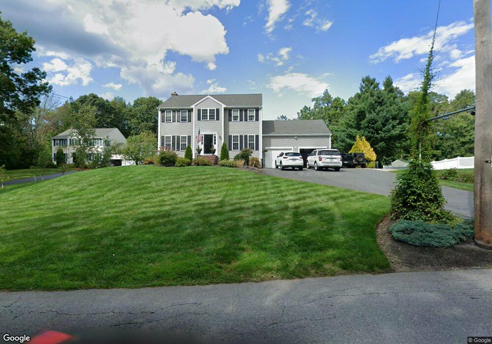
21 Draper Ave North Attleboro, MA 02760
North Attleboro NeighborhoodEstimated Value: $714,000 - $863,000
4
Beds
3
Baths
2,056
Sq Ft
$375/Sq Ft
Est. Value
About This Home
This home is located at 21 Draper Ave, North Attleboro, MA 02760 and is currently estimated at $771,153, approximately $375 per square foot. 21 Draper Ave is a home located in Bristol County with nearby schools including North Attleboro High School.
Ownership History
Date
Name
Owned For
Owner Type
Purchase Details
Closed on
Nov 30, 2005
Sold by
David Sam R
Bought by
Crump Brian and Crump Mandi
Current Estimated Value
Home Financials for this Owner
Home Financials are based on the most recent Mortgage that was taken out on this home.
Original Mortgage
$367,920
Outstanding Balance
$204,015
Interest Rate
6.14%
Mortgage Type
Purchase Money Mortgage
Estimated Equity
$567,138
Create a Home Valuation Report for This Property
The Home Valuation Report is an in-depth analysis detailing your home's value as well as a comparison with similar homes in the area
Home Values in the Area
Average Home Value in this Area
Purchase History
| Date | Buyer | Sale Price | Title Company |
|---|---|---|---|
| Crump Brian | $459,900 | -- |
Source: Public Records
Mortgage History
| Date | Status | Borrower | Loan Amount |
|---|---|---|---|
| Open | Crump Brian | $367,920 |
Source: Public Records
Tax History Compared to Growth
Tax History
| Year | Tax Paid | Tax Assessment Tax Assessment Total Assessment is a certain percentage of the fair market value that is determined by local assessors to be the total taxable value of land and additions on the property. | Land | Improvement |
|---|---|---|---|---|
| 2025 | $7,733 | $655,900 | $163,200 | $492,700 |
| 2024 | $7,704 | $667,600 | $163,200 | $504,400 |
| 2023 | $7,529 | $588,700 | $170,300 | $418,400 |
| 2022 | $7,033 | $504,900 | $163,200 | $341,700 |
| 2021 | $6,864 | $481,000 | $163,200 | $317,800 |
| 2020 | $6,773 | $472,000 | $163,200 | $308,800 |
| 2019 | $6,592 | $462,900 | $148,500 | $314,400 |
| 2018 | $5,931 | $444,600 | $148,500 | $296,100 |
| 2017 | $5,878 | $444,600 | $148,500 | $296,100 |
| 2016 | $5,730 | $433,400 | $172,300 | $261,100 |
| 2015 | $5,587 | $425,200 | $179,500 | $245,700 |
| 2014 | $5,337 | $403,100 | $157,400 | $245,700 |
Source: Public Records
Map
Nearby Homes
- 31 Paine Rd
- 11 Primrose Terrace
- 82 Reservoir St
- 25 Gregory Way
- 740 Allen Ave
- 31 Walnut Rd
- 121 E Washington St Unit 8
- 121 E Washington St Unit 12
- 121 E Washington St Unit 6
- 121 E Washington St Unit 13
- 121 E Washington St Unit 11
- 181 Paine Rd
- 90 Walnut Rd
- 47 Juniper Rd Unit F9
- 30 Juniper Rd Unit 37
- 0 Anawan Rd
- 1 Diamond St
- 130 E Washington St Unit 57
- 130 E Washington St Unit 71
- 130 E Washington St Unit 36
- 31 Draper Ave
- 11 Draper Ave
- 397 Old Post Rd
- 441 Old Post Rd
- 409 Old Post Rd
- 385 Old Post Rd
- 373 Old Post Rd
- 382 Old Post Rd
- 369 Old Post Rd
- 424 Old Post Rd
- 368 Old Post Rd
- 355 Old Post Rd
- 345 Old Post Rd
- 350 Old Post Rd
- 344 Old Post Rd
- 331 Old Post Rd
- 468 Old Post Rd
- 468 Old Post Rd Unit 2nd
- 392 Old Post Rd
- 392 Old Post Rd