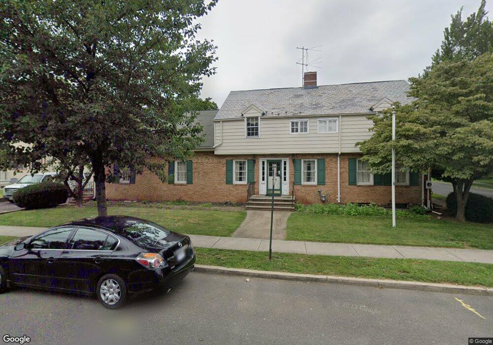
21 E 2nd St Bound Brook, NJ 08805
Estimated Value: $725,000
Studio
--
Bath
8,850
Sq Ft
$82/Sq Ft
Est. Value
About This Home
This home is located at 21 E 2nd St, Bound Brook, NJ 08805 and is currently estimated at $725,000, approximately $81 per square foot. 21 E 2nd St is a home located in Somerset County with nearby schools including LaMonte Annex Elementary School, Lafayette Elementary School, and Bound Brook High School.
Ownership History
Date
Name
Owned For
Owner Type
Purchase Details
Closed on
Feb 11, 2009
Sold by
Conroy Maureen E and Cummings Cornelia H C
Bought by
Christian Center Of Somerset County Inc
Current Estimated Value
Home Financials for this Owner
Home Financials are based on the most recent Mortgage that was taken out on this home.
Original Mortgage
$248,500
Interest Rate
4.82%
Mortgage Type
Commercial
Purchase Details
Closed on
Oct 20, 2004
Sold by
Conroy Funeral Home Inc
Bought by
Cummings Cornelia H C and Conroy Maureen
Create a Home Valuation Report for This Property
The Home Valuation Report is an in-depth analysis detailing your home's value as well as a comparison with similar homes in the area
Home Values in the Area
Average Home Value in this Area
Purchase History
| Date | Buyer | Sale Price | Title Company |
|---|---|---|---|
| Christian Center Of Somerset County Inc | $355,000 | Silk City Title & Abstract A | |
| Cummings Cornelia H C | -- | -- |
Source: Public Records
Mortgage History
| Date | Status | Borrower | Loan Amount |
|---|---|---|---|
| Previous Owner | Christian Center Of Somerset County Inc | $248,500 |
Source: Public Records
Tax History
| Year | Tax Paid | Tax Assessment Tax Assessment Total Assessment is a certain percentage of the fair market value that is determined by local assessors to be the total taxable value of land and additions on the property. | Land | Improvement |
|---|---|---|---|---|
| 2025 | -- | $579,700 | $242,000 | $337,700 |
| 2024 | -- | $539,700 | $222,000 | $317,700 |
Source: Public Records
Map
Nearby Homes
- 17 Talmage Ave
- 306 Church St
- 328 John St
- 162 Linden Ave
- 126 W High St
- 112 East St
- 315 East St
- 520 Winsor St
- 20 van Syckle Blvd
- 261 W Main St
- 107 Chestnut St
- 589 Mountain Ave
- 26 Louis Ave
- 650 Central Ave
- 120B Little Place
- 265 Metape Cir S
- 9 Swing Bridge Ln Unit 118
- 123 Elizabeth St
- 432 Talmage Ave
- 206 Bathgate Ave
- 111 John St
- 15 E 2nd St Unit 1A
- 15 E 2nd St
- 101 E 2nd St Unit 103
- 113 John St Unit 115
- 22 E 2nd St
- 9 E 2nd St
- 9 E 2nd St Unit 1A
- 9 E 2nd St Unit 3
- 9 E 2nd St Unit 1B
- 29-31 John St
- 34 Church St
- 29 John St Unit 31
- 13 E 2nd St Unit 15
- 13 E 2nd St Unit 2A
- 13 E 2nd St Unit 1B
- 13 E 2nd St Unit 1A
- 12 E High St
- 22 E High St
- 18 E High St