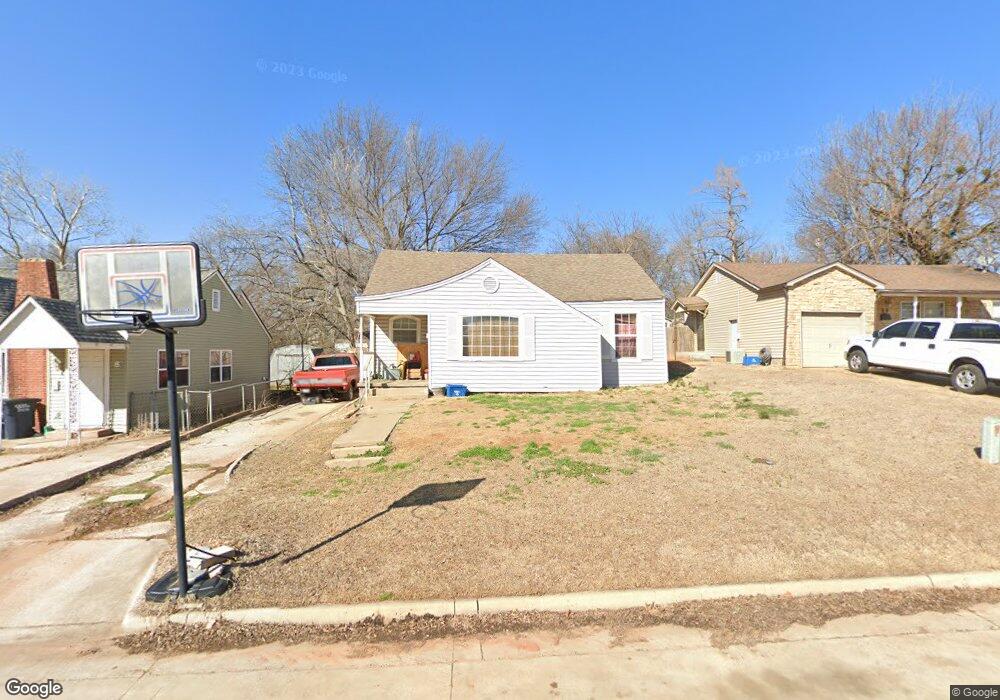
21 E Park Dr Shawnee, OK 74801
Estimated Value: $85,332 - $109,000
2
Beds
1
Bath
1,234
Sq Ft
$80/Sq Ft
Est. Value
About This Home
This home is located at 21 E Park Dr, Shawnee, OK 74801 and is currently estimated at $99,083, approximately $80 per square foot. 21 E Park Dr is a home located in Pottawatomie County with nearby schools including Sequoyah Elementary School, Shawnee Middle School, and Shawnee High School.
Ownership History
Date
Name
Owned For
Owner Type
Purchase Details
Closed on
Apr 13, 2015
Sold by
Mitchell Amanda R and Clanin Jake A
Bought by
Mitchell Concetta Rose
Current Estimated Value
Purchase Details
Closed on
Sep 26, 2008
Sold by
Mitchell E Keith
Bought by
Mitchell Concetta R
Purchase Details
Closed on
Apr 13, 2005
Sold by
Tomlinson David L and Tomlinson Nancy
Bought by
Mitchell E Keith and Mitchell Concetta Rose
Home Financials for this Owner
Home Financials are based on the most recent Mortgage that was taken out on this home.
Original Mortgage
$44,421
Outstanding Balance
$22,845
Interest Rate
5.93%
Mortgage Type
FHA
Estimated Equity
$76,238
Purchase Details
Closed on
Dec 2, 1991
Sold by
American National Bank
Bought by
Tomlinson David
Create a Home Valuation Report for This Property
The Home Valuation Report is an in-depth analysis detailing your home's value as well as a comparison with similar homes in the area
Purchase History
| Date | Buyer | Sale Price | Title Company |
|---|---|---|---|
| Mitchell Concetta Rose | -- | None Available | |
| Mitchell Concetta R | -- | None Available | |
| Mitchell E Keith | -- | None Available | |
| Tomlinson David | $17,000 | -- |
Source: Public Records
Mortgage History
| Date | Status | Borrower | Loan Amount |
|---|---|---|---|
| Open | Mitchell E Keith | $44,421 |
Source: Public Records
Tax History
| Year | Tax Paid | Tax Assessment Tax Assessment Total Assessment is a certain percentage of the fair market value that is determined by local assessors to be the total taxable value of land and additions on the property. | Land | Improvement |
|---|---|---|---|---|
| 2025 | $562 | $5,727 | $504 | $5,223 |
| 2024 | $543 | $5,454 | $504 | $4,950 |
| 2023 | $543 | $5,194 | $504 | $4,690 |
| 2022 | $533 | $5,194 | $504 | $4,690 |
| 2021 | $523 | $5,194 | $504 | $4,690 |
| 2020 | $525 | $5,194 | $504 | $4,690 |
| 2019 | $542 | $5,194 | $504 | $4,690 |
| 2018 | $519 | $5,074 | $504 | $4,570 |
| 2017 | $512 | $5,074 | $504 | $4,570 |
| 2016 | $512 | $5,014 | $504 | $4,510 |
| 2015 | $501 | $5,011 | $504 | $4,507 |
| 2014 | $531 | $5,310 | $505 | $4,805 |
Source: Public Records
Map
Nearby Homes
- 1102 N Park Ave
- 0 Independence and Minnesota St
- 1510 N Union Ave
- 1539 N Pennsylvania Ave
- 1108 N Pennsylvania Ave
- 1416 N Mckinley Ave
- 1607 N Beard Ave
- 210 E Cammack
- 1712 N Pennsylvania Ave
- 434 E Wallace St
- 508 E Wallace St
- 114 E Wallace St
- 1816 N Bell Ave
- 1822 N Philadelphia Ave
- 1324 N Park Ave
- 1432 N Park Ave
- 1115 N Tucker Ave
- 1901 N Bell Ave
- 1919 N Union Ave
- 204 W Wallace St
- 19 E Park Dr
- 8 E Morgan St
- 17 E Park Dr
- 211 E Severn St
- 215 E Severn St
- 4 E Morgan St
- 1210 N Phil
- 209 E Severn St
- 217 E Severn St
- 207 E Severn St
- 219 E Severn St
- 1208 N Phil
- 15 E Park Dr
- 221 E Severn St
- 5 E Morgan St
- 1202 N Oklahoma Ave
- 1303 N Union Ave
- 1206 N Philadelphia Ave
- 1325 N Union Ave
- 1301 N Union Ave