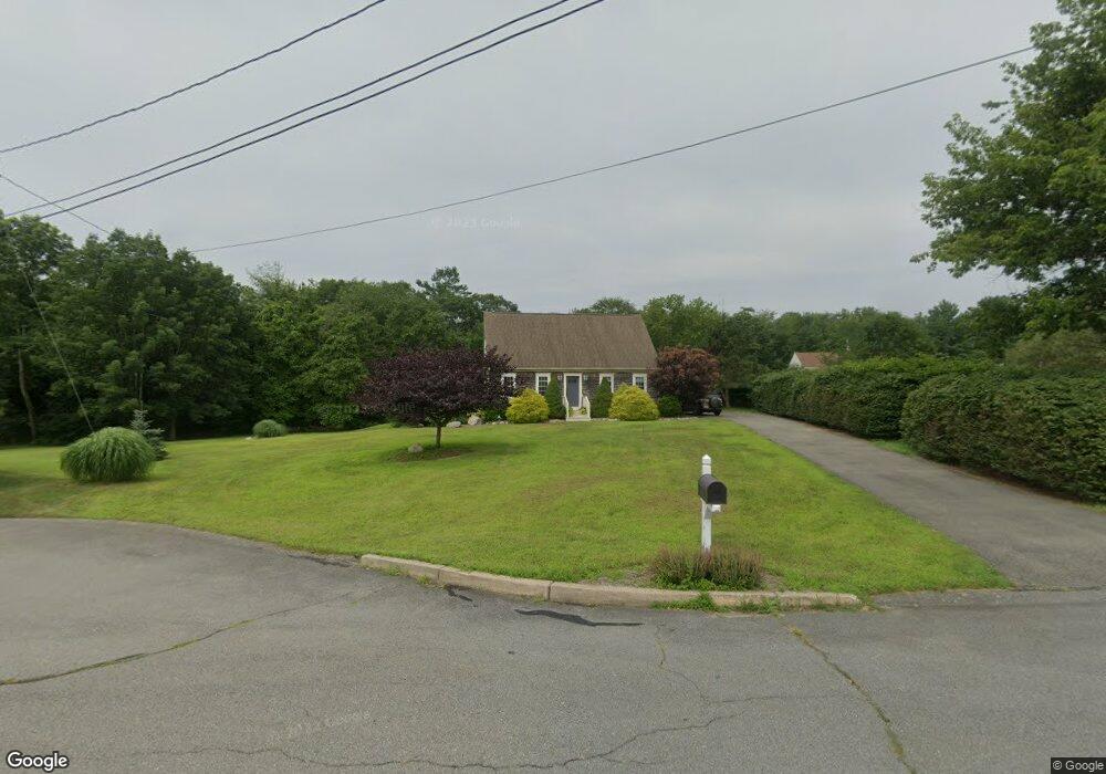
21 Earl St Acushnet, MA 02743
Sherwood Forest NeighborhoodEstimated Value: $546,704 - $588,000
1
Bed
1
Bath
1,667
Sq Ft
$339/Sq Ft
Est. Value
About This Home
This home is located at 21 Earl St, Acushnet, MA 02743 and is currently estimated at $565,676, approximately $339 per square foot. 21 Earl St is a home located in Bristol County with nearby schools including Acushnet Elementary School, Albert F Ford Middle School, and All Saints Catholic School.
Ownership History
Date
Name
Owned For
Owner Type
Purchase Details
Closed on
Dec 7, 2012
Sold by
Lemrise Richard P and Lemrise Sharon A
Bought by
Lemrise Sharon A
Current Estimated Value
Purchase Details
Closed on
Jun 26, 2001
Sold by
Modern Continental Con
Bought by
Lemrise Richard P and Lemrise Sharon A
Home Financials for this Owner
Home Financials are based on the most recent Mortgage that was taken out on this home.
Original Mortgage
$44,000
Interest Rate
7.09%
Mortgage Type
Purchase Money Mortgage
Create a Home Valuation Report for This Property
The Home Valuation Report is an in-depth analysis detailing your home's value as well as a comparison with similar homes in the area
Home Values in the Area
Average Home Value in this Area
Purchase History
| Date | Buyer | Sale Price | Title Company |
|---|---|---|---|
| Lemrise Sharon A | -- | -- | |
| Lemrise Richard P | $55,000 | -- |
Source: Public Records
Mortgage History
| Date | Status | Borrower | Loan Amount |
|---|---|---|---|
| Previous Owner | Lemrise Richard P | $141,000 | |
| Previous Owner | Lemrise Richard P | $44,000 |
Source: Public Records
Tax History
| Year | Tax Paid | Tax Assessment Tax Assessment Total Assessment is a certain percentage of the fair market value that is determined by local assessors to be the total taxable value of land and additions on the property. | Land | Improvement |
|---|---|---|---|---|
| 2025 | $52 | $484,100 | $177,200 | $306,900 |
| 2024 | $5,096 | $446,600 | $167,900 | $278,700 |
| 2023 | $5,104 | $425,300 | $152,300 | $273,000 |
| 2022 | $5,044 | $380,100 | $143,300 | $236,800 |
| 2021 | $4,695 | $339,500 | $143,300 | $196,200 |
| 2020 | $4,607 | $330,500 | $134,300 | $196,200 |
| 2019 | $4,410 | $311,000 | $128,300 | $182,700 |
| 2018 | $4,273 | $296,300 | $128,300 | $168,000 |
| 2017 | $4,111 | $284,700 | $128,300 | $156,400 |
| 2016 | $4,173 | $287,200 | $128,300 | $158,900 |
| 2015 | $3,834 | $268,500 | $128,300 | $140,200 |
Source: Public Records
Map
Nearby Homes
- 329 Middle Rd
- 941 Bartlett St
- 7 Hamlin St
- 1015 Forbes St
- ES Acushnet Ave
- 40 Foley Dr
- 23 Coury Dr
- 79 Park Dr
- 1044 Phillips Rd Unit 20
- 68 Gisele's Way
- 1044 Victoria St Unit B-29
- 1056 Victoria St Unit A-13
- 0 Church Dutton & Chaffee Unit 73371719
- 1251 Church St Unit 10
- 363 Main St
- 279 Adelaide St
- 1164 Victoria St
- 1261 Church St Unit 70
- 1261 Church St Unit 53
- 1261 Church St Unit 85
Your Personal Tour Guide
Ask me questions while you tour the home.