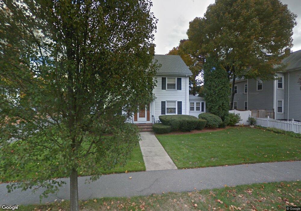
21 Elm St Melrose, MA 02176
Horace Mann NeighborhoodEstimated Value: $964,000 - $1,278,000
4
Beds
3
Baths
2,292
Sq Ft
$500/Sq Ft
Est. Value
About This Home
This home is located at 21 Elm St, Melrose, MA 02176 and is currently estimated at $1,145,256, approximately $499 per square foot. 21 Elm St is a home located in Middlesex County with nearby schools including Horace Mann Elementary School, Winthrop Elementary School, and Roosevelt Elementary School.
Ownership History
Date
Name
Owned For
Owner Type
Purchase Details
Closed on
Apr 23, 1991
Sold by
Ricciardelli Albert J and Ricciardelli Ruth
Bought by
Difraia Robert S and Difraia Kathryn A
Current Estimated Value
Create a Home Valuation Report for This Property
The Home Valuation Report is an in-depth analysis detailing your home's value as well as a comparison with similar homes in the area
Home Values in the Area
Average Home Value in this Area
Purchase History
| Date | Buyer | Sale Price | Title Company |
|---|---|---|---|
| Difraia Robert S | $182,500 | -- |
Source: Public Records
Mortgage History
| Date | Status | Borrower | Loan Amount |
|---|---|---|---|
| Open | Difraia Robert S | $153,300 | |
| Closed | Difraia Robert S | $125,000 | |
| Closed | Difraia Robert S | $135,000 |
Source: Public Records
Tax History Compared to Growth
Tax History
| Year | Tax Paid | Tax Assessment Tax Assessment Total Assessment is a certain percentage of the fair market value that is determined by local assessors to be the total taxable value of land and additions on the property. | Land | Improvement |
|---|---|---|---|---|
| 2025 | $94 | $950,200 | $505,000 | $445,200 |
| 2024 | $9,292 | $935,800 | $490,600 | $445,200 |
| 2023 | $9,185 | $881,500 | $476,200 | $405,300 |
| 2022 | $8,704 | $823,500 | $432,900 | $390,600 |
| 2021 | $8,450 | $771,700 | $404,000 | $367,700 |
| 2020 | $8,527 | $771,700 | $404,000 | $367,700 |
| 2019 | $7,556 | $699,000 | $360,700 | $338,300 |
| 2018 | $7,348 | $648,500 | $310,200 | $338,300 |
| 2017 | $7,108 | $602,400 | $288,600 | $313,800 |
| 2016 | $7,162 | $580,900 | $288,600 | $292,300 |
| 2015 | $6,709 | $517,700 | $274,200 | $243,500 |
| 2014 | $6,491 | $488,800 | $245,300 | $243,500 |
Source: Public Records
Map
Nearby Homes
- 55 Burrell St
- 128 Green St Unit 128
- 180 Green St Unit 416
- 180 Green St Unit 303
- 6 Linden Rd
- 46 Country Club Rd
- 8 Crystal St Unit 3
- 8 Crystal St Unit 2
- 49 Melrose St Unit 7E
- 760 Lynn Fells Pkwy
- 218 Upham St
- 50-52 Albion St
- 67 Lovell Rd
- 76 Lovell Rd
- 119 W Highland Ave Unit 1
- 257 1st St
- 260 Tremont St Unit 1
- 66 Richardson Rd
- 110 Ellis Farm Ln
- 54 Brunswick Park