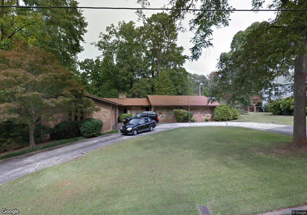
21 Elm St Newnan, GA 30263
Estimated Value: $519,000 - $659,000
5
Beds
3
Baths
4,368
Sq Ft
$132/Sq Ft
Est. Value
About This Home
This home is located at 21 Elm St, Newnan, GA 30263 and is currently estimated at $575,099, approximately $131 per square foot. 21 Elm St is a home located in Coweta County with nearby schools including Elm Street Elementary School, Evans Middle School, and Newnan High School.
Ownership History
Date
Name
Owned For
Owner Type
Purchase Details
Closed on
Jan 30, 2018
Sold by
Geo Investment Grp Llc
Bought by
Sapp Matthew and Sapp Julie
Current Estimated Value
Home Financials for this Owner
Home Financials are based on the most recent Mortgage that was taken out on this home.
Original Mortgage
$224,800
Outstanding Balance
$190,194
Interest Rate
3.95%
Mortgage Type
New Conventional
Estimated Equity
$384,905
Purchase Details
Closed on
Jun 23, 2016
Sold by
Jackson Frances R
Bought by
Geo Investment Grp Llc
Purchase Details
Closed on
Dec 31, 1976
Bought by
Jackson Edward B and Jackson France
Create a Home Valuation Report for This Property
The Home Valuation Report is an in-depth analysis detailing your home's value as well as a comparison with similar homes in the area
Home Values in the Area
Average Home Value in this Area
Purchase History
| Date | Buyer | Sale Price | Title Company |
|---|---|---|---|
| Sapp Matthew | $281,000 | -- | |
| Geo Investment Grp Llc | $160,000 | -- | |
| Jackson Edward B | -- | -- |
Source: Public Records
Mortgage History
| Date | Status | Borrower | Loan Amount |
|---|---|---|---|
| Open | Sapp Matthew | $224,800 |
Source: Public Records
Tax History Compared to Growth
Tax History
| Year | Tax Paid | Tax Assessment Tax Assessment Total Assessment is a certain percentage of the fair market value that is determined by local assessors to be the total taxable value of land and additions on the property. | Land | Improvement |
|---|---|---|---|---|
| 2024 | $4,292 | $187,854 | $32,000 | $155,854 |
| 2023 | $4,292 | $191,692 | $32,000 | $159,692 |
| 2022 | $4,415 | $181,482 | $41,200 | $140,282 |
| 2021 | $4,039 | $150,272 | $41,200 | $109,072 |
| 2020 | $4,130 | $150,272 | $41,200 | $109,072 |
| 2019 | $3,336 | $111,063 | $25,789 | $85,274 |
| 2018 | $3,063 | $101,350 | $25,789 | $75,562 |
| 2017 | $1,926 | $97,478 | $25,788 | $71,690 |
| 2016 | $2,622 | $87,088 | $25,789 | $61,299 |
| 2015 | $1,511 | $102,046 | $25,789 | $76,258 |
| 2014 | $1,356 | $95,114 | $25,789 | $69,325 |
Source: Public Records
Map
Nearby Homes
- 3 Northside Dr
- 37 Powell Place
- 1 Ellis Way
- 61 Clark St
- 144 Jackson St
- 0 Georgia 34 Unit 7614778
- 30 Elm Cir
- 43 Jackson St
- 7 Maple Dr
- 15 Casey St
- 33 Ray St
- 5 Casey Rd
- 55A Perry St
- 42 W Washington St
- 0 Highway 29 N Unit 14.41+/- AC 10432364
- 0 N Highway 29 Unit 20115352
- 0 Benelli Ridge Unit 10429105
- 0 Highway 34 Unit 20149159
- 97 W Washington St
- 71 Spring St
- 19 Elm St
- 6 Briarwood Ln
- 8 Briarwood Ln
- 17 Elm St
- 31 Elm St
- 4 Briarwood Ln
- 1 Mansour Cir
- 22 Elm St
- 29 Northside Dr
- 15 Elm St
- 2 Briarwood Ln
- 24 Elm St
- 27 Northside Dr
- 5 Briarwood Ln
- 5 Briarwood Ln
- 0 Elm St Unit 8581864
- 0 Elm St Unit 8187883
- 0 Elm St Unit 9033523
- 0 Elm St Unit 8742405
- 0 Elm St Unit 2933556