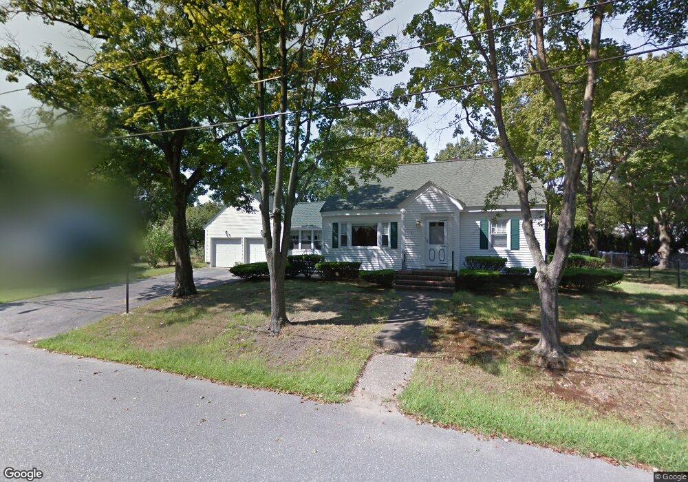
21 Emerald Ave Lawrence, MA 01843
Colonial Heights NeighborhoodEstimated Value: $561,000 - $666,000
5
Beds
2
Baths
1,750
Sq Ft
$342/Sq Ft
Est. Value
About This Home
This home is located at 21 Emerald Ave, Lawrence, MA 01843 and is currently estimated at $598,376, approximately $341 per square foot. 21 Emerald Ave is a home located in Essex County with nearby schools including John Breen School, South Lawrence East Elementary School, and School For Exceptional Studies.
Ownership History
Date
Name
Owned For
Owner Type
Purchase Details
Closed on
May 1, 2018
Sold by
21 Emerald Avenue Rt and Lapointe
Bought by
Lapointe Patricia A and Lapointe Thomas A
Current Estimated Value
Home Financials for this Owner
Home Financials are based on the most recent Mortgage that was taken out on this home.
Original Mortgage
$100,000
Outstanding Balance
$85,441
Interest Rate
4.44%
Mortgage Type
New Conventional
Estimated Equity
$512,935
Purchase Details
Closed on
Apr 9, 2004
Sold by
Lapointe Helen A
Bought by
21 Emerald Avenue Rt and Lapointe
Create a Home Valuation Report for This Property
The Home Valuation Report is an in-depth analysis detailing your home's value as well as a comparison with similar homes in the area
Home Values in the Area
Average Home Value in this Area
Purchase History
| Date | Buyer | Sale Price | Title Company |
|---|---|---|---|
| Lapointe Patricia A | $305,000 | -- | |
| 21 Emerald Avenue Rt | -- | -- |
Source: Public Records
Mortgage History
| Date | Status | Borrower | Loan Amount |
|---|---|---|---|
| Open | Lapointe Patricia A | $100,000 |
Source: Public Records
Tax History
| Year | Tax Paid | Tax Assessment Tax Assessment Total Assessment is a certain percentage of the fair market value that is determined by local assessors to be the total taxable value of land and additions on the property. | Land | Improvement |
|---|---|---|---|---|
| 2025 | $4,406 | $500,700 | $163,800 | $336,900 |
| 2024 | $4,127 | $446,200 | $143,500 | $302,700 |
| 2023 | $4,342 | $427,400 | $143,500 | $283,900 |
| 2022 | $4,202 | $367,300 | $127,900 | $239,400 |
| 2021 | $3,892 | $317,200 | $123,800 | $193,400 |
| 2020 | $3,632 | $292,200 | $106,100 | $186,100 |
| 2019 | $3,752 | $274,300 | $110,000 | $164,300 |
| 2018 | $3,639 | $254,100 | $108,000 | $146,100 |
| 2017 | $3,490 | $227,500 | $105,000 | $122,500 |
| 2016 | $3,082 | $198,700 | $75,000 | $123,700 |
| 2015 | $2,853 | $188,700 | $65,000 | $123,700 |
Source: Public Records
Map
Nearby Homes
- 12B Stevens St
- 102 Weare St
- 341 S Broadway- Parcel II
- 24 Inman St Unit 4
- 27-29 Dorchester St
- 356-360 S Union St
- 46-46A Dorchester St
- 31 Garfield St
- 87-87A Brookfield St
- 28 Stirling St
- 42 York St
- 91-93 Andover St
- 119 Andover St
- 11 W Hawley St
- 350 Greene St Unit 410
- 350 Greene St Unit 305
- 183 Farnham St Unit 189
- 354 N Main St Unit 204
- 10 Dartmouth Rd
- 161-167 S Union St
Your Personal Tour Guide
Ask me questions while you tour the home.