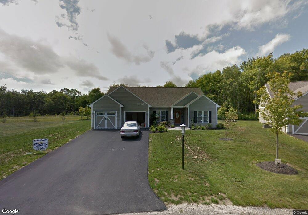
21 Evan Way Kingston, RI 02881
Estimated Value: $700,078 - $839,000
2
Beds
2
Baths
1,869
Sq Ft
$416/Sq Ft
Est. Value
About This Home
This home is located at 21 Evan Way, Kingston, RI 02881 and is currently estimated at $777,020, approximately $415 per square foot. 21 Evan Way is a home located in Washington County with nearby schools including South Kingstown High School, Kingston Hill Academy, and The Compass School.
Ownership History
Date
Name
Owned For
Owner Type
Purchase Details
Closed on
Aug 9, 2022
Sold by
Martelli Frank P and Martelli Valerie A
Bought by
Frank P & V A Martelli Ret and Martelli
Current Estimated Value
Purchase Details
Closed on
Sep 3, 2019
Sold by
Hansen James E and Hansen Anne M
Bought by
Matelli Frank P and Matelli Valerie A
Purchase Details
Closed on
Jul 12, 2012
Sold by
Stony Fort Partners Ll
Bought by
Hensen James E and Hansen Anne M
Home Financials for this Owner
Home Financials are based on the most recent Mortgage that was taken out on this home.
Original Mortgage
$287,000
Interest Rate
3.76%
Create a Home Valuation Report for This Property
The Home Valuation Report is an in-depth analysis detailing your home's value as well as a comparison with similar homes in the area
Home Values in the Area
Average Home Value in this Area
Purchase History
| Date | Buyer | Sale Price | Title Company |
|---|---|---|---|
| Frank P & V A Martelli Ret | -- | None Available | |
| Frank P & V A Martelli Ret | -- | None Available | |
| Frank P & V A Martelli Ret | -- | None Available | |
| Matelli Frank P | $499,000 | -- | |
| Matelli Frank P | $499,000 | -- | |
| Matelli Frank P | $499,000 | -- | |
| Hensen James E | $359,000 | -- | |
| Hensen James E | $359,000 | -- |
Source: Public Records
Mortgage History
| Date | Status | Borrower | Loan Amount |
|---|---|---|---|
| Previous Owner | Hensen James E | $287,000 |
Source: Public Records
Tax History Compared to Growth
Tax History
| Year | Tax Paid | Tax Assessment Tax Assessment Total Assessment is a certain percentage of the fair market value that is determined by local assessors to be the total taxable value of land and additions on the property. | Land | Improvement |
|---|---|---|---|---|
| 2025 | $6,074 | $679,400 | $170,500 | $508,900 |
| 2024 | $5,868 | $531,000 | $131,200 | $399,800 |
| 2023 | $5,868 | $531,000 | $131,200 | $399,800 |
| 2022 | $5,814 | $531,000 | $131,200 | $399,800 |
| 2021 | $5,802 | $401,500 | $114,100 | $287,400 |
| 2020 | $5,802 | $401,500 | $114,100 | $287,400 |
| 2019 | $5,802 | $401,500 | $114,100 | $287,400 |
| 2018 | $5,483 | $349,700 | $106,100 | $243,600 |
| 2017 | $5,354 | $349,700 | $106,100 | $243,600 |
| 2016 | $5,277 | $349,700 | $106,100 | $243,600 |
| 2015 | $5,317 | $342,600 | $103,600 | $239,000 |
| 2014 | $5,303 | $342,600 | $103,600 | $239,000 |
Source: Public Records
Map
Nearby Homes
- 48 Fieldstone Ln
- 91 Old Rd N
- 81 Old Rd N
- 150 Delta Dr
- 1081 Mooresfield Rd
- 449 Sylvan Ct
- 247 Glen Hill Dr
- 400 Yawgoo Valley Rd
- 42 Ledgewood Rd
- 155 Beechwood Hill Trail
- 79 Linden Dr
- 23 Conant Ln
- 202 Explorer Dr
- 158 Explorer Dr
- 168 Explorer Dr
- 294 Rose Hill Rd
- 222 Windmill Dr
- 1332 South Rd
- 0 South Rd Unit 1400966
- 18 Railroad Ave