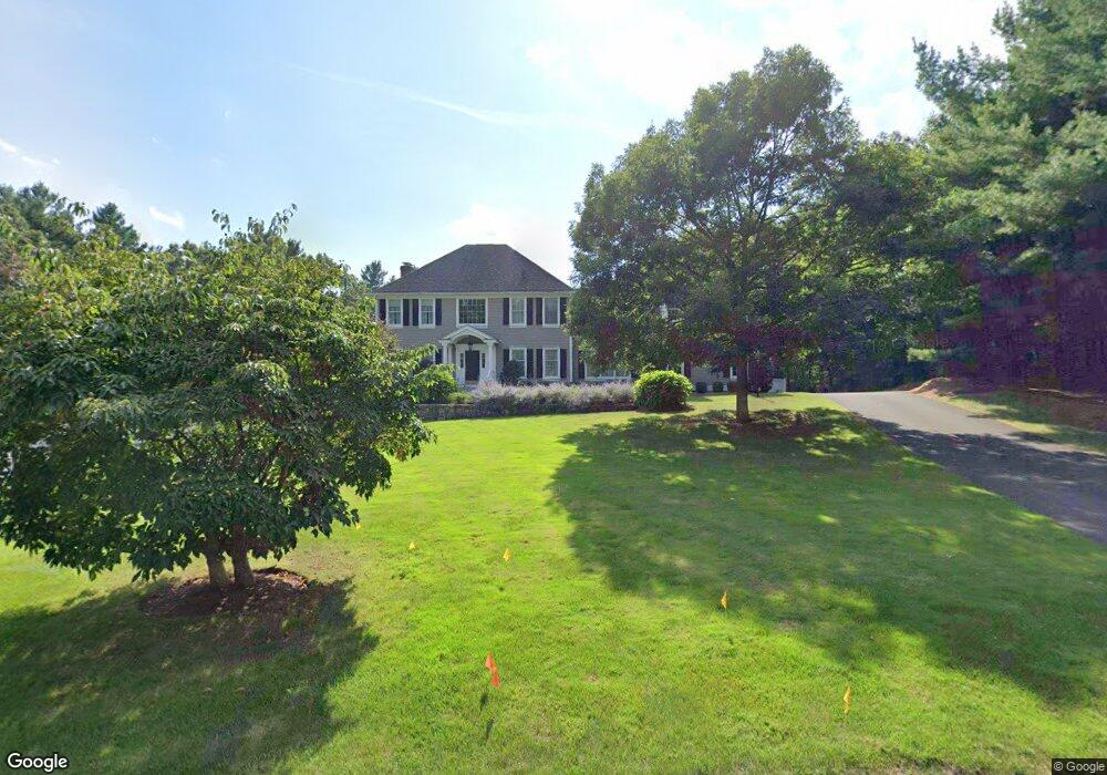
21 Field Rd Sudbury, MA 01776
Estimated Value: $1,550,868 - $1,907,000
4
Beds
4
Baths
3,456
Sq Ft
$505/Sq Ft
Est. Value
About This Home
This home is located at 21 Field Rd, Sudbury, MA 01776 and is currently estimated at $1,744,967, approximately $504 per square foot. 21 Field Rd is a home located in Middlesex County with nearby schools including Josiah Haynes Elementary School, Ephraim Curtis Middle School, and Lincoln-Sudbury Regional High School.
Ownership History
Date
Name
Owned For
Owner Type
Purchase Details
Closed on
Feb 21, 2017
Sold by
Darveau Peter J and Menna-Darveau Mary
Bought by
Menna Darveau Rt 2017
Current Estimated Value
Purchase Details
Closed on
Jun 24, 1999
Sold by
Cormier Homes Inc
Bought by
Darveau Peter J and Darveau Mary M
Home Financials for this Owner
Home Financials are based on the most recent Mortgage that was taken out on this home.
Original Mortgage
$480,000
Interest Rate
7.54%
Purchase Details
Closed on
Apr 10, 1998
Sold by
Candlewood T T and Candlewood Maillet
Bought by
Parkwood Est Rlty Inc
Home Financials for this Owner
Home Financials are based on the most recent Mortgage that was taken out on this home.
Original Mortgage
$468,750
Interest Rate
6.98%
Mortgage Type
Purchase Money Mortgage
Create a Home Valuation Report for This Property
The Home Valuation Report is an in-depth analysis detailing your home's value as well as a comparison with similar homes in the area
Home Values in the Area
Average Home Value in this Area
Purchase History
| Date | Buyer | Sale Price | Title Company |
|---|---|---|---|
| Menna Darveau Rt 2017 | -- | -- | |
| Menna Darveau Rt 2017 | -- | -- | |
| Darveau Peter J | $632,500 | -- | |
| Parkwood Est Rlty Inc | $252,000 | -- |
Source: Public Records
Mortgage History
| Date | Status | Borrower | Loan Amount |
|---|---|---|---|
| Previous Owner | Parkwood Est Rlty Inc | $270,000 | |
| Previous Owner | Parkwood Est Rlty Inc | $480,000 | |
| Previous Owner | Parkwood Est Rlty Inc | $480,000 | |
| Previous Owner | Parkwood Est Rlty Inc | $468,750 |
Source: Public Records
Tax History Compared to Growth
Tax History
| Year | Tax Paid | Tax Assessment Tax Assessment Total Assessment is a certain percentage of the fair market value that is determined by local assessors to be the total taxable value of land and additions on the property. | Land | Improvement |
|---|---|---|---|---|
| 2025 | $22,436 | $1,532,500 | $462,600 | $1,069,900 |
| 2024 | $21,547 | $1,474,800 | $449,000 | $1,025,800 |
| 2023 | $20,182 | $1,279,800 | $415,800 | $864,000 |
| 2022 | $19,342 | $1,071,600 | $381,400 | $690,200 |
| 2021 | $18,229 | $968,100 | $381,400 | $586,700 |
| 2020 | $17,638 | $956,000 | $381,400 | $574,600 |
| 2019 | $17,122 | $956,000 | $381,400 | $574,600 |
| 2018 | $16,352 | $912,000 | $401,400 | $510,600 |
| 2017 | $16,016 | $902,800 | $396,600 | $506,200 |
| 2016 | $15,563 | $874,300 | $381,400 | $492,900 |
| 2015 | $14,971 | $850,600 | $366,600 | $484,000 |
| 2014 | $14,983 | $831,000 | $355,800 | $475,200 |
Source: Public Records
Map
Nearby Homes
- 42 Dakin Rd
- 16 Blacksmith Dr
- 40 Rookery Ln Unit 5
- 72 Rookery Ln Unit 3
- 401 Emery Ln Unit 104
- 24 Rookery Ln Unit 6
- 56 Rookery Ln Unit 4
- 369 Border Rd
- 67 Powder Mill Rd
- 394 Plainfield Rd Unit 394
- 14 Frost Ln
- 57 Longfellow Rd
- 29 Black Birch Ln Unit 29
- 9 Black Birch Ln Unit 9
- 589 North Rd
- 96 Forest Ridge Rd Unit 96
- 941 Concord Rd
- Lot 5 Sailaway Ln
- 45 N Crescent Cir
- Lot 4 Sailaway Ln