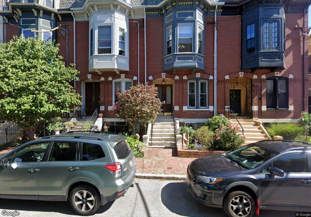
21 Fort Ave Roxbury, MA 02119
Fort Hill NeighborhoodEstimated Value: $998,000 - $1,157,832
4
Beds
3
Baths
2,419
Sq Ft
$451/Sq Ft
Est. Value
About This Home
This home is located at 21 Fort Ave, Roxbury, MA 02119 and is currently estimated at $1,090,958, approximately $450 per square foot. 21 Fort Ave is a home located in Suffolk County with nearby schools including City on a Hill Charter Public School, Paige Academy, and Malik Academy.
Ownership History
Date
Name
Owned For
Owner Type
Purchase Details
Closed on
Dec 27, 2022
Sold by
Perry Sedrick
Bought by
Fort Llc 21
Current Estimated Value
Purchase Details
Closed on
Dec 29, 1995
Sold by
Jackson Lewis D and Jackson Deborah C
Bought by
Perry Sedrick
Create a Home Valuation Report for This Property
The Home Valuation Report is an in-depth analysis detailing your home's value as well as a comparison with similar homes in the area
Home Values in the Area
Average Home Value in this Area
Purchase History
| Date | Buyer | Sale Price | Title Company |
|---|---|---|---|
| Fort Llc 21 | -- | None Available | |
| Perry Sedrick | $134,500 | -- |
Source: Public Records
Mortgage History
| Date | Status | Borrower | Loan Amount |
|---|---|---|---|
| Previous Owner | Perry Sedrick | $216,500 | |
| Previous Owner | Perry Sedrick | $222,000 | |
| Previous Owner | Perry Sedrick | $354,000 | |
| Previous Owner | Perry Sedrick | $187,400 |
Source: Public Records
Tax History Compared to Growth
Tax History
| Year | Tax Paid | Tax Assessment Tax Assessment Total Assessment is a certain percentage of the fair market value that is determined by local assessors to be the total taxable value of land and additions on the property. | Land | Improvement |
|---|---|---|---|---|
| 2025 | $11,404 | $984,800 | $313,800 | $671,000 |
| 2024 | $11,010 | $1,010,100 | $197,100 | $813,000 |
| 2023 | $10,431 | $971,200 | $189,500 | $781,700 |
| 2022 | $9,607 | $883,000 | $172,300 | $710,700 |
| 2021 | $8,805 | $825,200 | $161,000 | $664,200 |
| 2020 | $7,463 | $706,700 | $150,300 | $556,400 |
| 2019 | $6,964 | $660,700 | $115,100 | $545,600 |
| 2018 | $5,772 | $550,800 | $103,590 | $447,210 |
| 2017 | $5,647 | $533,280 | $101,288 | $431,992 |
| 2016 | $5,140 | $467,300 | $115,100 | $352,200 |
| 2015 | $4,067 | $335,800 | $88,600 | $247,200 |
| 2014 | $3,841 | $305,300 | $88,600 | $216,700 |
Source: Public Records
Map
Nearby Homes
- 78 Fort Ave Unit 78
- 1 Centre Street Terrace Unit 7
- 51 Beech Glen St Unit 3
- 127 Marcella St Unit 1
- 63 Beech Glen St
- 10 Linwood St
- 22 Hawthorne St Unit 2
- 9-45 Vale St
- 49 Norfolk St
- 51 Norfolk St
- 38 Juniper St
- 9 W Cedar St Unit 1
- 6 Fisher Ave
- 249 Roxbury St Unit 1
- 2826 Washington St
- 133 Martin Luther King Blvd
- 2856 Washington St
- 27 Dudley St
- 743 Parker St Unit 3
- 8 Brinton St Unit 2
- 21 Fort Ave Unit n/a
- 21 Fort Ave
- 21 Fort Ave Unit 1
- 23 Fort Ave
- 23 Fort Ave Unit 1
- 19 Fort Ave
- 25 Fort Ave Unit 3
- 25 Fort Ave Unit 2
- 25 Fort Ave Unit 1
- 25 Fort Ave
- 27 Fort Ave Unit 3
- 29 Fort Ave
- 29 Fort Ave Unit 1
- 31 Fort Ave
- 31 Fort Ave Unit 1
- 31 Fort Ave Unit 3
- 31 Fort Ave Unit 3
- 31 Fort Ave Unit G
- 31 Fort Ave Unit 2
- 17 Fort Ave Unit D