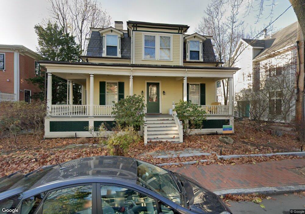
21 Frost St Cambridge, MA 02140
Baldwin NeighborhoodEstimated Value: $2,297,000 - $3,556,000
4
Beds
3
Baths
2,808
Sq Ft
$1,049/Sq Ft
Est. Value
About This Home
This home is located at 21 Frost St, Cambridge, MA 02140 and is currently estimated at $2,945,177, approximately $1,048 per square foot. 21 Frost St is a home located in Middlesex County with nearby schools including St Peter School, Saint Theresa School, and Cambridge Montessori School.
Ownership History
Date
Name
Owned For
Owner Type
Purchase Details
Closed on
Apr 16, 2002
Sold by
Herman James G and Mason David H
Bought by
Forbath Theodore C and Roberts Alison M
Current Estimated Value
Purchase Details
Closed on
May 26, 1989
Sold by
Dupont E Marilyn
Bought by
Mason David H
Purchase Details
Closed on
Dec 6, 1988
Sold by
Newport Apt Trust
Bought by
Dupont E Marilynn
Create a Home Valuation Report for This Property
The Home Valuation Report is an in-depth analysis detailing your home's value as well as a comparison with similar homes in the area
Home Values in the Area
Average Home Value in this Area
Purchase History
| Date | Buyer | Sale Price | Title Company |
|---|---|---|---|
| Forbath Theodore C | $1,480,000 | -- | |
| Mason David H | $525,000 | -- | |
| Dupont E Marilynn | $310,000 | -- |
Source: Public Records
Mortgage History
| Date | Status | Borrower | Loan Amount |
|---|---|---|---|
| Open | Dupont E Marilynn | $185,000 | |
| Closed | Dupont E Marilynn | $198,000 |
Source: Public Records
Tax History Compared to Growth
Tax History
| Year | Tax Paid | Tax Assessment Tax Assessment Total Assessment is a certain percentage of the fair market value that is determined by local assessors to be the total taxable value of land and additions on the property. | Land | Improvement |
|---|---|---|---|---|
| 2025 | $16,528 | $2,602,800 | $1,140,200 | $1,462,600 |
| 2024 | $15,315 | $2,587,000 | $1,187,100 | $1,399,900 |
| 2023 | $14,191 | $2,421,600 | $1,208,700 | $1,212,900 |
| 2022 | $13,338 | $2,253,000 | $1,180,100 | $1,072,900 |
| 2021 | $12,903 | $2,205,600 | $1,206,200 | $999,400 |
| 2020 | $12,187 | $2,119,500 | $1,173,100 | $946,400 |
| 2019 | $11,192 | $1,884,200 | $1,011,000 | $873,200 |
| 2018 | $10,976 | $1,745,000 | $912,400 | $832,600 |
| 2017 | $10,492 | $1,616,600 | $838,400 | $778,200 |
| 2016 | $10,099 | $1,444,800 | $725,700 | $719,100 |
| 2015 | $9,971 | $1,275,100 | $634,100 | $641,000 |
| 2014 | $10,257 | $1,224,000 | $591,800 | $632,200 |
Source: Public Records
Map
Nearby Homes
- 15-15A Forest St
- 3 Arlington St Unit 52
- 749 Somerville Ave Unit 1
- 22 Agassiz St
- 32-40 White St
- 1 Richdale Ave Unit 2
- 8 Craigie St
- 24 Cambridge Terrace Unit 2
- 72 Oxford St Unit 72
- 72 Oxford St
- 74 Oxford St
- 74 Oxford St Unit 3
- 13 Mellen St Unit Front
- 86 Avon Hill St
- 43 Linnaean St Unit 42
- 31-33 Mellen St
- 35 Mellen St
- 37 Mellen St
- 22 Lowell St Unit 3
- 82 Sacramento St
- 11 Forest St
- 11 Forest St Unit 2T
- 11 Forest St Unit 2A
- 11 Forest St
- 11 Forest St Unit 22
- 11 Forest St Unit 3
- 11 Forest St Unit 34
- 11 Forest St Unit 43
- 12 Newport Rd Unit B
- 12 Newport Rd
- 9 Frost St
- 9 Forest St Unit 2
- 9 Forest St Unit 1
- 9 Forest St Unit 4
- 9 Forest St Unit 5
- 9 Forest St Unit 3A
- 9 Forest St Unit 32
- 9 Forest St
- 9 Forest St
- 7 Frost St