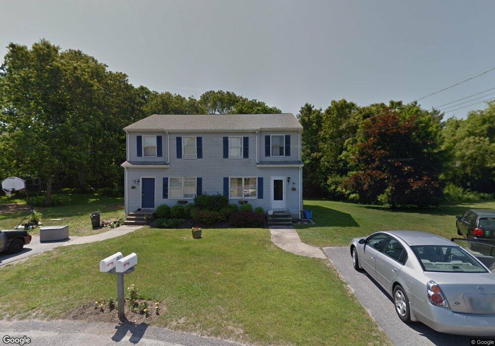
21 Greene Ct Unit 23 Westerly, RI 02891
Estimated Value: $442,000 - $631,868
4
Beds
4
Baths
2,280
Sq Ft
$246/Sq Ft
Est. Value
About This Home
This home is located at 21 Greene Ct Unit 23, Westerly, RI 02891 and is currently estimated at $561,967, approximately $246 per square foot. 21 Greene Ct Unit 23 is a home located in Washington County with nearby schools including Westerly High School.
Ownership History
Date
Name
Owned For
Owner Type
Purchase Details
Closed on
Feb 4, 2022
Sold by
Panciera Donald M
Bought by
Panciera Ft
Current Estimated Value
Purchase Details
Closed on
Nov 10, 2010
Sold by
Mason Kenneth and Mason Tonya M
Bought by
Mason Tonya M
Purchase Details
Closed on
Apr 24, 2002
Sold by
Garten Patrick W
Bought by
Mason Kenneth and Mason Tonya M
Home Financials for this Owner
Home Financials are based on the most recent Mortgage that was taken out on this home.
Original Mortgage
$146,000
Interest Rate
7.05%
Create a Home Valuation Report for This Property
The Home Valuation Report is an in-depth analysis detailing your home's value as well as a comparison with similar homes in the area
Home Values in the Area
Average Home Value in this Area
Purchase History
| Date | Buyer | Sale Price | Title Company |
|---|---|---|---|
| Panciera Ft | -- | None Available | |
| Mason Tonya M | -- | -- | |
| Mason Kenneth | $91,500 | -- | |
| Mason Kenneth | $91,500 | -- |
Source: Public Records
Mortgage History
| Date | Status | Borrower | Loan Amount |
|---|---|---|---|
| Previous Owner | Mason Kenneth | $146,000 | |
| Previous Owner | Mason Kenneth | $146,000 |
Source: Public Records
Tax History Compared to Growth
Tax History
| Year | Tax Paid | Tax Assessment Tax Assessment Total Assessment is a certain percentage of the fair market value that is determined by local assessors to be the total taxable value of land and additions on the property. | Land | Improvement |
|---|---|---|---|---|
| 2025 | $3,501 | $492,400 | $206,600 | $285,800 |
| 2024 | $3,568 | $363,700 | $147,900 | $215,800 |
| 2023 | $3,499 | $363,700 | $147,900 | $215,800 |
| 2022 | $3,477 | $363,700 | $147,900 | $215,800 |
| 2021 | $3,564 | $309,400 | $128,700 | $180,700 |
| 2020 | $3,499 | $309,400 | $128,700 | $180,700 |
| 2019 | $3,465 | $309,400 | $128,700 | $180,700 |
| 2018 | $3,332 | $280,500 | $128,700 | $151,800 |
| 2017 | $3,251 | $280,500 | $128,700 | $151,800 |
| 2016 | $3,276 | $280,500 | $128,700 | $151,800 |
| 2015 | $3,042 | $281,100 | $131,200 | $149,900 |
| 2014 | $2,991 | $281,100 | $131,200 | $149,900 |
Source: Public Records
Map
Nearby Homes
- 33 Stuart St
- 11 Bucks Trail
- 17 Plateau Rd
- 30 Clifford Dr
- 2 Belle Rose Dr Unit A
- 5 Robin Hollow Ln
- 14 Piezzo Dr
- 10 Morris Rd
- 342 Post Rd
- 15 Breach Dr
- 346 Post Rd
- 54 Sherwood Dr
- 597 Atlantic Ave
- 7 Fenway Rd
- 118 Dunns Corner Rd
- 12 Fallon Trail
- 470 Atlantic Ave
- 446 Atlantic Ave
- 432 Atlantic Ave
- 53 Bradford Rd
- 17 Greene Ct Unit 19
- 22 Greene Ct Unit 24
- 12 Pine Woods Ct
- 22-24 Greene Ct
- 14 Pine Woods Ct
- 18 Greene Ct Unit 20
- 70A Quannacut Rd Unit 70A
- 70B Quannacut Rd Unit D3
- 72A Quannacut Rd Unit B
- 10 Pine Woods Ct
- 13 Greene Ct Unit 15
- 68A Quannacut Rd Unit 68
- 78 Quannacut Rd Unit 78A
- 78 Quannacut Rd Unit 78-B
- 78 Quannacut Rd Unit B
- 78 Quannacut Rd Unit A
- 14 Greene Ct Unit 16
- 74A Quannacut Rd Unit 74A
- 8 Pine Woods Ct
- 74 Quannacut Rd Unit 74