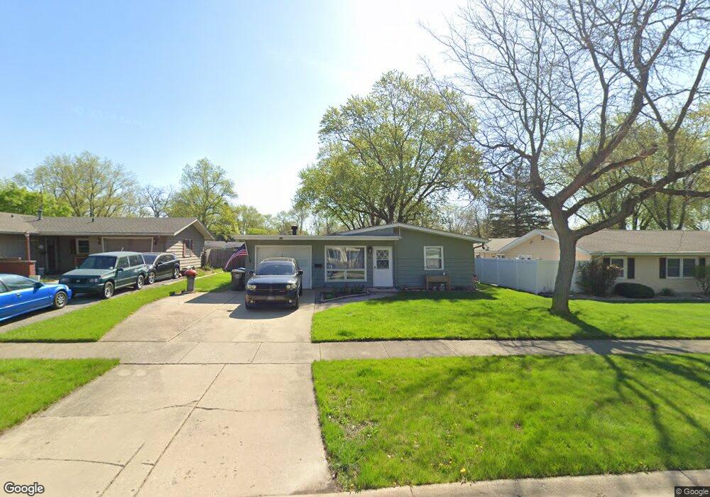
21 Hawthorne Dr North Aurora, IL 60542
Estimated Value: $277,000 - $321,000
3
Beds
1
Bath
1,194
Sq Ft
$247/Sq Ft
Est. Value
About This Home
This home is located at 21 Hawthorne Dr, North Aurora, IL 60542 and is currently estimated at $294,835, approximately $246 per square foot. 21 Hawthorne Dr is a home located in Kane County with nearby schools including Goodwin Elementary School, Jewel Middle School, and West Aurora High School.
Ownership History
Date
Name
Owned For
Owner Type
Purchase Details
Closed on
Jan 19, 2017
Sold by
Nauert John H and Nauert Peggy J
Bought by
Nauert John H and Nauert Peggy J
Current Estimated Value
Purchase Details
Closed on
May 15, 2006
Sold by
Vermaat Kenneth D
Bought by
Seymour Steven P and Seymour Cynthia K
Purchase Details
Closed on
Apr 19, 1996
Sold by
Johnson Roger and Johnson Deborah M
Bought by
Vermaat Kenneth D
Home Financials for this Owner
Home Financials are based on the most recent Mortgage that was taken out on this home.
Original Mortgage
$82,000
Interest Rate
7.45%
Create a Home Valuation Report for This Property
The Home Valuation Report is an in-depth analysis detailing your home's value as well as a comparison with similar homes in the area
Home Values in the Area
Average Home Value in this Area
Purchase History
| Date | Buyer | Sale Price | Title Company |
|---|---|---|---|
| Nauert John H | -- | None Available | |
| Seymour Steven P | $166,500 | -- | |
| Vermaat Kenneth D | $102,500 | Greater Illinois Title Compa |
Source: Public Records
Mortgage History
| Date | Status | Borrower | Loan Amount |
|---|---|---|---|
| Previous Owner | Vermaat Kenneth D | $82,000 |
Source: Public Records
Tax History Compared to Growth
Tax History
| Year | Tax Paid | Tax Assessment Tax Assessment Total Assessment is a certain percentage of the fair market value that is determined by local assessors to be the total taxable value of land and additions on the property. | Land | Improvement |
|---|---|---|---|---|
| 2024 | $6,100 | $80,153 | $13,622 | $66,531 |
| 2023 | $5,903 | $71,616 | $12,171 | $59,445 |
| 2022 | $5,475 | $65,343 | $11,105 | $54,238 |
| 2021 | $5,254 | $60,835 | $10,339 | $50,496 |
| 2020 | $5,472 | $62,185 | $9,603 | $52,582 |
| 2019 | $5,330 | $57,616 | $8,897 | $48,719 |
| 2018 | $5,086 | $53,145 | $8,230 | $44,915 |
| 2017 | $4,761 | $48,352 | $7,583 | $40,769 |
| 2016 | $4,283 | $42,178 | $6,327 | $35,851 |
| 2015 | -- | $37,012 | $5,441 | $31,571 |
| 2014 | -- | $34,649 | $5,233 | $29,416 |
| 2013 | -- | $35,090 | $5,158 | $29,932 |
Source: Public Records
Map
Nearby Homes
- 6 S Sycamore Ln
- 43 S Juniper Dr Unit 3
- 328 W State St
- 320 Harmony Dr
- 727 Harmony Ct
- 307 John St
- 306 Harmony Dr
- 202 Larchwood Ln
- 302 Pin Oak Dr
- 22 Silver Trail Unit 2
- 503 Redwood Ct
- 16 S Grace St
- 791 Cottonwood Dr
- 341 Pheasant Hill Dr
- 218 Timber Oaks Dr
- 438 Mallard Point Dr
- 442 Mallard Point Dr
- 12 N Lincolnway
- 413 N Sycamore Ln
- 148 N Lincolnway
- 19 Hawthorne Dr
- 413 Princeton Dr
- 18 Princeton Ct
- 17 Hawthorne Dr
- 20 Princeton Ct
- 24 Hawthorne Dr
- 16 Princeton Ct
- 501 Princeton Dr
- 15 Hawthorne Dr
- 22 Hawthorne Dr
- 424 Princeton Dr
- 422 Princeton Dr
- 20 Hawthorne Dr
- 426 Princeton Dr
- 420 Princeton Dr
- 13 Hawthorne Dr
- 14 Princeton Ct
- 502 Princeton Dr
- 18 Hawthorne Dr
- 418 Princeton Dr