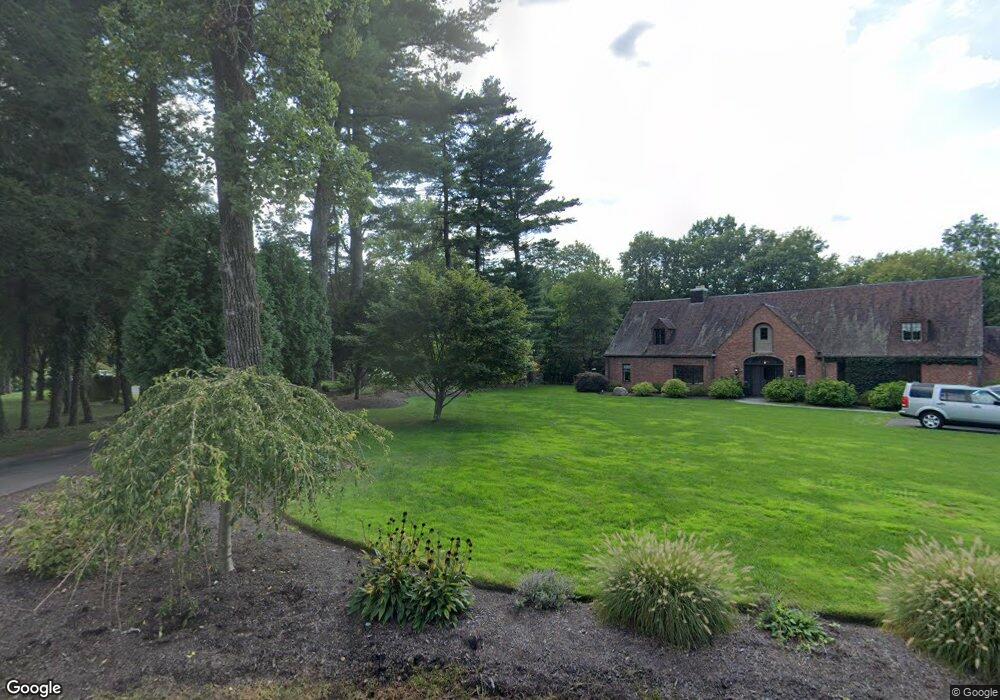
21 High Gate Ln West Hartford, CT 06107
Estimated Value: $706,000 - $826,000
4
Beds
3
Baths
2,206
Sq Ft
$338/Sq Ft
Est. Value
About This Home
This home is located at 21 High Gate Ln, West Hartford, CT 06107 and is currently estimated at $746,027, approximately $338 per square foot. 21 High Gate Ln is a home located in Hartford County with nearby schools including Braeburn School, Sedgwick Middle School, and Conard High School.
Ownership History
Date
Name
Owned For
Owner Type
Purchase Details
Closed on
Nov 1, 2017
Sold by
Fowler Joseph S
Bought by
Joseph S Fowler 3 Ret
Current Estimated Value
Purchase Details
Closed on
Oct 27, 1999
Sold by
Smolkin Bradley M and Smolkin Melinda W
Bought by
Fowler Joseph S
Purchase Details
Closed on
Jun 15, 1994
Sold by
Collins Bradford and Collins Bonnie
Bought by
Smolkin Bradley and Smolkin Melinda
Home Financials for this Owner
Home Financials are based on the most recent Mortgage that was taken out on this home.
Original Mortgage
$231,200
Interest Rate
5.95%
Mortgage Type
Unknown
Create a Home Valuation Report for This Property
The Home Valuation Report is an in-depth analysis detailing your home's value as well as a comparison with similar homes in the area
Home Values in the Area
Average Home Value in this Area
Purchase History
| Date | Buyer | Sale Price | Title Company |
|---|---|---|---|
| Joseph S Fowler 3 Ret | -- | -- | |
| Fowler Joseph S | $315,000 | -- | |
| Smolkin Bradley | $289,000 | -- |
Source: Public Records
Mortgage History
| Date | Status | Borrower | Loan Amount |
|---|---|---|---|
| Previous Owner | Smolkin Bradley | $150,000 | |
| Previous Owner | Smolkin Bradley | $222,350 | |
| Previous Owner | Smolkin Bradley | $231,200 |
Source: Public Records
Tax History Compared to Growth
Tax History
| Year | Tax Paid | Tax Assessment Tax Assessment Total Assessment is a certain percentage of the fair market value that is determined by local assessors to be the total taxable value of land and additions on the property. | Land | Improvement |
|---|---|---|---|---|
| 2025 | $13,968 | $311,920 | $84,770 | $227,150 |
| 2024 | $13,210 | $311,920 | $84,770 | $227,150 |
| 2023 | $12,764 | $311,920 | $84,770 | $227,150 |
| 2022 | $12,689 | $311,920 | $84,770 | $227,150 |
| 2021 | $12,299 | $289,940 | $89,180 | $200,760 |
| 2020 | $11,818 | $282,730 | $83,370 | $199,360 |
| 2019 | $10,373 | $248,150 | $83,370 | $164,780 |
| 2018 | $10,866 | $265,020 | $83,370 | $181,650 |
| 2017 | $10,876 | $265,020 | $83,370 | $181,650 |
| 2016 | $10,070 | $254,870 | $87,360 | $167,510 |
| 2015 | $9,764 | $254,870 | $87,360 | $167,510 |
| 2014 | $9,524 | $254,870 | $87,360 | $167,510 |
Source: Public Records
Map
Nearby Homes
- 37 W Normandy Dr
- 26 Berwyn Rd
- 41 Soby Dr
- 170 Hunter Dr
- 186 Hunter Dr
- 269 Mountain Rd
- 56 Fox Chase Ln
- 16 Morningcrest Dr
- 15 Rushleigh Rd
- 21 Rushleigh Rd
- 124 High Ridge Rd
- 592 Mountain Rd Unit A
- 132 N Main St
- 47 Flagg Rd
- 51 Lemay St
- 62 Blue Ridge Ln
- 2581 Albany Ave
- 183 Loomis Dr Unit 109
- 2 Arapahoe Rd Unit 313
- 2 Arapahoe Rd Unit 308
- 19 High Gate Ln
- 23 High Gate Ln
- 40 Hillsboro Dr
- 17 High Gate Ln
- 38 Hillsboro Dr
- 22 Cedar Ledge Rd
- 42 Hillsboro Dr
- 32 Hillsboro Dr
- 65 Westmont St
- 18 Cedar Ledge Rd
- 11 High Gate Ln
- 39 Cedar Ledge Rd
- 44 Hillsboro Dr
- 59 Westmont St
- 43 Hillsboro Dr
- 27 Cedar Ledge Rd
- 33 Hillsboro Dr
- 30 Hillsboro Dr
- 71 Westmont St
- 7 High Gate Ln