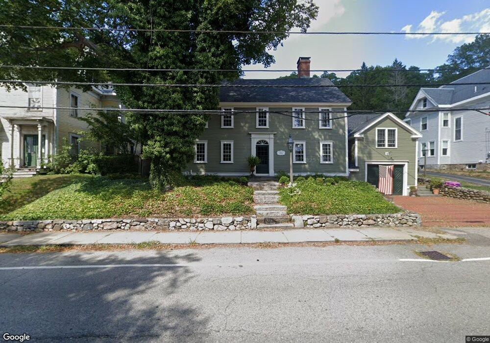
21 High St Ipswich, MA 01938
Estimated Value: $932,000 - $1,255,000
3
Beds
3
Baths
3,272
Sq Ft
$329/Sq Ft
Est. Value
About This Home
This home is located at 21 High St, Ipswich, MA 01938 and is currently estimated at $1,076,452, approximately $328 per square foot. 21 High St is a home located in Essex County with nearby schools including Ipswich High School, North Shore Montessori School, and Pingree School.
Ownership History
Date
Name
Owned For
Owner Type
Purchase Details
Closed on
Nov 21, 2014
Sold by
Curl Joseph R and Gorden Phillip L
Bought by
Curl Joseph R and Golden Phillip L
Current Estimated Value
Purchase Details
Closed on
Jul 31, 1996
Sold by
Oconno Peter F and Oconnor Michelle
Bought by
Golden Philip L and Curl Joseph R
Create a Home Valuation Report for This Property
The Home Valuation Report is an in-depth analysis detailing your home's value as well as a comparison with similar homes in the area
Home Values in the Area
Average Home Value in this Area
Purchase History
| Date | Buyer | Sale Price | Title Company |
|---|---|---|---|
| Curl Joseph R | -- | -- | |
| Curl Joseph R | -- | -- | |
| Curl Joseph R | -- | -- | |
| Golden Philip L | $265,000 | -- | |
| Golden Philip L | $265,000 | -- |
Source: Public Records
Mortgage History
| Date | Status | Borrower | Loan Amount |
|---|---|---|---|
| Previous Owner | Golden Philip L | $550,000 | |
| Previous Owner | Golden Philip L | $209,759 |
Source: Public Records
Tax History
| Year | Tax Paid | Tax Assessment Tax Assessment Total Assessment is a certain percentage of the fair market value that is determined by local assessors to be the total taxable value of land and additions on the property. | Land | Improvement |
|---|---|---|---|---|
| 2025 | $12,542 | $1,124,800 | $317,900 | $806,900 |
| 2024 | $11,885 | $1,044,400 | $318,200 | $726,200 |
| 2023 | $10,733 | $877,600 | $271,700 | $605,900 |
| 2022 | $10,554 | $820,700 | $256,200 | $564,500 |
| 2021 | $10,476 | $792,400 | $252,300 | $540,100 |
| 2020 | $10,483 | $747,700 | $258,100 | $489,600 |
| 2019 | $10,422 | $739,700 | $246,400 | $493,300 |
| 2018 | $10,035 | $704,700 | $232,900 | $471,800 |
| 2017 | $10,345 | $729,000 | $221,200 | $507,800 |
| 2016 | $8,811 | $593,300 | $186,300 | $407,000 |
| 2015 | $7,963 | $589,400 | $182,400 | $407,000 |
Source: Public Records
Map
Nearby Homes
- 11 Washington St Unit 11
- 11 Washington St Unit 7
- 11 Washington St Unit 5
- 11 Washington St Unit 4
- 11 Washington St Unit 12
- 29 Summer St Unit 15
- 50 Market St Unit 2
- 16 Elm St
- 45 County St Unit 4
- 59 S Main St Unit 1
- 8 Cleveland Ave
- 57 East St
- 20 Caroline Ave
- 64 County Rd Unit 1
- 70 East St
- 21 Brownville Ave
- 9 Ryan Ave
- 7 Woods Ln
- 2 Heartbreak Hill
- 500 Colonial Dr Unit 5
Your Personal Tour Guide
Ask me questions while you tour the home.