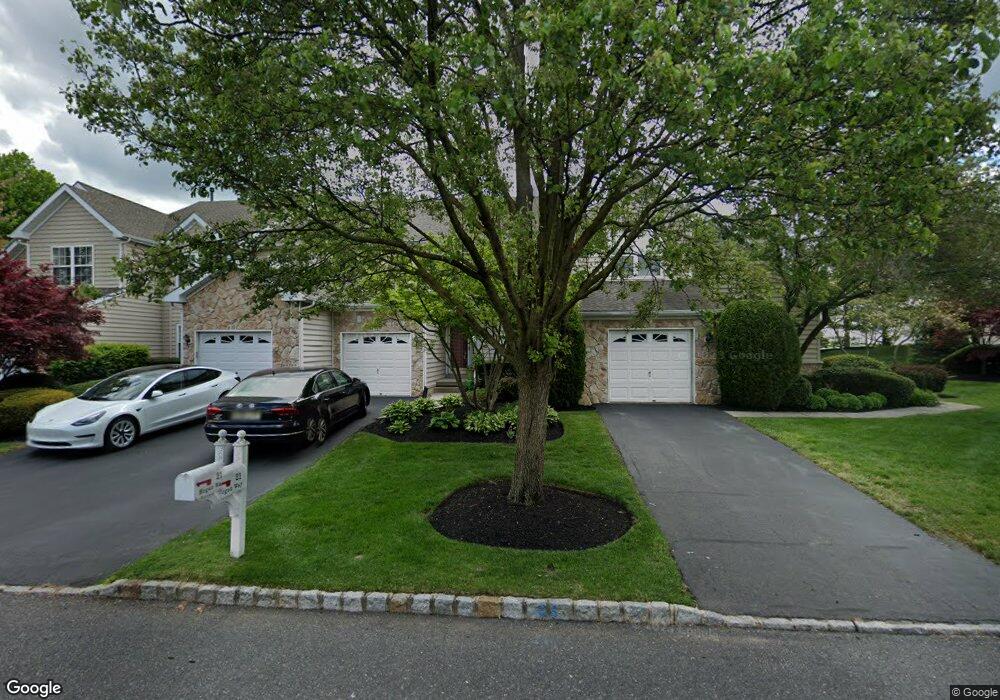
21 Hogan Way Unit 37 Moorestown, NJ 08057
Estimated Value: $538,682 - $618,000
--
Bed
--
Bath
1,996
Sq Ft
$298/Sq Ft
Est. Value
About This Home
This home is located at 21 Hogan Way Unit 37, Moorestown, NJ 08057 and is currently estimated at $594,171, approximately $297 per square foot. 21 Hogan Way Unit 37 is a home located in Burlington County with nearby schools including South Valley Elementary School, Moorestown Upper Elementary School, and William Allen Middle School.
Ownership History
Date
Name
Owned For
Owner Type
Purchase Details
Closed on
Jan 25, 2019
Sold by
Dale Claire N
Bought by
Dale Mary Claire
Current Estimated Value
Home Financials for this Owner
Home Financials are based on the most recent Mortgage that was taken out on this home.
Original Mortgage
$85,000
Interest Rate
4.4%
Mortgage Type
Purchase Money Mortgage
Purchase Details
Closed on
Oct 26, 1998
Sold by
Dale Robert N
Bought by
Dale Claire N
Purchase Details
Closed on
Sep 4, 1997
Sold by
Laurel Creek Lp
Bought by
Dale Claire N and Dale Robert N
Home Financials for this Owner
Home Financials are based on the most recent Mortgage that was taken out on this home.
Original Mortgage
$150,000
Interest Rate
5.87%
Create a Home Valuation Report for This Property
The Home Valuation Report is an in-depth analysis detailing your home's value as well as a comparison with similar homes in the area
Home Values in the Area
Average Home Value in this Area
Purchase History
| Date | Buyer | Sale Price | Title Company |
|---|---|---|---|
| Dale Mary Claire | $370,000 | Surety Title Company | |
| Dale Claire N | -- | -- | |
| Dale Claire N | $206,311 | -- |
Source: Public Records
Mortgage History
| Date | Status | Borrower | Loan Amount |
|---|---|---|---|
| Previous Owner | Dale Mary Claire | $85,000 | |
| Previous Owner | Dale Claire N | $150,000 |
Source: Public Records
Tax History Compared to Growth
Tax History
| Year | Tax Paid | Tax Assessment Tax Assessment Total Assessment is a certain percentage of the fair market value that is determined by local assessors to be the total taxable value of land and additions on the property. | Land | Improvement |
|---|---|---|---|---|
| 2025 | $9,076 | $319,900 | $90,000 | $229,900 |
| 2024 | $8,800 | $319,900 | $90,000 | $229,900 |
| 2023 | $8,800 | $319,900 | $90,000 | $229,900 |
| 2022 | $8,711 | $319,900 | $90,000 | $229,900 |
| 2021 | $8,596 | $319,900 | $90,000 | $229,900 |
| 2020 | $8,541 | $319,900 | $90,000 | $229,900 |
| 2019 | $8,391 | $319,900 | $90,000 | $229,900 |
| 2018 | $6,677 | $319,900 | $90,000 | $229,900 |
| 2017 | $7,070 | $319,900 | $90,000 | $229,900 |
| 2016 | $7,955 | $319,900 | $90,000 | $229,900 |
| 2015 | $7,856 | $319,900 | $90,000 | $229,900 |
| 2014 | $7,447 | $319,900 | $90,000 | $229,900 |
Source: Public Records
Map
Nearby Homes
- 40 Palmer Dr Unit 110
- 158 Sarazen Dr
- 482 Monte Farm Rd
- 69 Sister's Farmstead Rd
- 22 Cardinal Way
- 107 Hartford Rd
- 39 Bramley Rd
- 127 Oakmont Dr
- 14 Baltusrol Terrace
- 97 Brooks Rd
- 7503A Normandy Dr Unit 7503
- 5 Murray Rd
- 3604B Chadbury Rd
- 57 Brooks Rd
- 4107A Chadbury Rd
- 8006 Normandy Dr Unit 8006
- 4208A Aberdeen Dr Unit 4208
- 950 Bortons Landing Rd
- 2720B Sussex Ct
- 21 Lancelot Ln
- 23 Hogan Way Unit 38
- 19 Hogan Way Unit 36
- 17 Hogan Way Unit 35
- 25 Hogan Way
- 27 Hogan Way Unit 27
- 15 Hogan Way
- 29 Hogan Way Unit 41
- 13 Hogan Way Unit 33
- 20 Hogan Way
- 31 Hogan Way
- 31 Hogan Way Unit 42
- 11 Hogan Way
- 9 Hogan Way Unit 31
- 22 Hogan Way
- 18 Hogan Way Unit 13
- 16 Hogan Way
- 24 Hogan Way
- 14 Hogan Way
- 33 Hogan Way Unit 43
- 26 Hogan Way Unit 17