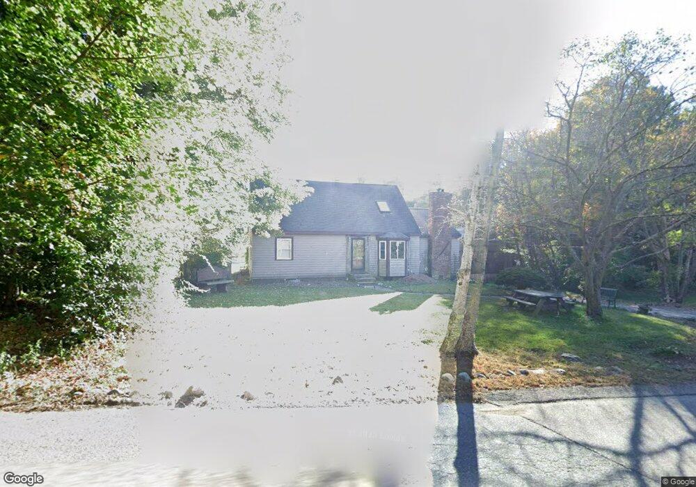
21 Holbrook St Norfolk, MA 02056
Estimated Value: $632,000 - $753,000
3
Beds
3
Baths
1,776
Sq Ft
$391/Sq Ft
Est. Value
About This Home
This home is located at 21 Holbrook St, Norfolk, MA 02056 and is currently estimated at $694,236, approximately $390 per square foot. 21 Holbrook St is a home located in Norfolk County with nearby schools including H. Olive Day School, Freeman-Kennedy School, and Woodside Montessori Academy.
Ownership History
Date
Name
Owned For
Owner Type
Purchase Details
Closed on
Mar 26, 2018
Sold by
Lantague Ft
Bought by
Callahan Robert
Current Estimated Value
Home Financials for this Owner
Home Financials are based on the most recent Mortgage that was taken out on this home.
Original Mortgage
$456,577
Outstanding Balance
$392,008
Interest Rate
4.37%
Mortgage Type
FHA
Estimated Equity
$302,228
Purchase Details
Closed on
Apr 3, 2007
Sold by
Lantagne Jacqueline M and Lantagne Kevin
Bought by
Lantagne Jacqueline M and Lantagne Kevin
Purchase Details
Closed on
Feb 4, 2002
Sold by
Callahan Alvin R and Callahan Dorothy E
Bought by
Lantagne Kevin and Lantagne Jacqueline M
Home Financials for this Owner
Home Financials are based on the most recent Mortgage that was taken out on this home.
Original Mortgage
$148,000
Interest Rate
7.15%
Mortgage Type
Purchase Money Mortgage
Create a Home Valuation Report for This Property
The Home Valuation Report is an in-depth analysis detailing your home's value as well as a comparison with similar homes in the area
Home Values in the Area
Average Home Value in this Area
Purchase History
| Date | Buyer | Sale Price | Title Company |
|---|---|---|---|
| Callahan Robert | $465,000 | -- | |
| Lantagne Jacqueline M | -- | -- | |
| Lantagne Kevin | $185,000 | -- |
Source: Public Records
Mortgage History
| Date | Status | Borrower | Loan Amount |
|---|---|---|---|
| Open | Callahan Robert | $456,577 | |
| Previous Owner | Lantagne Kevin | $148,000 |
Source: Public Records
Tax History Compared to Growth
Tax History
| Year | Tax Paid | Tax Assessment Tax Assessment Total Assessment is a certain percentage of the fair market value that is determined by local assessors to be the total taxable value of land and additions on the property. | Land | Improvement |
|---|---|---|---|---|
| 2025 | $8,627 | $540,200 | $243,900 | $296,300 |
| 2024 | $8,205 | $527,000 | $243,900 | $283,100 |
| 2023 | $7,895 | $481,100 | $243,900 | $237,200 |
| 2022 | $7,990 | $439,000 | $230,200 | $208,800 |
| 2021 | $7,860 | $436,900 | $224,100 | $212,800 |
| 2020 | $7,286 | $390,900 | $206,500 | $184,400 |
| 2019 | $7,428 | $406,100 | $206,500 | $199,600 |
| 2018 | $7,264 | $390,100 | $206,500 | $183,600 |
| 2017 | $7,155 | $392,700 | $206,500 | $186,200 |
| 2016 | $7,236 | $400,200 | $230,100 | $170,100 |
| 2015 | $6,917 | $391,700 | $217,500 | $174,200 |
| 2014 | $6,864 | $393,800 | $217,500 | $176,300 |
Source: Public Records
Map
Nearby Homes
- 29 Wildwood Rd Unit 29
- 7 Malcolm St
- 10 Medway St
- 27 Whichita Rd
- 3 Elliot Mills Unit 3
- 6 Elliot Mills Unit 6
- 8 Boyde's Crossing
- 8 Boyde's Crossing Unit 4
- 118 Main St
- 23 Algonquin Rd
- 45 Meetinghouse Rd Unit 45
- 16 Keeney Pond Rd
- 51 Thomas Mann Unit 30
- 53 Thomas Mann Cir Unit 31
- 57 Thomas Mann Cir Unit 57
- 63 Thomas Mann Cir Unit 36
- 37 Thomas Mann Cir Unit 23
- 18 Keeney Pond Rd
- 12 Brookside Ln
- 10 Stop River Rd