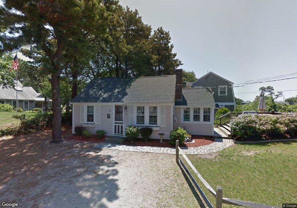
21 Honeysuckle Ln Dennis Port, MA 02639
Dennis Port NeighborhoodEstimated Value: $381,000 - $503,852
2
Beds
1
Bath
650
Sq Ft
$671/Sq Ft
Est. Value
About This Home
This home is located at 21 Honeysuckle Ln, Dennis Port, MA 02639 and is currently estimated at $436,213, approximately $671 per square foot. 21 Honeysuckle Ln is a home located in Barnstable County with nearby schools including Dennis-Yarmouth Regional High School and St. Pius X. School.
Ownership History
Date
Name
Owned For
Owner Type
Purchase Details
Closed on
Aug 4, 1997
Sold by
Dewolfe Daniel C and Dewolfe Barbara H
Bought by
Bradshaw Lawrence H and Bradshaw Kristi A
Current Estimated Value
Home Financials for this Owner
Home Financials are based on the most recent Mortgage that was taken out on this home.
Original Mortgage
$53,600
Interest Rate
7.55%
Mortgage Type
Purchase Money Mortgage
Create a Home Valuation Report for This Property
The Home Valuation Report is an in-depth analysis detailing your home's value as well as a comparison with similar homes in the area
Home Values in the Area
Average Home Value in this Area
Purchase History
| Date | Buyer | Sale Price | Title Company |
|---|---|---|---|
| Bradshaw Lawrence H | $67,000 | -- |
Source: Public Records
Mortgage History
| Date | Status | Borrower | Loan Amount |
|---|---|---|---|
| Open | Bradshaw Lawrence H | $85,000 | |
| Closed | Bradshaw Lawrence H | $19,000 | |
| Closed | Bradshaw Lawrence H | $53,600 | |
| Previous Owner | Bradshaw Lawrence H | $50,000 |
Source: Public Records
Tax History Compared to Growth
Tax History
| Year | Tax Paid | Tax Assessment Tax Assessment Total Assessment is a certain percentage of the fair market value that is determined by local assessors to be the total taxable value of land and additions on the property. | Land | Improvement |
|---|---|---|---|---|
| 2025 | $1,736 | $401,000 | $193,500 | $207,500 |
| 2024 | $1,592 | $362,600 | $186,100 | $176,500 |
| 2023 | $1,540 | $329,700 | $169,200 | $160,500 |
| 2022 | $1,513 | $270,100 | $152,400 | $117,700 |
| 2021 | $1,566 | $259,700 | $170,800 | $88,900 |
| 2020 | $1,430 | $234,400 | $149,400 | $85,000 |
| 2019 | $1,382 | $224,000 | $146,500 | $77,500 |
| 2018 | $1,348 | $212,600 | $139,500 | $73,100 |
| 2017 | $1,246 | $202,600 | $129,500 | $73,100 |
| 2016 | $1,304 | $199,700 | $139,500 | $60,200 |
| 2015 | $1,278 | $199,700 | $139,500 | $60,200 |
| 2014 | $1,104 | $173,900 | $119,500 | $54,400 |
Source: Public Records
Map
Nearby Homes
- 37 Ocean Dr Unit 2
- 80 Michaels Ave
- 64 Beaten Rd
- 61 Trotters Ln
- 6 Baker Way
- 112 Old Wharf Rd Unit E4
- 112 Old Wharf Rd Unit E1
- 120 Old Wharf Rd Unit 11
- 154 Old Wharf Rd Unit 26
- 154 Old Wharf Rd Unit 14
- 15 Woodside Park Rd
- 31 Easy St
- 19 Standish Way
- 12 Spoonbill Rd
- 217 Old Wharf Rd Unit 64
- 22 Wixon Rd
- 71 Main St
- 4 Coffey Ln
- 241 Old Wharf Rd Unit 82
- 241 Old Wharf Rd Unit 127
- 22 Mayflower Ln
- 20 Mayflower Ln
- 20 Honeysuckle Ln
- 24 Honeysuckle Ln
- 26 Mayflower Ln
- 15 Honeysuckle Ln
- 0 Mayflower Ln Unit 2
- 18 Honeysuckle Ln
- 23 Myrtle Ln
- 14 Mayflower Ln
- 25 Myrtle Ln
- 13 Honeysuckle Ln
- 23 Mayflower Ln
- 27 Mayflower Ln
- 9 Dexter Snow Ave
- 14 Honeysuckle Ln
- 5 Dexter Snow Ave
- 7 Dexter Snow Ave
- 13 Mayflower Ln
- 20 Dexter Snow Ave