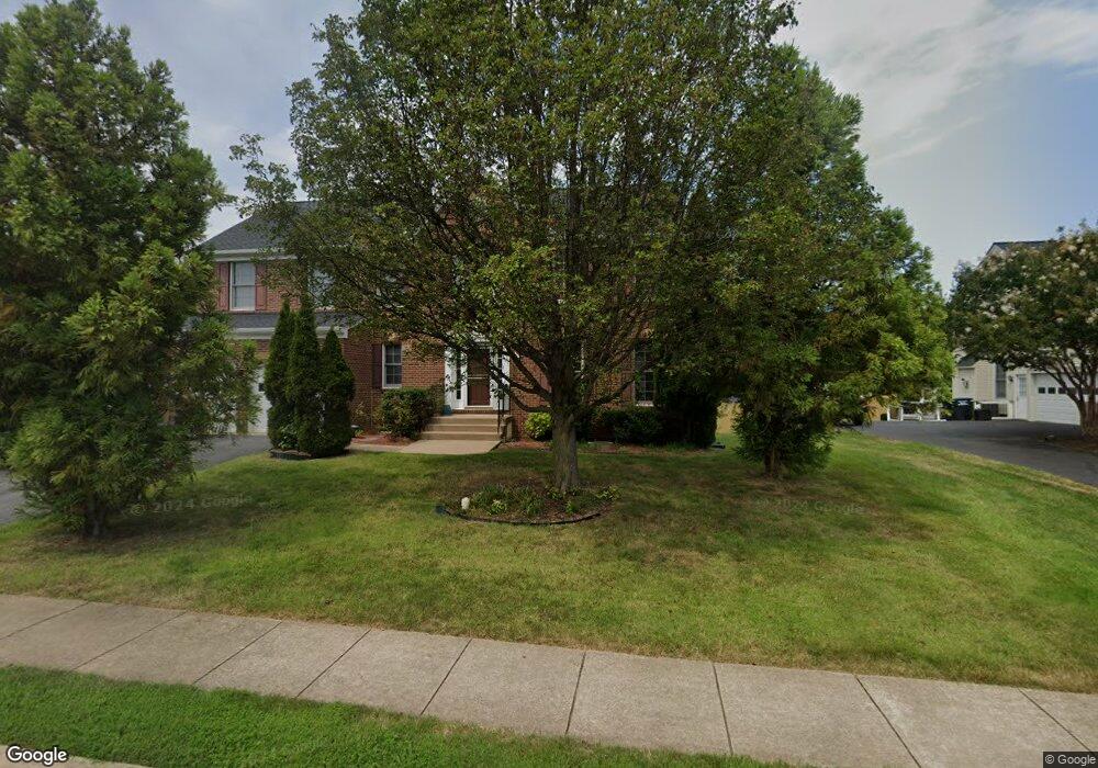
21 Hubbard Ct Stafford, VA 22554
Embrey Mill NeighborhoodEstimated Value: $636,080 - $689,000
4
Beds
3
Baths
2,412
Sq Ft
$276/Sq Ft
Est. Value
About This Home
This home is located at 21 Hubbard Ct, Stafford, VA 22554 and is currently estimated at $664,520, approximately $275 per square foot. 21 Hubbard Ct is a home located in Stafford County with nearby schools including Anthony Burns Elementary School, Rodney E. Thompson Middle School, and Colonial Forge High School.
Ownership History
Date
Name
Owned For
Owner Type
Purchase Details
Closed on
Jan 27, 2009
Sold by
Rodriguez Carlos
Bought by
Lewis Michael
Current Estimated Value
Home Financials for this Owner
Home Financials are based on the most recent Mortgage that was taken out on this home.
Original Mortgage
$343,436
Outstanding Balance
$219,175
Interest Rate
5.28%
Mortgage Type
FHA
Estimated Equity
$445,345
Purchase Details
Closed on
May 9, 2003
Sold by
Rodriguez Moses
Bought by
Rodriguez Carlos
Purchase Details
Closed on
Oct 18, 2002
Sold by
Atlantic Bldrs
Bought by
Rodriguez Moises
Home Financials for this Owner
Home Financials are based on the most recent Mortgage that was taken out on this home.
Original Mortgage
$214,350
Interest Rate
6.18%
Mortgage Type
New Conventional
Create a Home Valuation Report for This Property
The Home Valuation Report is an in-depth analysis detailing your home's value as well as a comparison with similar homes in the area
Home Values in the Area
Average Home Value in this Area
Purchase History
| Date | Buyer | Sale Price | Title Company |
|---|---|---|---|
| Lewis Michael | $345,300 | -- | |
| Rodriguez Carlos | -- | -- | |
| Rodriguez Moises | $267,950 | -- |
Source: Public Records
Mortgage History
| Date | Status | Borrower | Loan Amount |
|---|---|---|---|
| Open | Lewis Michael | $343,436 | |
| Previous Owner | Rodriguez Moises | $214,350 |
Source: Public Records
Tax History Compared to Growth
Tax History
| Year | Tax Paid | Tax Assessment Tax Assessment Total Assessment is a certain percentage of the fair market value that is determined by local assessors to be the total taxable value of land and additions on the property. | Land | Improvement |
|---|---|---|---|---|
| 2025 | $4,567 | $503,700 | $170,000 | $333,700 |
| 2024 | $4,567 | $503,700 | $170,000 | $333,700 |
| 2023 | $4,510 | $477,300 | $155,000 | $322,300 |
| 2022 | $4,057 | $477,300 | $155,000 | $322,300 |
| 2021 | $3,630 | $374,200 | $120,000 | $254,200 |
| 2020 | $3,630 | $374,200 | $120,000 | $254,200 |
| 2019 | $3,639 | $360,300 | $120,000 | $240,300 |
| 2018 | $3,567 | $360,300 | $120,000 | $240,300 |
| 2017 | $3,310 | $334,300 | $120,000 | $214,300 |
| 2016 | $3,310 | $334,300 | $120,000 | $214,300 |
| 2015 | -- | $330,400 | $120,000 | $210,400 |
| 2014 | -- | $330,400 | $120,000 | $210,400 |
Source: Public Records
Map
Nearby Homes
- 25 Hubbard Ct
- 23 Hubbard Ct
- 388 Pear Blossom Rd
- 384 Pear Blossom Rd
- 392 Pear Blossom Rd
- 396 Pear Blossom Rd
- 19 Hubbard Ct
- 17 Hubbard Ct
- 380 Pear Blossom Rd
- 400 Pear Blossom Rd
- 27 Hubbard Ct
- 376 Pear Blossom Rd
- 372 Pear Blossom Rd
- 15 Hubbard Ct
- 29 Hubbard Ct
- 404 Pear Blossom Rd
- 24 Hubbard Ct
- 368 Pear Blossom Rd
- 19 Wheelwright Ln
- 16 Hubbard Ct