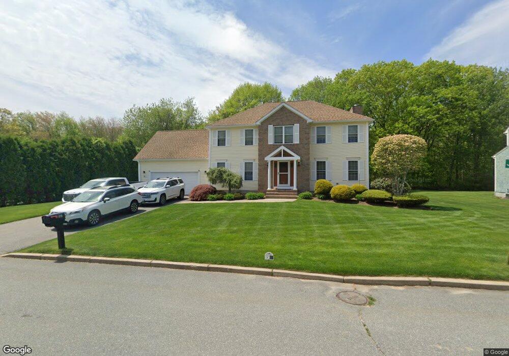
21 Jay Ct Cranston, RI 02921
Comstock Gardens NeighborhoodEstimated Value: $847,256 - $974,000
About This Home
This home is located at 21 Jay Ct, Cranston, RI 02921 and is currently estimated at $914,064, approximately $334 per square foot. 21 Jay Ct is a home located in Providence County with nearby schools including Orchard Farms El. School, Western Hills Middle School, and Cranston High School West.
Ownership History
We collect this data history from publicly available records. To have your information removed, we recommend requesting removal directly through your county’s website.
Purchase Details
Purchase Details
Home Financials for this Owner
Home Financials are based on the most recent Mortgage that was taken out on this home.Purchase Details
Purchase Details
Home Values in the Area
Average Home Value in this Area
Purchase History
We collect this data history from publicly available records. To have your information removed, we recommend requesting removal directly through your county’s website.
| Date | Buyer | Sale Price | Title Company |
|---|---|---|---|
| -- | -- | ||
| -- | -- | ||
| $540,000 | -- | ||
| $493,000 | -- | ||
| $493,000 | -- | ||
| $429,000 | -- |
Mortgage History
We collect this data history from publicly available records. To have your information removed, we recommend requesting removal directly through your county’s website.
| Date | Status | Borrower | Loan Amount |
|---|---|---|---|
| Previous Owner | $405,370 | ||
| Previous Owner | $417,000 | ||
| Previous Owner | $250,000 |
Tax History
We collect this data history from publicly available records. To have your information removed, we recommend requesting removal directly through your county’s website.
| Year | Tax Paid | Tax Assessment Tax Assessment Total Assessment is a certain percentage of the fair market value that is determined by local assessors to be the total taxable value of land and additions on the property. | Land | Improvement |
|---|---|---|---|---|
| 2025 | $9,072 | $653,600 | $188,700 | $464,900 |
| 2024 | $8,895 | $653,600 | $188,700 | $464,900 |
| 2023 | $9,223 | $488,000 | $135,500 | $352,500 |
| 2022 | $9,033 | $488,000 | $135,500 | $352,500 |
| 2021 | $8,784 | $488,000 | $135,500 | $352,500 |
| 2020 | $9,178 | $441,900 | $158,600 | $283,300 |
| 2019 | $9,178 | $441,900 | $158,600 | $283,300 |
| 2018 | $8,966 | $441,900 | $158,600 | $283,300 |
| 2017 | $9,844 | $429,100 | $167,700 | $261,400 |
| 2016 | $9,633 | $429,100 | $167,700 | $261,400 |
| 2015 | $9,633 | $429,100 | $167,700 | $261,400 |
| 2014 | $8,531 | $373,500 | $140,200 | $233,300 |
Map
- 52 Hummingbird Ln
- 27 Alpine Estates Dr
- 9 Gray Coach Ln Unit 911
- 9 Gray Coach Ln Unit 913
- 0 Plainfield Pike
- 02 Paula Ln
- 01 Paula Ln
- 12 Gray Coach E Unit 1206
- 0 Taylor Rd
- 2446 Plainfield Pike
- 7 Taylor Rd
- 31 Wildflower Dr
- 12 Beechwood Dr
- 1164 Scituate Ave
- 2 Trinity Way
- 8 Sweet Corn Dr
- 4 Trinity Way
- 480 Comstock Pkwy
- 44 Orchard Valley Dr
- 560 Seven Mile Rd
Ask me questions while you tour the home.