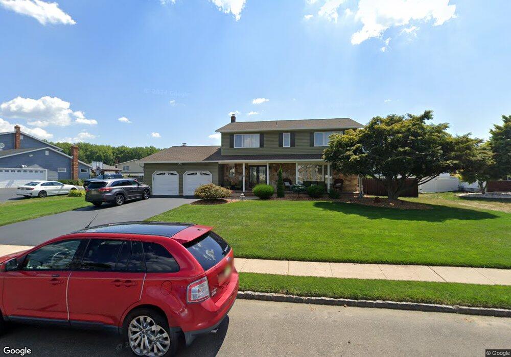
21 John Lenhardt Rd Trenton, NJ 08690
Estimated Value: $679,869 - $782,000
--
Bed
--
Bath
2,784
Sq Ft
$269/Sq Ft
Est. Value
About This Home
This home is located at 21 John Lenhardt Rd, Trenton, NJ 08690 and is currently estimated at $749,467, approximately $269 per square foot. 21 John Lenhardt Rd is a home located in Mercer County with nearby schools including Langtree Elementary School, Richard C. Crockett Middle School, and Steinert - Hamilton High East.
Ownership History
Date
Name
Owned For
Owner Type
Purchase Details
Closed on
Jun 23, 2022
Sold by
Ficarro and Maria
Bought by
Ficarro Living Trust
Current Estimated Value
Purchase Details
Closed on
Aug 24, 2018
Sold by
Ricigliano Jay R and Ricigliano Mary Ann
Bought by
Ficarro Jeffrey and Ficarro Maria
Home Financials for this Owner
Home Financials are based on the most recent Mortgage that was taken out on this home.
Original Mortgage
$396,000
Interest Rate
4.5%
Mortgage Type
New Conventional
Purchase Details
Closed on
Dec 11, 1984
Bought by
Ricigliano Jay R & Mary Ann
Create a Home Valuation Report for This Property
The Home Valuation Report is an in-depth analysis detailing your home's value as well as a comparison with similar homes in the area
Home Values in the Area
Average Home Value in this Area
Purchase History
| Date | Buyer | Sale Price | Title Company |
|---|---|---|---|
| Ficarro Living Trust | -- | Ficarro Jeffrey | |
| Ficarro Living Trust | -- | Ficarro Jeffrey | |
| Ficarro Jeffrey | $440,000 | Emerald Title Agency | |
| Ricigliano Jay R & Mary Ann | $124,900 | -- |
Source: Public Records
Mortgage History
| Date | Status | Borrower | Loan Amount |
|---|---|---|---|
| Previous Owner | Ficarro Jeffrey | $396,000 |
Source: Public Records
Tax History Compared to Growth
Tax History
| Year | Tax Paid | Tax Assessment Tax Assessment Total Assessment is a certain percentage of the fair market value that is determined by local assessors to be the total taxable value of land and additions on the property. | Land | Improvement |
|---|---|---|---|---|
| 2025 | $13,856 | $393,200 | $101,200 | $292,000 |
| 2024 | $12,987 | $393,200 | $101,200 | $292,000 |
| 2023 | $12,987 | $393,200 | $101,200 | $292,000 |
| 2022 | $12,783 | $393,200 | $101,200 | $292,000 |
| 2021 | $13,459 | $393,200 | $101,200 | $292,000 |
| 2020 | $12,044 | $393,200 | $101,200 | $292,000 |
| 2019 | $11,776 | $393,200 | $101,200 | $292,000 |
| 2018 | $11,710 | $393,200 | $101,200 | $292,000 |
| 2017 | $11,515 | $396,800 | $101,200 | $295,600 |
| 2016 | $10,729 | $396,800 | $101,200 | $295,600 |
| 2015 | $11,665 | $254,200 | $62,600 | $191,600 |
| 2014 | $11,467 | $254,200 | $62,600 | $191,600 |
Source: Public Records
Map
Nearby Homes
- 14 Baggaley Rd
- 85 Tudor Dr
- 11 Sandtown Terrace
- 515 Spruce St
- 3534 Klockner Rd
- 2330 Route 33 Unit 315
- 2346 Route 33 Unit 202
- 2346 Route 33 Unit 308
- 12 Aster Rd
- 31 Rolling Ln
- 6 Forman Dr
- 117 George St
- 968 Robbins-Edin Burg Rd Unit 306
- 10 North St
- 15 Newtown Blvd
- 968 Robbins-Edinburg
- 31 Baltusrol St
- 62 Wyndham Place
- 86 Mark Twain Dr
- 968 Robbinsville Edinburg Rd Unit 306
- 19 John Lenhardt Rd
- 23 John Lenhardt Rd
- 84 Peter Rafferty Dr
- 86 Peter Rafferty Dr
- 18 Baggaley Rd
- 17 John Lenhardt Rd
- 20 John Lenhardt Rd
- 22 John Lenhardt Rd
- 88 Peter Rafferty Dr
- 82 Peter Rafferty Dr
- 16 Baggaley Rd
- 24 John Lenhardt Rd
- 16 John Lenhardt Rd
- 15 John Lenhardt Rd
- 26 John Lenhardt Rd
- 43 Ray Dwier Dr
- 45 Ray Dwier Dr
- 41 Ray Dwier Dr
- 87 Peter Rafferty Dr
- 28 John Lenhardt Rd