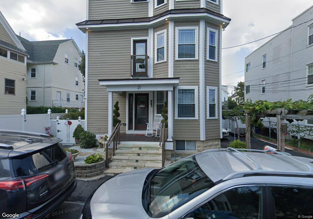
21 Kenneson Rd Somerville, MA 02145
Winter Hill NeighborhoodEstimated Value: $1,416,000 - $1,664,000
6
Beds
3
Baths
3,963
Sq Ft
$384/Sq Ft
Est. Value
About This Home
This home is located at 21 Kenneson Rd, Somerville, MA 02145 and is currently estimated at $1,520,667, approximately $383 per square foot. 21 Kenneson Rd is a home located in Middlesex County with nearby schools including Somerville High School, Prospect Hill Academy Upper Elementary Campus, and Bright Future Educare Center.
Create a Home Valuation Report for This Property
The Home Valuation Report is an in-depth analysis detailing your home's value as well as a comparison with similar homes in the area
Home Values in the Area
Average Home Value in this Area
Tax History Compared to Growth
Tax History
| Year | Tax Paid | Tax Assessment Tax Assessment Total Assessment is a certain percentage of the fair market value that is determined by local assessors to be the total taxable value of land and additions on the property. | Land | Improvement |
|---|---|---|---|---|
| 2025 | $13,965 | $1,280,000 | $409,400 | $870,600 |
| 2024 | $13,069 | $1,242,300 | $409,400 | $832,900 |
| 2023 | $12,747 | $1,232,800 | $409,400 | $823,400 |
| 2022 | $12,192 | $1,197,600 | $389,900 | $807,700 |
| 2021 | $11,727 | $1,150,800 | $371,300 | $779,500 |
| 2020 | $11,468 | $1,136,600 | $357,100 | $779,500 |
| 2019 | $10,107 | $939,300 | $303,100 | $636,200 |
| 2018 | $8,623 | $762,400 | $292,300 | $470,100 |
| 2017 | $8,394 | $719,300 | $272,600 | $446,700 |
| 2016 | $7,811 | $623,400 | $235,700 | $387,700 |
| 2015 | $7,173 | $568,800 | $210,200 | $358,600 |
Source: Public Records
Map
Nearby Homes
- 9 Montgomery Ave Unit 1
- 10 Mortimer Place
- 11 Macarthur St Unit B
- 11 Macarthur St Unit A
- 7 Stickney Ave
- 30A Summer
- 59 Dartmouth St Unit A
- 176-182 Broadway
- 232 Pearl St
- 185 School St
- 36 Everett Ave
- 84 Grant St Unit 7
- 16 Bonair St
- 71 Thurston St
- 14 Bonair St Unit 14
- 19 Everett Ave
- 31 Thurston St Unit 6
- 94 Jaques St Unit B
- 19 Fenwick St Unit 4
- 4 Cross St
- 17 Kenneson Rd Unit 3
- 17 Kenneson Rd Unit 2
- 17 Kenneson Rd Unit 1
- 17 Kenneson Rd
- 17 Kenneson Rd Unit 12
- 17 Kenneson Rd Unit 13
- 17 Kenneson Rd Unit 14
- 17 Kenneson Rd Unit 11
- 17 Kenneson Rd Unit A
- 17 Kenneson Rd Unit C
- 17 Kenneson Rd Unit D
- 17 Kenneson Rd Unit 4
- 17 Kenneson Rd
- 21 Walnut Rd
- 27 Walnut Rd
- 15 Kenneson Rd
- 8 Sargent Ave
- 17 Walnut Rd
- 22 Kenneson Rd
- 12 Sargent Ave