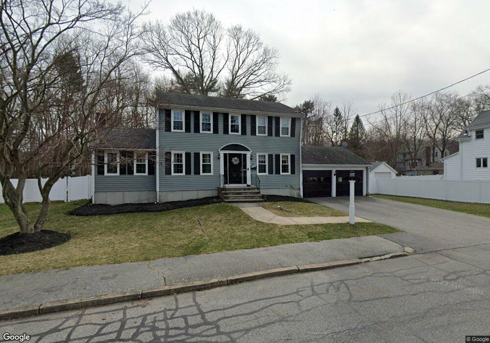
21 King Philip St South Weymouth, MA 02190
South Weymouth NeighborhoodEstimated Value: $874,000 - $985,000
4
Beds
3
Baths
1,864
Sq Ft
$495/Sq Ft
Est. Value
About This Home
This home is located at 21 King Philip St, South Weymouth, MA 02190 and is currently estimated at $922,696, approximately $495 per square foot. 21 King Philip St is a home located in Norfolk County with nearby schools including Thomas V Nash, Abigail Adams Middle School, and Weymouth Middle School Chapman.
Ownership History
Date
Name
Owned For
Owner Type
Purchase Details
Closed on
Aug 1, 2006
Sold by
Mass Res Nominee
Bought by
Obrien Jennifer and Obrien Thomas
Current Estimated Value
Purchase Details
Closed on
Sep 29, 1995
Sold by
Nelson Homes Inc
Bought by
Cerone Joseph W and Cerone Linda A
Purchase Details
Closed on
Feb 10, 1995
Sold by
Hatch Lavena M and Hatch Robert F
Bought by
Nelson Homes Inc
Create a Home Valuation Report for This Property
The Home Valuation Report is an in-depth analysis detailing your home's value as well as a comparison with similar homes in the area
Home Values in the Area
Average Home Value in this Area
Purchase History
| Date | Buyer | Sale Price | Title Company |
|---|---|---|---|
| Obrien Jennifer | $512,500 | -- | |
| Mass Res Nt | $512,500 | -- | |
| Obrien Jennifer | $512,500 | -- | |
| Cerone Joseph W | $210,000 | -- | |
| Nelson Homes Inc | $65,000 | -- |
Source: Public Records
Mortgage History
| Date | Status | Borrower | Loan Amount |
|---|---|---|---|
| Open | Nelson Homes Inc | $280,000 | |
| Closed | Nelson Homes Inc | $279,500 |
Source: Public Records
Tax History Compared to Growth
Tax History
| Year | Tax Paid | Tax Assessment Tax Assessment Total Assessment is a certain percentage of the fair market value that is determined by local assessors to be the total taxable value of land and additions on the property. | Land | Improvement |
|---|---|---|---|---|
| 2025 | $8,697 | $861,100 | $225,500 | $635,600 |
| 2024 | $8,423 | $820,200 | $214,800 | $605,400 |
| 2023 | $7,919 | $757,800 | $217,000 | $540,800 |
| 2022 | $7,716 | $673,300 | $200,900 | $472,400 |
| 2021 | $6,978 | $594,400 | $200,900 | $393,500 |
| 2020 | $6,604 | $554,000 | $200,900 | $353,100 |
| 2019 | $6,489 | $535,400 | $193,200 | $342,200 |
| 2018 | $6,263 | $501,000 | $184,000 | $317,000 |
| 2017 | $6,162 | $481,000 | $175,300 | $305,700 |
| 2016 | $6,132 | $479,100 | $168,500 | $310,600 |
| 2015 | $5,862 | $454,400 | $168,500 | $285,900 |
| 2014 | $5,651 | $424,900 | $156,800 | $268,100 |
Source: Public Records
Map
Nearby Homes
- 24 Fisher Rd
- 68 Massapoag St Unit 7
- 16 Jay Rd
- 308 Forest St
- 211 Randolph St
- 193 Randolph St
- 354 Tilden Commons Ln
- 120 Randolph St
- 92 Mercury St
- 175 Tyson Commons Ln
- 134 Tyson Commons Ln
- 50 Hollis St
- 30 Bradford Commons Ln
- 262 West St
- 255 West St
- 27 Park Ave
- 2 Mitchell Ln Unit B
- 655 Summer St
- 18 Fountain Ln Unit 2
- 441 Grove St
- 15 King Philip St
- 29 King Philip St
- 13 King Philip St
- 18 King Philip St
- 26 King Philip St
- 37 King Philip St
- 34 King Philip St
- 203 Forest St
- 213 Forest St
- 221 Forest St
- 185 Forest St
- 56 Shady Ln
- 0 Massapoag St Unit 72051974
- 0 Massapoag St
- 45 King Philip St
- 42 King Philip St
- 48 Shady Ln
- 175 Forest St
- 200 Forest St
- 229 Forest St